Click to visit the main New York Public Library Homepage
The New York Public Library
Digital Collections
About Digital Collections
Browse
Search only public domain materials
Items
Collections
Divisions
Home
Search
Browse
About
Search only public domain materials
Items
Collections
Divisions
Digital Collections
Using Images
Using Data
Collections
Charting America: Maps from the Lawrence H. Slaughter Collection and Others
Charting America: Maps from the Lawrence H. Slaughter Collection and Others
Navigation
Filters
Charting America: Maps from the Lawrence H. Slaughter Collection and Others
Previous
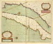
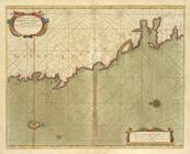
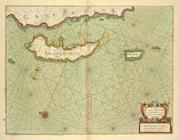
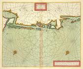
The south part of Virginia, now the north part of Carolina
0
Atlases, gazetteers, guidebooks and other books
377
Maps of the World
16
Maps of the Oceans
24
Maps of North and South America
23
Maps of North America.
551
Maps of New York City and State
1340
Lawrence H. Slaughter Collection of English maps, charts, globes, books and atlases
1020
John H. Levine Collection
60
More
Show filters
Hide filters
Show Only Public Domain
topic
Geography
516
Administrative and political divisions
340
Railroads
317
Real property
302
Landowners
216
More
Less
name
Thornton, Samuel
182
Ortelius, Abraham, 1527-1598
130
Coignet, Michel, 1549-1623
126
Shawe, James
126
Montanus, Arnoldus, 1625?-1683
118
More
Less
collection
Maps of New York City and State
2004
Lawrence H. Slaughter Collection of English maps, charts, globes, books and atlases
1252
Atlases, gazetteers, guidebooks and other books
543
John H. Levine Collection
60
Maps of North and South America
40
More
Less
place
New York (State)
1295
New York (N.Y.)
652
New York
524
Manhattan (New York, N.Y.)
347
Brooklyn (New York, N.Y.)
266
More
Less
genre
Maps
3810
Nautical charts
187
Cadastral maps
183
Manuscript maps
71
Aerial views
30
More
Less
publisher
Printed for Ieames Shawe, and are to be solde at his shoppe nigh Ludgate,
126
publisher not identified
119
Printed by the author, and are to be had at his house
116
Chapman and Hall
115
S. A. Mitchell, jr
79
More
Less
division
Map Division
3930
Manuscripts and Archives Division
2
type
cartographic
3687
text
191
still image
161
Date Range
to
3,936 results found
Sort by:
Title
Date created
Date digitized
Sequence
101st St. & 102nd St. and the…
m
12,000 Square Miles around Ne…
1863, West Point: [New York]
1889, Larchmont Harbor, N.Y.:…
m
1905 Library map of Manhattan…
m
1906 Library map of Manhattan…
m
1907 Library map of Manhattan…
m
1907 Library map of Manhattan…
1st Ward of NYC: [in draft du…
m
20th ward.
m
27th assembly district
m
[3 maps of New York and vicin…
m
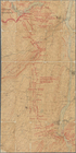
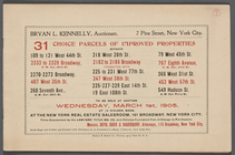
31 Choice Parcels of Improved…
m
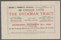
33 Choice Lots situate [sic] …
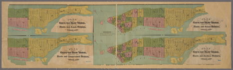
4 plans of the City of New Yo…
m
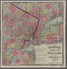
40 miles around New York. H. …
4th Senatorial District. 1,2,…
5th Senatorial District 8, 9,…
64 Central Park Lots, New Yor…
6th Senatorial District 10, 1…
7th Senatorial District 18, 2…
A chart od Iland of NEW FOUND…
A chart of coast of ANGOLA fr…
A chart of coast of BARBARY f…
A chart of coast of BIAFRA fr…
A chart of coast SWEDEN from …
A chart of coasts of CIMBEBAS…
A chart of coasts of GABON, L…
A chart of Delawar Bay : with…
A chart of Delawar River from…
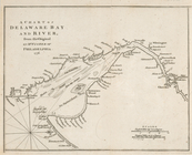
A chart of Delaware Bay and R…
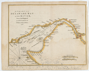
A chart of Delaware Bay and R…
A chart of Delaware Bay and R…
A chart of Delaware Bay and R…
A chart of Delaware Bay and R…
A chart of Delaware Bay and R…
A chart of Delaware Bay and R…
A chart of EEMS ELVE, Wefer, …
A chart of Islands Corfu, Pac…
A chart of JUTLAND and the Is…
A chart of LYF LAND and East …
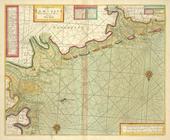
A chart of New York Harbour :…
A chart of New York Harbour :…
A chart of New York Harbour :…
A chart of New York Island & …
[A chart of New York Island &…
m
A chart of North and South Am…
A chart of North and South Am…
A chart of NORWAY from High L…
A chart of PRUSSIA and Coerla…
1
2
3
4
5
6
7
8
9
10
…
15
16
Previous
Next
1
2
3
4
5
6
7
8
9
10
…
15
16
Previous
Next