Click to visit the main New York Public Library Homepage
The New York Public Library
Digital Collections
About Digital Collections
Browse
Search only public domain materials
Items
Collections
Divisions
Home
Search
Browse
About
Search only public domain materials
Items
Collections
Divisions
Digital Collections
Using Images
Using Data
Collections
Charting America: Maps from the Lawrence H. Slaughter Collection and Others
Charting America: Maps from the Lawrence H. Slaughter Collection and Others
Navigation
Filters
Charting America: Maps from the Lawrence H. Slaughter Collection and Others
Previous
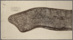
The south part of Virginia, now the north part of Carolina
0
Atlases, gazetteers, guidebooks and other books
377
Maps of the World
16
Maps of the Oceans
24
Maps of North and South America
23
Maps of North America.
551
Maps of New York City and State
1340
Lawrence H. Slaughter Collection of English maps, charts, globes, books and atlases
1020
John H. Levine Collection
60
More
Show filters
Hide filters
Show Only Public Domain
topic
Geography
516
Administrative and political divisions
340
Railroads
317
Real property
302
Landowners
216
More
Less
name
Thornton, Samuel
182
Ortelius, Abraham, 1527-1598
130
Coignet, Michel, 1549-1623
126
Shawe, James
126
Montanus, Arnoldus, 1625?-1683
118
More
Less
collection
Maps of New York City and State
2004
Lawrence H. Slaughter Collection of English maps, charts, globes, books and atlases
1252
Atlases, gazetteers, guidebooks and other books
543
John H. Levine Collection
60
Maps of North and South America
40
More
Less
place
New York (State)
1295
New York (N.Y.)
652
New York
524
Manhattan (New York, N.Y.)
347
Brooklyn (New York, N.Y.)
266
More
Less
genre
Maps
3810
Nautical charts
187
Cadastral maps
183
Manuscript maps
71
Aerial views
30
More
Less
publisher
Printed for Ieames Shawe, and are to be solde at his shoppe nigh Ludgate,
126
publisher not identified
119
Printed by the author, and are to be had at his house
116
Chapman and Hall
115
S. A. Mitchell, jr
79
More
Less
division
Map Division
3930
Manuscripts and Archives Division
2
type
cartographic
3687
text
191
still image
161
Date Range
to
3,936 results found for:
Maps?tab=filter
Sort by:
Relevance
Title
Date created
Date digitized
Sequence
m
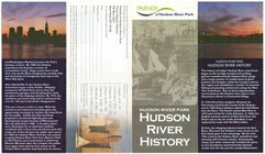
Hudson River Park, Hudson Riv…
collection:
Maps
of New York City and State
m
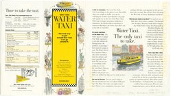
New York Water Taxi : the bes…
collection:
Maps
of New York City and State
Urban development of the City…
collection:
Maps
of New York City and State
Vingboons
map
of Manhattan, 1639
note:
Pictorial
map
showing buildings
Map
of the Greenwich Village section
image:
psnypl_
map
_352
m
Map
of the Greenwich Village section
image:
ps_
map
_cd6_077
m
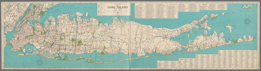
Hagstrom's
map
of Long Island New York …
note:
…"
Map
No. 2520A." Includes indexes.
N.Y. City's waterfront.
collection:
Maps
of New York City and State
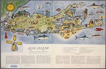
Long Island: an interpretive …
note:
…"In this
map
the eastern section
A sight-seers
map
of Manhattan.
image:
ps_
map
_124
m
Hagstrom's
map
of Queens N.Y. City …
note:
NYPL
Map
Div. copy has accession no
m
Shell street guide of Brookly…
note:
NYPL
Map
Div. copy has accession no
Blum's travel and guide
map
New York world
m
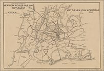
New York world's fair by auto…
collection:
Maps
of New York City and State
Map
of the New York world's fair
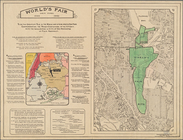
World's fair New York.: World…
note:
2
maps
in 1 sheet.
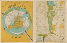
All roads lead to the world's…
collection:
Maps
of New York City and State
Romance
map
of the Hudson River Valley
Manhattan, first city in Amer…
collection:
Maps
of New York City and State
Patroonships, manors and seig…
note:
… keyed to
map
and inset
Staten Island, N.Y., ed. of F…
collection:
Maps
of New York City and State
m
Hagstom's
map
of Long Island New York
City of New Manhattan : propo…
collection:
Maps
of New York City and State
m
Map
of original grants and farms
image:
psnypl_
map
_306
Playland," Rye Beach : Westch…
collection:
Maps
of New York City and State
…" - An accurate and detailed
map
note:
…
map
of Greenwich
m
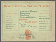
Real Estate at Public Auction
collection:
Maps
of New York City and State
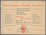
m
Real Estate at Public Auction
collection:
Maps
of New York City and State
Paterson, N.J. - N.Y., ed. of…
collection:
Maps
of New York City and State
Santanoni, ed. of Mar. 1904, …
collection:
Maps
of New York City and State
Map
of the Borough of Manhattan showing average
Industrial
map
of New York City
note:
Includes inset continuation
map
of Richmond
m
New York City, photographed f…
collection:
Maps
of New York City and State
Map
of New York City (Manhattan
Map
of New York City [Manhattan
…
Map
of the Bronx
Map
of the Bronx, showing the transit system.
Hagstrom's
map
of the Bronx, New York City
m
Hagstrom's
map
of Brooklyn (New York City) …
m
Map
of Brooklyn, House Number and Subway
Hagstrom's
Map
of Queens, city of New York
m
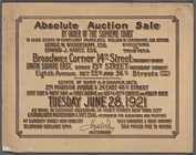
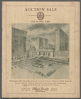
Absolute Auction Sale by Orde…
collection:
Maps
of New York City and State
m
Map
of the Borough of Brooklyn, City of New York
Richmond Borough Congressiona…
collection:
Maps
of New York City and State
m
Aerial survey, Manhattan Isla…
collection:
Maps
of New York City and State
m
New York City, Congressional …
collection:
Maps
of New York City and State
m
Petersen's New
Map
of the Bronx showing all
Panorama of the Borough of th…
collection:
Maps
of New York City and State
m
Street Indexed
map
of the Borough of Queens, also
m
Auction Sale by order of the …
collection:
Maps
of New York City and State
1
2
3
4
5
6
7
8
9
10
…
15
16
Previous
Next
1
2
3
4
5
6
7
8
9
10
…
15
16
Previous
Next