Click to visit the main New York Public Library Homepage
The New York Public Library
Digital Collections
About Digital Collections
Browse
Search only public domain materials
Items
Collections
Divisions
Home
Search
Browse
About
Search only public domain materials
Items
Collections
Divisions
Digital Collections
Using Images
Using Data
Collections
Charting America: Maps from the Lawrence H. Slaughter Collection and Others
Charting America: Maps from the Lawrence H. Slaughter Collection and Others
Navigation
Filters
Charting America: Maps from the Lawrence H. Slaughter Collection and Others
Previous
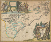
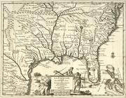
The south part of Virginia, now the north part of Carolina
0
Atlases, gazetteers, guidebooks and other books
377
Maps of the World
16
Maps of the Oceans
24
Maps of North and South America
23
Maps of North America.
551
Maps of New York City and State
1340
Lawrence H. Slaughter Collection of English maps, charts, globes, books and atlases
1020
John H. Levine Collection
60
More
Show filters
Hide filters
Show Only Public Domain
topic
Geography
516
Administrative and political divisions
340
Railroads
317
Real property
302
Landowners
216
More
Less
name
Thornton, Samuel
182
Ortelius, Abraham, 1527-1598
130
Coignet, Michel, 1549-1623
126
Shawe, James
126
Montanus, Arnoldus, 1625?-1683
118
More
Less
collection
Maps of New York City and State
2004
Lawrence H. Slaughter Collection of English maps, charts, globes, books and atlases
1252
Atlases, gazetteers, guidebooks and other books
543
John H. Levine Collection
60
Maps of North and South America
40
More
Less
place
New York (State)
1295
New York (N.Y.)
652
New York
524
Manhattan (New York, N.Y.)
347
Brooklyn (New York, N.Y.)
266
More
Less
genre
Maps
3810
Nautical charts
187
Cadastral maps
183
Manuscript maps
71
Aerial views
30
More
Less
publisher
Printed for Ieames Shawe, and are to be solde at his shoppe nigh Ludgate,
126
publisher not identified
119
Printed by the author, and are to be had at his house
116
Chapman and Hall
115
S. A. Mitchell, jr
79
More
Less
division
Map Division
3930
Manuscripts and Archives Division
2
type
cartographic
3687
text
191
still image
161
Date Range
to
3,936 results found for:
Maps?tab=filter
Sort by:
Relevance
Title
Date created
Date digitized
Sequence
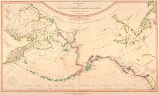
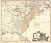
Chart of the N.W. coast of Am…
Pacific Ocean showing part of…
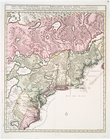
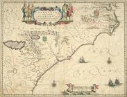
Virginiae partis australis, e…
note:
…. Burden's
Mapping
of North
Virginiae partis australis, e…
note:
… to Early
Maps
of the Middle
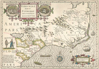
Virginiae item et Floridae Am…
note:
Map
by J. Hondius, from a French edition
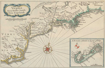
Virginia, Nieu Neder-landt, N…
note:
… to Early
Maps
of the Middle
The United States of North Am…
note:
… to Early
Maps
of the Middle
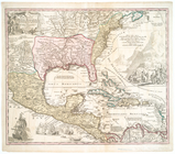
Regni Mexicani seu Novae Hisp…
Recens edita totius Novi Belg…
note:
… to Early
Maps
of the Middle
Partie de l'Amerique septentr…
note:
Later version of a
map
originally
Novissima et accuratissima to…
note:
… to Early
Maps
of the Middle
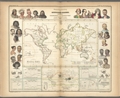
Ethnological Chart of the Wor…
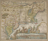
Novi Belgii Novaeque Angliae …
note:
… to Early
Maps
of the Middle
The Earth
Population
Cram's unrivaled atlas of the…
Nova tabula geographica compl…
note:
A later version of the
map
first published "Â…
m
Johnson's Physical
Map
…
m
Nova tabula geographica compl…
note:
Map
Div. 01-10239: Pencilled in upper left
England & Wales
note:
Maps
by George F. Cram.
Types of the races of man
note:
Maps
by George F. Cram.
Nova Belgica et Anglia Nova.
note:
… to Early
Maps
of the Middle
m
Chart of the world exhibiting…
Zoological chart of the world…
Nova Anglia, Novum Belgium, e…
note:
… in early
maps
, 39
Ethnographic
map
of the world showing
Nova Anglia Septentrionali Am…
note:
Differs from a variant
map
in engraving
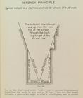
Setback principle
image:
ps_
map
_164
Northern Hemisphere ; Souther…
note:
… Hemisphere
map
only.
Map
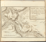
showing locations of Delafield
note:
Missing small section of
map
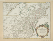
A New and correct
map
of the British
note:
… to Early
Maps
of the Middle
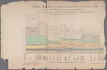
Tableau figuratif du mouvemen…
New World, or, Western Hemisp…
topic:
World
maps
East India Islands
La Floride : suivant les nouv…
note:
… to Early
Maps
of the Middle
Plano del terreno en que se h…
L'Amerique septentrionale: dr…
note:
… to Early
Maps
of the Middle
Geographische Verbreitung der…
Alexander von Humboldt's Syst…
Le nouveau monde descouvert e…
note:
NYPL
Map
Div. copy has accession no
L'Amerique divisée par grands…
note:
… to Early
Maps
of the Middle
m
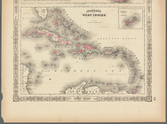
Johnson's West Indies, Plate …
m
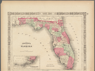
Johnson's Florida, Plate 43
Ètats-Unis de l'Amérique sept…
note:
Copy in
Map
Div. 96-7694: John H. Levine
Karte von Amerika: zum gebrau…
note:
NYPL
Map
Div. copy has accession no
Plano topografico de la ciuda…
Carte réduite des côtes orien…
note:
LC
Maps
of North America, 1750-1789, 215
Trade of the United States wi…
note:
Mapping
the Nation (NEH grant, 2015-2018)…
La Pologne, Plate 19
topic:
Maps
Transportation routes between…
note:
Mapping
the Nation (NEH grant, 2015-2018)…
1
2
3
4
5
6
7
8
9
10
…
15
16
Previous
Next
1
2
3
4
5
6
7
8
9
10
…
15
16
Previous
Next