Click to visit the main New York Public Library Homepage
The New York Public Library
Digital Collections
About Digital Collections
Browse
Search only public domain materials
Items
Collections
Divisions
Home
Search
Browse
About
Search only public domain materials
Items
Collections
Divisions
Digital Collections
Using Images
Using Data
Collections
Charting America: Maps from the Lawrence H. Slaughter Collection and Others
Charting America: Maps from the Lawrence H. Slaughter Collection and Others
Navigation
Filters
Charting America: Maps from the Lawrence H. Slaughter Collection and Others
Previous
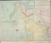
The south part of Virginia, now the north part of Carolina
0
Atlases, gazetteers, guidebooks and other books
377
Maps of the World
16
Maps of the Oceans
24
Maps of North and South America
23
Maps of North America.
551
Maps of New York City and State
1340
Lawrence H. Slaughter Collection of English maps, charts, globes, books and atlases
1020
John H. Levine Collection
60
More
Show filters
Hide filters
Show Only Public Domain
topic
Administrative and political divisions
340
Railroads
316
Real property
301
Landowners
215
Geography
157
More
Less
name
New York (N.Y.). Common Council
99
Moll, Herman, -1732
81
Sayer, Robert, 1725-1794
80
Dunn, Samuel, d. 1794
76
Colles, Christopher, 1738-1816
54
More
Less
collection
Maps of New York City and State
2004
Lawrence H. Slaughter Collection of English maps, charts, globes, books and atlases
382
Atlases, gazetteers, guidebooks and other books
124
John H. Levine Collection
28
Maps of North and South America
8
More
Less
place
New York (State)
1295
New York (N.Y.)
628
New York
524
Manhattan (New York, N.Y.)
341
Brooklyn (New York, N.Y.)
266
More
Less
genre
Maps
2488
Cadastral maps
183
Manuscript maps
71
Aerial views
30
Topographic maps
29
More
Less
publisher
publisher not identified
118
Printed for Robert Sayer, No. 53, Fleet-Street
76
Printed for Timothy Childe at the White Hart at the West-end of St. Paul's Church-yard
46
s.n
41
S. A. Mitchell, jr
34
More
Less
division
Map Division
2552
Manuscripts and Archives Division
2
type
cartographic
2478
text
83
still image
36
Date Range
to
2,554 results found for:
New York (State)?tab=filter
Sort by:
Relevance
Title
Date created
Date digitized
Sequence
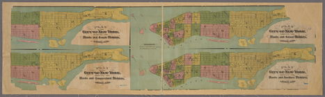
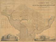
101st St. & 102nd St. and the…
use:
… partner (e.g.,
New
York
m
12,000 Square Miles around
New
York
City
use:
… partner (e.g.,
New
York
1863, West Point: [New York]
use:
… partner (e.g.,
New
York
1889, Larchmont Harbor, N.Y.:…
use:
… partner (e.g.,
New
York
m
1905 Library map of Manhattan, City of
New
York
use:
… partner (e.g.,
New
York
m
1906 Library map of Manhattan, City of
New
York
use:
… partner (e.g.,
New
York
m
1907 Library map of Manhattan, City of
New
York
use:
… partner (e.g.,
New
York
m
1907 Library map of Manhattan, City of
New
York
use:
… partner (e.g.,
New
York
1st Ward of NYC: [in draft du…
use:
… partner (e.g.,
New
York
m
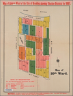
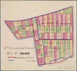
20th ward.
use:
… partner (e.g.,
New
York
m
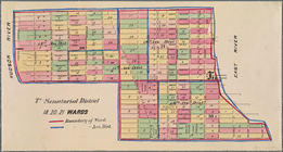
27th assembly district
use:
… partner (e.g.,
New
York
m
[3 maps of
New
York
use:
… partner (e.g.,
New
York
m
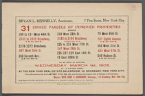
31 Choice Parcels of Improved…
use:
… partner (e.g.,
New
York
m
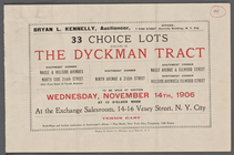
33 Choice Lots situate [sic] …
use:
… partner (e.g.,
New
York
4 plans of the City of
New
York
showing
use:
… partner (e.g.,
New
York
m
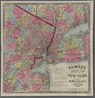
40 miles around
New
York
. H. H. Lloyd's
new
use:
… partner (e.g.,
New
York
4th Senatorial District. 1,2,…
use:
… partner (e.g.,
New
York
5th Senatorial District 8, 9,…
use:
… partner (e.g.,
New
York
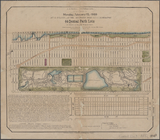
64 Central Park Lots,
New
York
City.
use:
… partner (e.g.,
New
York
6th Senatorial District 10, 1…
use:
… partner (e.g.,
New
York
7th Senatorial District 18, 2…
use:
… partner (e.g.,
New
York
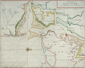
A chart of
New
York
Harbour
use:
… partner (e.g.,
New
York
A chart of
New
York
Harbour
use:
… partner (e.g.,
New
York
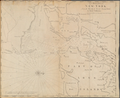
A chart of
New
York
Island & North River
use:
… partner (e.g.,
New
York
[A chart of
New
York
Island & North
use:
… partner (e.g.,
New
York
A chart of the Atlantick Ocea…
use:
… partner (e.g.,
New
York
… in the province of
New
Jersey
use:
… partner (e.g.,
New
York
…
New
York
use:
… partner (e.g.,
New
York
… coasts of
New
England,
New
Iarsey, Virginia
use:
… partner (e.g.,
New
York
… coasts of
New
-England,
New
-Jarsey, Virginia
use:
… partner (e.g.,
New
York
… and
states
: also
use:
… partner (e.g.,
New
York
… of
New
York
in North
use:
… partner (e.g.,
New
York
… of
New
York
in North
use:
… partner (e.g.,
New
York
… of
New
-
York
in North
use:
… partner (e.g.,
New
York
m
… of
New
-
York
in North
use:
… partner (e.g.,
New
York
… of
New
-
York
in North
use:
… partner (e.g.,
New
York
… to the Old and
New
Testament
use:
… partner (e.g.,
New
York
…, Louisiana,
New
Spain
use:
… partner (e.g.,
New
York
A complete map of the East In…
use:
… partner (e.g.,
New
York
…
States
of America : lat
use:
… partner (e.g.,
New
York
…
States
of America : lat
use:
… partner (e.g.,
New
York
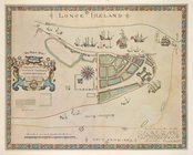
A description of the Towne of Mannados or
New
use:
… partner (e.g.,
New
York
A draught of
New
York
and Perthamboy
use:
… partner (e.g.,
New
York
… to
New
York
Town
use:
… partner (e.g.,
New
York
… to
New
York
Town
use:
… partner (e.g.,
New
York
… to
New
York
Town by Mark
use:
… partner (e.g.,
New
York
… to
New
York
Town.
use:
… partner (e.g.,
New
York
A General Introduction to Geo…
use:
… partner (e.g.,
New
York
A General Introduction to Geo…
use:
… partner (e.g.,
New
York
A General Introduction to Geo…
use:
… partner (e.g.,
New
York
1
2
3
4
5
6
7
8
9
10
11
Previous
Next
1
2
3
4
5
6
7
8
9
10
11
Previous
Next