Click to visit the main New York Public Library Homepage
The New York Public Library
Digital Collections
About Digital Collections
Browse
Search only public domain materials
Items
Collections
Divisions
Home
Search
Browse
About
Search only public domain materials
Items
Collections
Divisions
Digital Collections
Using Images
Using Data
Collections
Charting America: Maps from the Lawrence H. Slaughter Collection and Others
Charting America: Maps from the Lawrence H. Slaughter Collection and Others
Navigation
Filters
Charting America: Maps from the Lawrence H. Slaughter Collection and Others
Previous
The south part of Virginia, now the north part of Carolina
0
Atlases, gazetteers, guidebooks and other books
377
Maps of the World
16
Maps of the Oceans
24
Maps of North and South America
23
Maps of North America.
551
Maps of New York City and State
1340
Lawrence H. Slaughter Collection of English maps, charts, globes, books and atlases
1020
John H. Levine Collection
60
More
Show filters
Hide filters
Show Only Public Domain
topic
Administrative and political divisions
282
Railroads
264
Real property
249
Landowners
182
City planning
105
More
Less
name
New York (N.Y.). Common Council
87
Mitchell, S. Augustus (Samuel Augustus), 1792-1868
49
Moll, Herman, -1732
41
Wells, Edward, 1667-1727
41
Dripps, M. (Matthew)
39
More
Less
collection
Maps of New York City and State
1385
Lawrence H. Slaughter Collection of English maps, charts, globes, books and atlases
262
Atlases, gazetteers, guidebooks and other books
85
John H. Levine Collection
13
Maps of the World
5
More
Less
place
New York (State)
930
New York (N.Y.)
464
New York
362
Manhattan (New York, N.Y.)
252
Brooklyn (New York, N.Y.)
206
More
Less
genre
Maps
1744
Cadastral maps
151
Manuscript maps
52
Topographic maps
24
Road maps
23
More
Less
publisher
publisher not identified
72
S. A. Mitchell, jr
42
Printed at the Theater,
38
G.W. & C.B. Colton & Co
33
s.n
30
More
Less
division
Map Division
1755
Manuscripts and Archives Division
2
type
cartographic
1736
text
26
still image
14
Date Range
to
1,758 results found for:
North Hempstead (N.Y. : Town) -- Maps?tab=filter
Sort by:
Relevance
Title
Date created
Date digitized
Sequence
Vingboons
map
of Manhattan, 1639
note:
Oriented with
north
to the right.
Map
of the Greenwich Village section
image:
psnypl_
map
_352
m
Map
of the Greenwich Village section
image:
ps_
map
_cd6_077
m
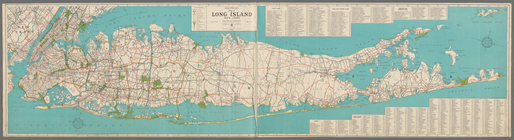
Hagstrom's
map
of Long Island New York …
note:
Oriented with
north
toward the upper right.
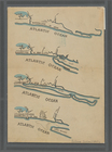
N
.
Y
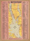
. City's waterfront.
collection:
N.Y
. City's waterfront.
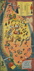
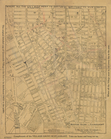
A sight-seers
map
of Manhattan.
image:
ps_
map
_124
m
Hagstrom's
map
of Queens
N
.
Y
. City …
note:
NYPL
Map
Div. copy has accession no
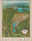
Blum's travel and guide
map
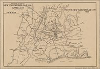
New York world
Map
of the New York world's fair
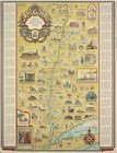
Romance
map
of the Hudson River Valley
Staten Island,
N
.
Y
., ed. of Feb. 1900
collection:
Staten Island,
N.Y
., ed. of Feb. 1900
m
Hagstom's
map
of Long Island New York
note:
…ʹ/
N
41°11ʹ--
N
40°32ʹ).
m
Map
of original grants and farms
image:
psnypl_
map
_306
…" - An accurate and detailed
map
note:
…
map
of Greenwich
Paterson,
N
.J. -
N
.
Y
., ed. of Feb. 1903
collection:
Paterson,
N
.J. -
N.Y
., ed. of Feb. 1903
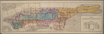
Map
of the Borough of Manhattan showing average
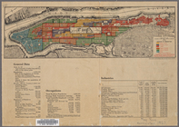
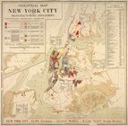
Industrial
map
of New York City
note:
Includes inset continuation
map
of Richmond
Map
of New York City (Manhattan
Map
of New York City [Manhattan
…
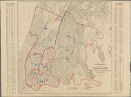
Map
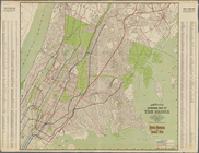
of the Bronx
Map
of the Bronx, showing the transit system.
Hagstrom's
map
of the Bronx, New York City
m
Hagstrom's
map
of Brooklyn (New York City) …
note:
… 74°03ʹ21ʺ--W 73°50ʹ00ʺ/
N
40°44ʹ21ʺ--
N
40°32ʹ59ʺ).
m
Map
of Brooklyn, House Number and Subway
Hagstrom's
Map
of Queens, city of New York
m
Map
of the Borough of Brooklyn, City of New York
m
Petersen's New
Map
of the Bronx showing all
m
Street Indexed
map
of the Borough of Queens, also
m
Hammond's complete
map
of Brooklyn …
Map
of the borough of Brooklyn, City of New York …
note:
Oriented with
north
at upper left corner.
m
Map
of routes to the Holland Tunnel.
note:
Text,
map
, and profile on verso.
…
map
of Staten Island,
N
.
Y
., Borough
collection:
…
map
of Staten Island,
N.Y
., Borough
Hagstrom's
map
of ... New York house-number
note:
Hagstrom
Map
Company.
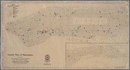
Health
map
of Manhattan
m
Map
of Boroughs of Manhattan and the Bronx
note:
Includes
Map
Map
of the Borough of Brooklyn, City of New York
m
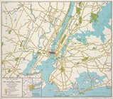
Map
showing 50 miles around New York
note:
…ʹ/
N
41°24ʹ--
N
39°59ʹ).
m
Map
of the borough of Brooklyn, City of New York
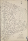
Map
of Manhattan south of 23rd St
New
Map
of the Borough of the Bronx.
Fishing
map
of City Island waters.
Map
of Flushing published by the Flushing
Map
of the city of Brooklyn.
Map
of Beechhurst (Whitestone Landing)situated
m
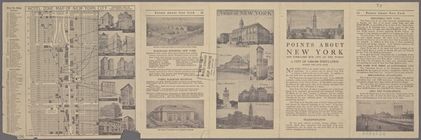
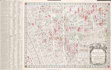
Hotel Zone
Map
of New York City
note:
2
maps
, views and text.
Map
of the Borough of Manhattan, showing
Map
of the Woodlawn Cemetery.
Petersen's new
map
of the Bronx, showing all
Rockaway, Queens,
N
.
Y
. [Four
maps
collection:
Rockaway, Queens,
N.Y
. [Four
maps
Petersen's new
map
of the Bronx, showing all
1
2
3
4
5
6
7
8
Previous
Next
1
2
3
4
5
6
7
8
Previous
Next