Click to visit the main New York Public Library Homepage
The New York Public Library
Digital Collections
About Digital Collections
Browse
Search only public domain materials
Items
Collections
Divisions
Home
Search
Browse
About
Search only public domain materials
Items
Collections
Divisions
Digital Collections
Using Images
Using Data
Collections
Charting America: Maps from the Lawrence H. Slaughter Collection and Others
Charting America: Maps from the Lawrence H. Slaughter Collection and Others
Navigation
Filters
Charting America: Maps from the Lawrence H. Slaughter Collection and Others
Previous
The south part of Virginia, now the north part of Carolina
0
Atlases, gazetteers, guidebooks and other books
377
Maps of the World
16
Maps of the Oceans
24
Maps of North and South America
23
Maps of North America.
551
Maps of New York City and State
1340
Lawrence H. Slaughter Collection of English maps, charts, globes, books and atlases
1020
John H. Levine Collection
60
More
Show filters
Hide filters
Show Only Public Domain
topic
Administrative and political divisions
63
Railroads
36
Landowners
20
Real property
20
Canals
18
More
Less
name
Atwood, John M., approximately 1818-
14
Burr, David H., 1803-1875
12
Colton, G. Woolworth (George Woolworth), 1827-1901
11
Colton, J. H. (Joseph Hutchins), 1800-1893
11
G.W. & C.B. Colton & Co
11
More
Less
collection
Maps of New York City and State
149
Lawrence H. Slaughter Collection of English maps, charts, globes, books and atlases
20
John H. Levine Collection
1
place
New York (State)
104
New York (N.Y.)
57
New York
41
Brooklyn (New York, N.Y.)
33
Manhattan (New York, N.Y.)
23
More
Less
genre
Maps
170
Cadastral maps
13
Nautical charts
3
Topographic maps
2
Advertisements
1
More
Less
publisher
publisher not identified
10
J.H. Colton
6
M. Dripps
6
Published by J.H. Colton & Co
6
G.W. & C.B. Colton
4
More
Less
division
Map Division
169
Manuscripts and Archives Division
1
type
cartographic
169
text
4
still image
2
Date Range
to
170 results found for:
Southern States?tab=filter
Sort by:
Relevance
Title
Date created
Date digitized
Sequence
m
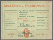
Real Estate at Public Auction
note:
… 110th St,
Southern
… of the
southern
part
m
… of the
southern
part
Map of the
southern
part of the borough
m
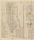
Map of northern part of New Y…
note:
Also shows
southern
part of New York City
Map showing the 19th Assembly…
note:
… portion, and
Southern
The Home Life Publishing Co.,…
collection:
Maps of New York City and
State
[Maps showing] Northern and
Southern
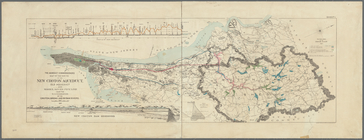
Map of the route of the new C…
note:
….) and
southern
Dutchess County
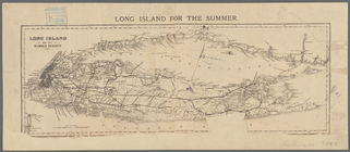
Long Island for the summer
note:
…, and the
southern
coast
m
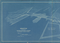
Sketch showing the
southern
boulevard approach
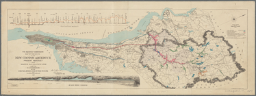
Map of the route of the new C…
note:
….) and
southern
Dutchess County
Map of New-York City
collection:
Maps of New York City and
State
Map of New-York City
collection:
Maps of New York City and
State
Map of New-York City / prepar…
note:
Southern
Manhattan and adjacent Brooklyn--Northern
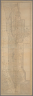
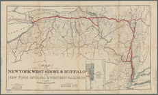
Map of the New York West Shor…
note:
…, Vermont, and
southern
m
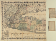
Map of Long Island and the
southern
part
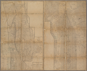
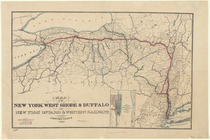
Map of the New York West Shor…
note:
…, Vermont, and
southern
Map showing route of the New …
collection:
Maps of New York City and
State
Map of property owned by Fran…
note:
…, and
southern
Long Island City.
Map of the Fitchburg, Cheshir…
note:
…
southern
Ontario and Quebec
Colton's New York City : Broo…
note:
… of the United
States
for the
Southern
District of New
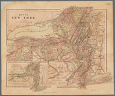
Map of New York
note:
…
southern
Ontario.
Revised map of the rail roads of the
State
note:
…, and adjacent
southern
Ontario
m
Colton's new map of Long Isla…
abstract:
…, and the
southern
coast
Revised map of the rail roads of the
State
note:
…
southern
Ontario and Quebec.
Colton's railroad & township map of the
state
note:
… for the
southern
dist. of N. York."…
Map of the country thirty thr…
note:
… of the
Southern
District of New
m
New map of the city of Brookl…
note:
… for the
Southern
District of New
Southern
part of Yonkers, and portion
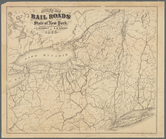
Map of the rail roads of the
State
note:
…,
State
Engr. & Surveyor
m
Map of Long Island and the
southern
part
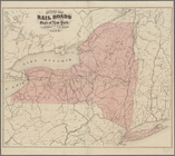
Map of the rail roads of the
State
note:
…
southern
Ontario and Quebec.
Map of the rail roads of the
state
note:
…
southern
Ontario and Quebec.
…, and the
southern
part of Harlem.
m
Map of Long Island and the
southern
part
m
Map of the City of New York :…
note:
…
States
for the
Southern
m
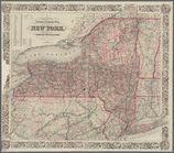
New map of the
state
of New York
note:
… of the United
States
for the
Southern
district of New
m
Map of Brooklyn and vicinity
note:
… for the
Southern
District of New
Map of the city of Brooklyn, …
note:
… for the
Southern
District of New
m
Asher & Adams' new topographical map of the
state
note:
… of the United
States
, for the
Southern
district
m
Map of the upper part of the …
note:
…
States
for the
Southern
m
Watson's new map of the city …
note:
… for the
Southern
district of New
m
Map of Kings County N.Y.
note:
… in the ...
Southern
District of New
Map of Brooklyn and vicinity
note:
…. for the
Southern
District of New
Map of the consolidated city …
note:
… Court of the
Southern
A map of the county between C…
collection:
Map of Lake George and the
southern
part of Lake
Map of Long Island: showing t…
note:
…, and the
southern
coast
Map of the
state
of New York
abstract:
…
southern
Ontario and Quebec
m
Map of Brooklyn and vicinity
note:
…. for the
Southern
District of New