Click to visit the main New York Public Library Homepage
The New York Public Library
Digital Collections
About Digital Collections
Browse
Search only public domain materials
Items
Collections
Divisions
Home
Search
Browse
About
Search only public domain materials
Items
Collections
Divisions
Digital Collections
Using Images
Using Data
Collections
Charting America: Maps from the Lawrence H. Slaughter Collection and Others
Charting America: Maps from the Lawrence H. Slaughter Collection and Others
Navigation
Filters
Charting America: Maps from the Lawrence H. Slaughter Collection and Others
Previous
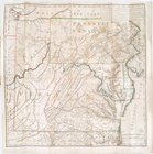
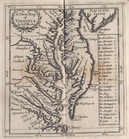
The south part of Virginia, now the north part of Carolina
0
Atlases, gazetteers, guidebooks and other books
377
Maps of the World
16
Maps of the Oceans
24
Maps of North and South America
23
Maps of North America.
551
Maps of New York City and State
1340
Lawrence H. Slaughter Collection of English maps, charts, globes, books and atlases
1020
John H. Levine Collection
60
More
Show filters
Hide filters
Show Only Public Domain
topic
Administrative and political divisions
279
Railroads
266
Real property
243
Landowners
175
City planning
107
More
Less
name
New York (N.Y.). Common Council
83
Mitchell, S. Augustus (Samuel Augustus), 1792-1868
48
Moll, Herman, -1732
40
Wells, Edward, 1667-1727
40
Dripps, M. (Matthew)
39
More
Less
collection
Maps of New York City and State
1387
Lawrence H. Slaughter Collection of English maps, charts, globes, books and atlases
216
Atlases, gazetteers, guidebooks and other books
74
John H. Levine Collection
10
Maps of the World
5
More
Less
place
New York (State)
934
New York (N.Y.)
457
New York
361
Manhattan (New York, N.Y.)
248
Brooklyn (New York, N.Y.)
200
More
Less
genre
Maps
1685
Cadastral maps
148
Manuscript maps
53
Topographic maps
24
Road maps
23
More
Less
publisher
publisher not identified
72
S. A. Mitchell, jr
42
Printed at the Theater,
37
G.W. & C.B. Colton & Co
33
... Sold ... by Tho. Bowles, print and map-seller in St. Paul's-Churchyard
28
More
Less
division
x
Map Division
type
cartographic
1680
text
18
still image
16
Date Range
to
1,698 results found for:
x
Niagara Canal (N.Y. : Proposed) -- Maps?tab=filter
Filtering on:
x
Division
: Map Division
Sort by:
Relevance
Title
Date created
Date digitized
Sequence
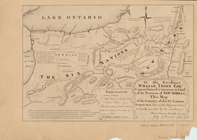
New York province.
Map
of the country
image:
ps_
map
_195
The generall historie of Virg…
note:
Map
Div. copy: Autographs in ink on t.p
A
map
of the world from the best
note:
… to Early
Maps
of the Middle
A new and accurat
map
of the world
note:
Imprint on
map
indicates this is 4th state
A chorographical
map
of the province
m
A chorographical
map
of the province
A
map
of the State of New York
A
map
of the British dominions in North
note:
… to Early
Maps
of the Middle
A
map
of the State of New York
A
map
of the state of New York : compiled
note:
… to Early
Maps
of the Middle
A
map
of the country between Albemarle
note:
… and Jefferson's
Map
of Virginia and Scull's
Map
A
map
of the state of New York : exhibiting
note:
… to Early
Maps
of the Middle
No. 1: [This
map
shows the position
note:
… to Early
Maps
of the Middle
A
map
of the State of New York : exhibiting
note:
…
N.Y
.'s wards
A
map
prepared
note:
… to Early
Maps
of the Middle
A new
map
of Virginia from the best
note:
… to Early
Maps
of the Middle
An Accurate
map
of New York in North
note:
Jolly D.C.
Maps
of America, in periodicals
Distance
map
of the state of New York
note:
… of the Falls of
Niagara
m
Map
of New York
note:
LC Railroad
maps
, 259
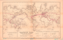
Map
Showing the Telegraph Lines in Operation
Map
of New-York
note:
… to Early
Maps
of the Middle
A general
map
of the world, or terraqueous
note:
… to Early
Maps
of the Middle
A
Map
of the country round Philadelphia
note:
… to Early
Maps
of the Middle
Map
of the State of New York
note:
…
Canal
," and statistical
Map
of the State of New York
note:
…
Canal
.
Map
of the State of New York
note:
… of the Western
Canal
" and Profile of the Northern
Canal
."…
Map
of the meetings constituting New York Yearly
note:
… to Early
Maps
of the Middle
m
Map
of the route of the
proposed
New York & Erie
note:
…
maps
.
m
Map
of the state of New York
note:
Described in Ristow's American
maps
and mapmakers
… Nouvelle York :
y
-compris les terres cédées du
N
note:
… statement on first
map
Map
of the state of New York
note:
… bridge,
Niagara
River
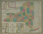
Map
of the state of New York : compiled
note:
… of the Falls of
Niagara
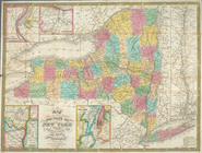
Map
of the state of New York : compiled
note:
… of the Falls of
Niagara
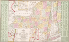
Map
of the state of New York : compiled
note:
Insets:
Map
Map
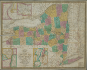
of the state of New York : compiled
note:
… of the Falls of
Niagara
Map
of the state of New York : compiled
note:
… of the Falls of
Niagara
A
map
of Florida and ye Great Lakes
A new
map
of Virginia
A new
map
of New Jarsey and Pensilvania
A new
map
of New England and New York
note:
…., and covers
N.Y
. as far west
Map
of the state
note:
… to Early
Maps
of the Middle
Map
of the state
note:
… to Early
Maps
of the Middle
Map
of the state
note:
… to Early
Maps
of the Middle
A
map
of the whole continent of America
note:
compiled from Mr. D'Anvilles
maps
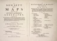
A new sett of
maps
both of antient
topic:
Maps
in education
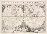
A new
map
of the terraqueous globe according
topic:
Maps
in education
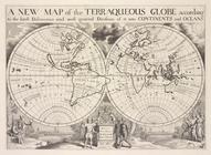
A new
map
of the terraqueous globe according
topic:
Maps
in education
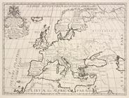
A new
map
of Europe according to its ancient
topic:
Maps
in education
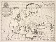
A new
map
of Europe according to the present
topic:
Maps
in education
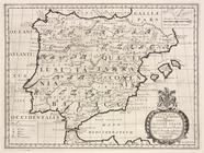
A new
map
of Iberia Europæa alias Celtiberia
topic:
Maps
in education
1
2
3
4
5
6
7
Previous
Next
1
2
3
4
5
6
7
Previous
Next