Click to visit the main New York Public Library Homepage
The New York Public Library
Digital Collections
About Digital Collections
Browse
Search only public domain materials
Items
Collections
Divisions
Home
Search
Browse
About
Search only public domain materials
Items
Collections
Divisions
Digital Collections
Using Images
Using Data
Collections
Charting America: Maps from the Lawrence H. Slaughter Collection and Others
Charting America: Maps from the Lawrence H. Slaughter Collection and Others
Navigation
Filters
Charting America: Maps from the Lawrence H. Slaughter Collection and Others
Previous
The south part of Virginia, now the north part of Carolina
0
Atlases, gazetteers, guidebooks and other books
377
Maps of the World
16
Maps of the Oceans
24
Maps of North and South America
23
Maps of North America.
551
Maps of New York City and State
1340
Lawrence H. Slaughter Collection of English maps, charts, globes, books and atlases
1020
John H. Levine Collection
60
More
Show filters
Hide filters
Show Only Public Domain
topic
Real property
19
Landowners
17
Railroads
9
Administrative and political divisions
5
Fire prevention
2
More
Less
name
Dripps, M. (Matthew)
4
Welcke, Robert A
2
Bartlett, L. L. (Lewis L.), 1809-1888
1
Beers, Ellis & Soule
1
Beers, F. W. (Frederick W.)
1
More
Less
collection
Maps of New York City and State
25
place
x
New York
New York (State)
25
Brooklyn (New York, N.Y.)
9
New York (N.Y.)
9
Queens (New York, N.Y.)
6
More
Less
genre
x
Cadastral maps
Maps
25
Manuscript maps
2
Facsimiles
1
publisher
publisher not identified
3
M. Dripps
2
Published by M. Dripps
2
Beers, Ellis & Soule
1
E. Belcher Hyde
1
More
Less
division
Map Division
25
type
cartographic
24
still image
1
text
1
Date Range
to
25 results found for:
x
Greenburgh (N.Y. : Town) -- Maps?tab=filter
Filtering on:
x
Genre
: Cadastral maps
x
Place
: New York
Sort by:
Relevance
Title
Date created
Date digitized
Sequence
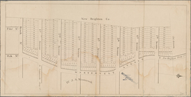
A plott of ye situations of the
towns
note:
…. Albany,
N.Y
. 1883.
m
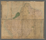
Map
of upper New York City and adjacent
note:
NYPL
Map
Div. copy is missing southwest sheet.
m
Map
of the
town
of Morrisania, Westchester Co.
N
note:
Cadastral
map
showing wards, buildings
m
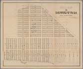
Map
of Kings County
N
.
Y
.
abstract:
… of Brooklyn and 6 rural
towns
m
Map
showing the injury to the property
note:
… catalog of the
Map
Map
of property belonging to the heirs
note:
… catalog of the
Map
Index
map
to Bensonhurst-by-the-Sea
collection:
Index
map
to Bensonhurst-by-the-Sea and additions
Index
map
to Bensonhurst-by-the Sea
collection:
Index
map
to Bensonhurst-by-the Sea and additions
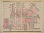
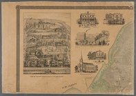
m
Map
of the city of Williamsburgh and
town
abstract:
… of the
map
, and illustrations
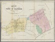
Map
of the
town
of Flatbush, Kings Co. L.I. …
note:
Mapping
the Nation (NEH grant, 2015-2018)…
Map
of the City of New York
abstract:
… flat with
map
.
Map
showing the relative position of lots
note:
… the property shewn on Ewens
map
."…
Mulberry Bend District.
Map
bounded
m
Map
of New York City from Battery
collection:
Map
of New York City from Battery to 29
m
Property identification
map
of Inwood Hill
note:
Blueprint of
map
, indicating property owners
m
Map
of the village of Astoria, Queens Co. L.I.
note:
… catalog of the
Map
Map
of Long Island City, Queens Co.
N
.
Y
.
collection:
Map
of Long Island City, Queens Co.
N.Y
.
m
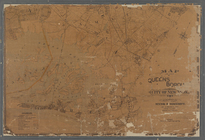
Map
of the Queens Boro[ugh], city of New
note:
… catalog of the
Map
m
Map
of the borough of Queens, City of New York …
note:
… 73°43ʹ09ʺ/
N
40°48ʹ10ʺ--
N
m
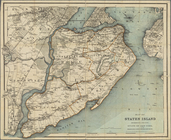
Map
of Staten Island, or Richmond
abstract:
… owners' names,
towns
m
Map
of Staten Island (Richmond Co.)
N
.
Y
note:
NYPL
Map
Div. copy has accession no
Map
of Staten Island, Richmond County
abstract:
… of neighboring
towns
. Shows
Real estate
map
of property bounded by Brook
note:
… catalog of the
Map
m
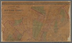
Higginson's
map
of New York and vicinity
abstract:
… 73°39ʹ18ʺ/
N
41°07ʹ08ʺ--
N
m
…, Long Island
N
.
Y
.
note:
Mapping
the Nation (NEH grant, 2015-2018)…
End of results
|
Top