Click to visit the main New York Public Library Homepage
The New York Public Library
Digital Collections
About Digital Collections
Browse
Search only public domain materials
Items
Collections
Divisions
Home
Search
Browse
About
Search only public domain materials
Items
Collections
Divisions
Digital Collections
Using Images
Using Data
Collections
Charting America: Maps from the Lawrence H. Slaughter Collection and Others
Charting America: Maps from the Lawrence H. Slaughter Collection and Others
Navigation
Filters
Charting America: Maps from the Lawrence H. Slaughter Collection and Others
Previous
The south part of Virginia, now the north part of Carolina
0
Atlases, gazetteers, guidebooks and other books
377
Maps of the World
16
Maps of the Oceans
24
Maps of North and South America
23
Maps of North America.
551
Maps of New York City and State
1340
Lawrence H. Slaughter Collection of English maps, charts, globes, books and atlases
1020
John H. Levine Collection
60
More
Show filters
Hide filters
Show Only Public Domain
topic
Real property
18
Landowners
11
Historical geography
2
History
2
Administrative and political divisions
1
More
Less
name
Baker
1
Baker, A. E
1
Bingham, Reuben H
1
C.B. Graham's Lith
1
Cartwright, Geo. W
1
More
Less
collection
Maps of New York City and State
22
place
New York (State)
20
Brooklyn (New York, N.Y.)
3
New York
3
Bronx (New York, N.Y.)
2
Bronx County
2
More
Less
genre
x
Cadastral maps
Maps
22
Manuscript maps
2
Bathymetric maps
1
Topographic maps
1
publisher
x
publisher not identified
Heffron & Phelps litho
1
Lith. by Berggoetz & Co
1
division
Map Division
22
type
cartographic
22
text
1
Date Range
to
22 results found for:
x
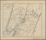
North Hempstead (N.Y. : Town) -- Maps?tab=filter
Filtering on:
x
Genre
: Cadastral maps
x
Publisher
: publisher not identified
Sort by:
Relevance
Title
Date created
Date digitized
Sequence
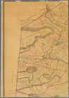
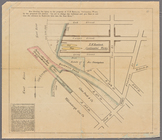
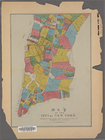
Map
of Dobbs Ferry and Hastings
note:
Map
also shows street names, roads
m
Map
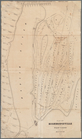
of Albany County, New York
note:
by Jay Gould, Roxbury
N.Y
. and I.B
m
Map
of the highlands of the Hudson
note:
by James P. Kirby, E.C., Newburgh,
N.Y
m
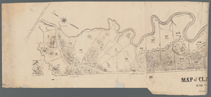
Map
of Clasons Point
note:
Mapping
the Nation (NEH grant, 2015-2018)…
Map
of part of Orange County, New York
note:
Mapping
the Nation (NEH grant, 2015-2018)…
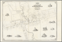
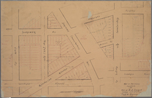
Map
of the village of Williamsville in Erie County,
N
note:
Cadastral
map
showing building
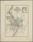
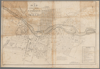
Map
of the city of Rochester
note:
Mapping
the Nation (NEH grant, 2015-2018)…
Map
of the upper part of the village
note:
Mapping
the Nation (NEH grant, 2015-2018)…
… of Ogdensburgh,
N
.
Y
.
note:
Cadastral
map
showing lot numbers
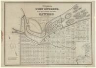
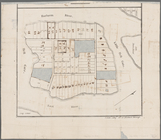
Village of Port Ontario, in the
Town
note:
Cadastral
map
showing blocks, lot
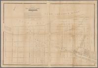
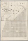
Map
of pr[op]erty of Union Avenue, Saratoga
note:
Oriented with
north
to the lower right.
Map
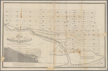
of Schuylerville
note:
Map
shows blocks and lot numbers, mills
…, Chatauque Co.
N
.
Y
.
note:
Includes text, note, and inset
map
of: "Part
… County,
N
.
Y
.
note:
Map
shows townships, block and lot numbers
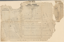
Map
of lots situated in the city
note:
Oriented with
north
toward the upper right.
Historical sketch
map
of Kings Bridge
note:
From: History of the
town
of Kings Bridge
Map
of Highbridgeville in the
town
note:
Mapping
the Nation (NEH grant, 2015-2018)…
m
Map
showing the injury to the property
note:
… catalog of the
Map
Map
of property belonging to the heirs
note:
… catalog of the
Map
Map
of property belonging to est. of S.J
note:
… catalog of the
Map
Map
of the City of New York
abstract:
… flat with
map
.
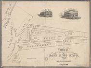
Map
of Great Barn Island, New York, showing
note:
Title, for
map
of place now known as Wards
End of results
|
Top