Click to visit the main New York Public Library Homepage
The New York Public Library
Digital Collections
About Digital Collections
Browse
Search only public domain materials
Items
Collections
Divisions
Home
Search
Browse
About
Search only public domain materials
Items
Collections
Divisions
Digital Collections
Using Images
Using Data
Collections
Charting America: Maps from the Lawrence H. Slaughter Collection and Others
Charting America: Maps from the Lawrence H. Slaughter Collection and Others
Navigation
Filters
Charting America: Maps from the Lawrence H. Slaughter Collection and Others
Previous
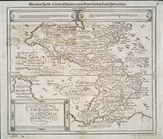
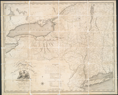
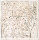
The south part of Virginia, now the north part of Carolina
0
Atlases, gazetteers, guidebooks and other books
377
Maps of the World
16
Maps of the Oceans
24
Maps of North and South America
23
Maps of North America.
551
Maps of New York City and State
1340
Lawrence H. Slaughter Collection of English maps, charts, globes, books and atlases
1020
John H. Levine Collection
60
More
Show filters
Hide filters
Show Only Public Domain
topic
Geography
461
Administrative and political divisions
340
Railroads
317
Real property
302
Landowners
216
More
Less
name
Thornton, Samuel
173
Ortelius, Abraham, 1527-1598
129
Coignet, Michel, 1549-1623
125
Shawe, James
125
Montanus, Arnoldus, 1625?-1683
117
More
Less
collection
Maps of New York City and State
1999
Lawrence H. Slaughter Collection of English maps, charts, globes, books and atlases
1218
Atlases, gazetteers, guidebooks and other books
459
John H. Levine Collection
60
Maps of North and South America
37
More
Less
place
New York (State)
1292
New York (N.Y.)
648
New York
523
Manhattan (New York, N.Y.)
345
Brooklyn (New York, N.Y.)
266
More
Less
genre
x
Maps
Nautical charts
187
Cadastral maps
183
Manuscript maps
71
Aerial views
30
More
Less
publisher
Printed for Ieames Shawe, and are to be solde at his shoppe nigh Ludgate,
125
publisher not identified
119
Printed by the author, and are to be had at his house
115
Chapman and Hall
109
M. Carey
58
More
Less
division
Map Division
3805
Manuscripts and Archives Division
2
type
cartographic
3681
still image
134
text
85
Date Range
to
3,810 results found for:
x
Maps?tab=filter
Filtering on:
x
Genre
: Maps
Sort by:
Relevance
Title
Date created
Date digitized
Sequence
Orbis terrae compendiosa desc…
note:
Shirley, R.W.
Mapping
of the world, 157
A chart of the world : exhibi…
note:
… to Early
Maps
of the Middle
New York province.
Map
of the country
image:
ps_
map
_195
Insulae Americanae in Oceano …
collection:
Maps
of North and South America
The generall historie of Virg…
note:
Map
Div. copy: Autographs in ink on t.p
Nova et accuratissima totius …
image:
psnypl_
map
_233
A
map
of the world from the best
note:
… to Early
Maps
of the Middle
Novae insvlae XXVI nova tabvla
note:
… to Early
Maps
of the Middle
Province de New-York : en 4 f…
abstract:
…'s A
map
of the Province
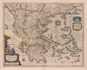
Græcia
A new and accurat
map
of the world
note:
Imprint on
map
indicates this is 4th state
A chorographical
map
of the province
m
America noviter delineata
note:
…, R.V. The
Mapping
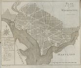
Plan de la ville de Washingto…
note:
Differs from other similar
map
. Lacks
m
Terra Sancta quae in Sacris T…
image:
ps_
map
_192
Carte generale de la terre : …
note:
… to Early
Maps
of the Middle
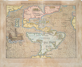
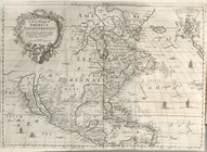
L'Amerique, ou, Le nouveau co…
collection:
Maps
of North and South America
m
A chorographical
map
of the province
State of New-York for Spaffor…
note:
Copy in
Map
Div. 97-6454: Lawrence H
Chart of the world on Mercato…
note:
… to Early
Maps
of the Middle
Americae sive novi orbis, nov…
note:
Burden, P.D.
Mapping
of North America
A
map
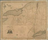
of the State of New York
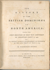
The history of the British do…
collection:
… of English
maps
, charts
A
map
of the British dominions in North
note:
… to Early
Maps
of the Middle
Die Neüwen Inseln so hinder H…
note:
Variant ed. of Burden, P.D.
Mapping
Isothermal chart, or, View of…
note:
… to Early
Maps
of the Middle
A
map
of the State of New York
Nouvelle carte de la Pensylva…
note:
… to Early
Maps
of the Middle
Nouvelle carte de la Caroline
note:
… to Early
Maps
of the Middle
A
map
of the state of New York : compiled
note:
… to Early
Maps
of the Middle
Americae sive Indiae occident…
note:
Map
engraved by Hessel Gerritsz--Burden.
Moral and political chart of …
note:
… to Early
Maps
of the Middle
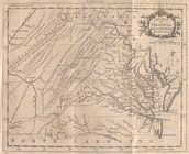
A
map
of the country between Albemarle
note:
… and Jefferson's
Map
of Virginia and Scull's
Map
A
map
of the state of New York : exhibiting
note:
… to Early
Maps
of the Middle
No. 1: [This
map
shows the position
note:
… to Early
Maps
of the Middle
America, siue, India Nova: ad…
note:
Burden, P.D.
Mapping
of North America
The state of Virginia : from …
note:
… to Early
Maps
of the Middle
Nova orbis tabvla
note:
Includes ancillary
maps
of north and south
America
note:
Burden, P.D.
Mapping
of North America
A
map
of the State of New York : exhibiting
note:
Map
printed on 4 sheets, pieced together.
A new mapp of America Septent…
note:
… to Early
Maps
of the Middle
A
map
prepared for the report of the New York
note:
… to Early
Maps
of the Middle
Scientia terrarum et coelorum…
note:
Map
shows boundaries, rivers, mountain
A new
map
of Virginia from the best
note:
… to Early
Maps
of the Middle
The world, on Mercator's proj…
note:
… to Early
Maps
of the Middle
An Accurate
map
of New York in North
note:
Jolly D.C.
Maps
of America, in periodicals
The state of Virginia : from …
note:
… to Early
Maps
of the Middle
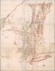
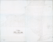
Distance
map
of the state of New York
note:
… of the
map
.
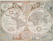
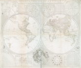
The world in hemispheres : wi…
note:
… to Early
Maps
of the Middle
Americae tam septentrionalis …
collection:
Maps
of North and South America
1
2
3
4
5
6
7
8
9
10
…
15
16
Previous
Next
1
2
3
4
5
6
7
8
9
10
…
15
16
Previous
Next