Click to visit the main New York Public Library Homepage
The New York Public Library
Digital Collections
About Digital Collections
Browse
Search only public domain materials
Items
Collections
Divisions
Home
Search
Browse
About
Search only public domain materials
Items
Collections
Divisions
Digital Collections
Using Images
Using Data
Collections
Charting America: Maps from the Lawrence H. Slaughter Collection and Others
Charting America: Maps from the Lawrence H. Slaughter Collection and Others
Navigation
Filters
Charting America: Maps from the Lawrence H. Slaughter Collection and Others
Previous
The south part of Virginia, now the north part of Carolina
0
Atlases, gazetteers, guidebooks and other books
377
Maps of the World
16
Maps of the Oceans
24
Maps of North and South America
23
Maps of North America.
551
Maps of New York City and State
1340
Lawrence H. Slaughter Collection of English maps, charts, globes, books and atlases
1020
John H. Levine Collection
60
More
Show filters
Hide filters
Show Only Public Domain
topic
Roads
18
Railroads
10
Administrative and political divisions
8
Aqueducts
3
Bicycle trails
3
More
Less
name
G.W. & C.B. Colton & Co
8
Rand McNally and Company
4
Buell & Wilgus
1
C.S. Hammond & Company
1
Colton, Ohman & Co
1
More
Less
collection
x
Maps of New York City and State
place
New York (State)
22
New York Metropolitan Area
7
New York
5
Long Island (N.Y.)
4
Bronx (New York, N.Y.)
3
More
Less
genre
x
Road maps
Maps
23
Mass transit
2
Wall maps
1
publisher
G.W. & C.B. Colton & Co
9
The Company
3
Buell & Wilgus
1
C.S. Hammond & Co
1
Colton, Ohman & Co., Geographical Publishers
1
More
Less
division
Map Division
23
type
cartographic
23
Date Range
to
23 results found for:
x
North Hempstead (N.Y. : Town) -- Maps?tab=filter
Filtering on:
x
Genre
: Road maps
x
Collection
: a1a9d830-c5a6-012f-00ec-58d385a7bc34
Sort by:
Relevance
Title
Date created
Date digitized
Sequence
Distance
map
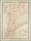
of the state of New York
note:
… 1:1,000,000 (W 80°--W 72°/
N
45°--
N
40°)…
Map
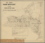
showing highway improvement in the state
note:
Mapping
the Nation (NEH grant, 2015-2018)…
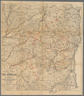
Van Loan's road
map
of the Catskills and vicinity
note:
Mapping
the Nation (NEH grant, 2015-2018)…
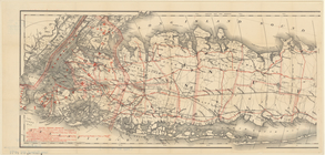
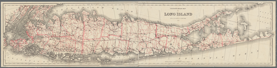
m
Colton's road
map
of Long Island
note:
Shows roads, railroads, cities and
towns
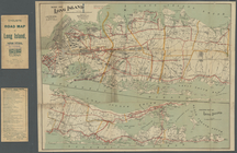
Map
of Long Island
note:
…., Brooklyn,
N.Y
."…
Colton's road
map
of Long Island
note:
Shows roads, railroads, cities and
towns
… of Niagara County,
N
.
Y
.
note:
… Washington St., Buffalo,
N.Y
."…
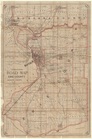
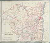
Road
map
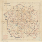
of the counties of Putnam
note:
…"Copyright 1898, by Colton, Ohman & Co.,
N.Y
."…
Colton's road
map
of the counties of Putnam
note:
Mapping
the Nation (NEH grant, 2015-2018)…
Colton's Road
map
of Sullivan County, State
note:
Also shows cities and
towns
, post offices
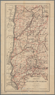
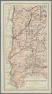
Colton's road
map
of the counties of Orange
note:
Shows Roads, railroads,
towns
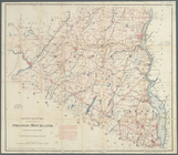
Road
map
of Westchester Co.,
N
.
Y
.
note:
Stevens & Morris, eng.,
N.Y
.
Colton's
map
of the county of Westchester
note:
… (
N.Y
.) to Harlem
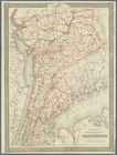
Colton's
map
of the county of Westchester
note:
… (
N.Y
.) to Harlem
Colton's road
map
of Ulster County, state
note:
Shows cities and
towns
, post offices
Rand McNally & Co.'s new handy
map
m
Hammond's complete
map
of Brooklyn
note:
Scale approximately 1:36,500 (W 73°57ʹ08ʺ/
N
m
Cyclists' road
map
of New York
note:
Mapping
the Nation (NEH grant, 2015-2018)…
m
Map
of New York City …
m
Hagstrom's
map
of Queens
N
.
Y
. City …
note:
NYPL
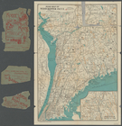
Map
Div. copy has accession no
Map
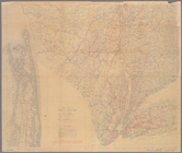
of the country thirty three miles around
note:
… 74°36ʹ--W 73°25ʹ/
N
41°09ʹ--
N
40°12ʹ).
… trails
map
, Long Island
note:
…ʹ/
N
41°19ʹ--
N
40°11ʹ).
…
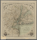
map
New York City
note:
…ʹ/
N
42°48ʹ--
N
39°09ʹ).
End of results
|
Top