Click to visit the main New York Public Library Homepage
The New York Public Library
Digital Collections
About Digital Collections
Browse
Search only public domain materials
Items
Collections
Divisions
Home
Search
Browse
About
Search only public domain materials
Items
Collections
Divisions
Digital Collections
Using Images
Using Data
Collections
Charting America: Maps from the Lawrence H. Slaughter Collection and Others
Charting America: Maps from the Lawrence H. Slaughter Collection and Others
Navigation
Filters
Charting America: Maps from the Lawrence H. Slaughter Collection and Others
Previous
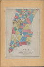
The south part of Virginia, now the north part of Carolina
0
Atlases, gazetteers, guidebooks and other books
377
Maps of the World
16
Maps of the Oceans
24
Maps of North and South America
23
Maps of North America.
551
Maps of New York City and State
1340
Lawrence H. Slaughter Collection of English maps, charts, globes, books and atlases
1020
John H. Levine Collection
60
More
Show filters
Hide filters
Show Only Public Domain
topic
City planning
73
Manhattan (New York, N.Y.)--Maps
7
New York (N.Y.)--Maps
7
Fire protection districts -- New York (State) -- New York -- Maps
6
Administrative and political divisions
5
More
Less
name
x
New York (N.Y.). Common Council
Valentine, D. T. (David Thomas), 1801-1869
22
Hayward, George, b. ca. 1800
16
American Revolution (1775-1783)
1
Bien, Julius, 1826-1909
1
More
Less
collection
Maps of New York City and State
87
place
New York (N.Y.)
79
Central Park (New York, N.Y.)
62
Manhattan (New York, N.Y.)
14
New York (State)
5
Brooklyn (New York, N.Y.)
2
More
Less
genre
Maps
87
publisher
Common Council
4
Common Council
3
New York Common Council
3
George Hayward
1
N.Y. City Common Council
1
More
Less
division
Map Division
87
type
cartographic
87
Date Range
to
87 results found for:
x
North Hempstead (N.Y. : Town) -- Maps?tab=filter
Filtering on:
x
Name
: New York (N.Y.). Common Council
Sort by:
Relevance
Title
Date created
Date digitized
Sequence
m
Map
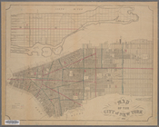
of the consolidated City of Brooklyn
note:
Oriented with
north
to lower left of sheet.
Map
of Brooklyn at the time
note:
…"Lith. by Geo. Hayward 120 Water St.
N.Y
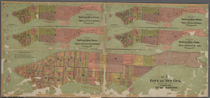
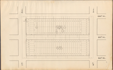
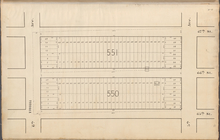
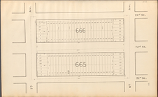
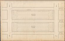
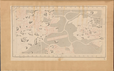
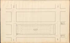
Central Park Planning
Map
No. 6: Bounded
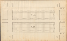
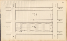
Central Park Planning
Map
: Bounded
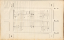
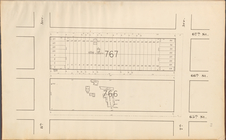
Central Park Planning
Map
No. 2: Bounded
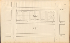
Central Park Planning
Map
: Bounded
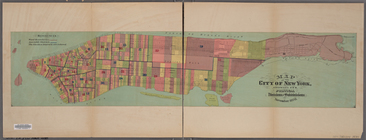
Map
of the City of New York showing
note:
…"Lith. by Geo. Hayward, 120 Water Str.
N
Central Park Planning
Map
: Bounded
collection:
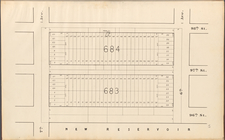
Central Park Planning
Map
: Bounded by 98
… of New York in
North
note:
…. 120 Water Str.
N.Y
.; Copied from a
Map
Central Park Planning
Map
No. 28
Central Park Planning
Map
: Bounded
collection:
Central Park Planning
Map
: Bounded by 95
Central Park Planning
Map
No. 4: Bounded
Central Park Planning
Map
: Bounded
Central Park Planning
Map
: Bounded
collection:
Central Park Planning
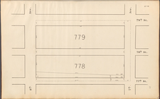
Map
: Bounded by 71
Central Park Planning
Map
No. 17
Central Park Planning
Map
: Bounded
Central Park Planning
Map
No. 9: Bounded
Central Park Planning
Map
No. 30
Central Park Planning
Map
: Bounded
collection:
Central Park Planning
Map
: Bounded by 65
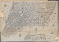
Map
of the City of New York, 1851
note:
…ʹ54ʺ/
N
40°42ʹ01ʺ--
N
Map
of the city of New York, showing its
note:
… 74°03ʹ01ʺ--W 73°54ʹ37ʺ/
N
40°52ʹ37ʺ--
N
40°41ʹ01ʺ)…
Central Park Planning
Map
No. 21
Central Park Planning
Map
: Bounded
collection:
Central Park Planning
Map
: Bounded by 97
Map
of the city of New York, showing its
note:
…,
N.Y
., 1870, c1871.
Central Park Planning
Map
: Bounded
Central Park Planning
Map
No. 12
Central Park Planning
Map
No. 20
Central Park Planning
Map
: Bounded
collection:
Central Park Planning
Map
: Bounded by 81
Central Park Planning
Map
: Bounded
Central Park Planning
Map
No. 19
Central Park Planning
Map
No. 7: Bounded
Central Park Planning
Map
No. 15
Central Park Planning
Map
: Bounded
collection:
Central Park Planning
Map
: Bounded by 82
Central Park Planning
Map
: Bounded
collection:
Central Park Planning
Map
: Bounded by 99
Central Park Planning
Map
No. 23
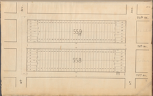
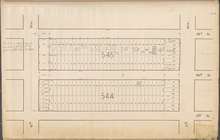
Map
of Drainage System on Lower Part
Key:
Map
of the City of New York
Central Park Planning
Map
No. 24
Central Park Planning
Map
No. 3: Bounded
Central Park Planning
Map
: Bounded
Central Park Planning
Map
No. 22
Central Park Planning
Map
: Bounded
collection:
Central Park Planning
Map
: Bounded by 67
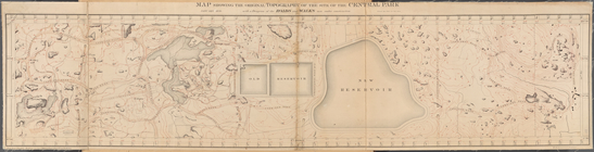
Map
Showing the Original Topography
Central Park Planning
Map
: Bounded
collection:
Central Park Planning
Map
: Bounded by 84
Central Park Planning
Map
: Bounded
collection:
Central Park Planning
Map
: Bounded by 83
Key continued:
Map
of the City of New York
Central Park Planning
Map
: Bounded
Central Park Planning
Map
: Bounded
collection:
Central Park Planning
Map
: Bounded by 67
Central Park Planning
Map
: Bounded
collection:
Central Park Planning
Map
: Bounded by 91
Central Park Planning
Map
No. 26