Click to visit the main New York Public Library Homepage
The New York Public Library
Digital Collections
About Digital Collections
Browse
Search only public domain materials
Items
Collections
Divisions
Home
Search
Browse
About
Search only public domain materials
Items
Collections
Divisions
Digital Collections
Using Images
Using Data
Collections
Charting America: Maps from the Lawrence H. Slaughter Collection and Others
Charting America: Maps from the Lawrence H. Slaughter Collection and Others
Navigation
Filters
Charting America: Maps from the Lawrence H. Slaughter Collection and Others
Previous
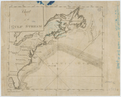
The south part of Virginia, now the north part of Carolina
0
Atlases, gazetteers, guidebooks and other books
377
Maps of the World
16
Maps of the Oceans
24
Maps of North and South America
23
Maps of North America.
551
Maps of New York City and State
1340
Lawrence H. Slaughter Collection of English maps, charts, globes, books and atlases
1020
John H. Levine Collection
60
More
Show filters
Hide filters
Show Only Public Domain
topic
Nautical charts
18
Magnetic declination
4
Navigation
2
Coasts
1
Discoveries in geography
1
More
Less
name
Thornton, Samuel
14
Goos, Pieter, approximately 1616-1675
8
Halley, Edmond, 1656-1742
3
Rich. Mount & Tho. Page
3
Seller, Jeremiah
3
More
Less
collection
Atlases, gazetteers, guidebooks and other books
22
Lawrence H. Slaughter Collection of English maps, charts, globes, books and atlases
21
Maps of the Oceans
8
Maps of New York City and State
2
John H. Levine Collection
1
More
Less
place
x
Atlantic Ocean
North Atlantic Ocean
13
Maps
9
Atlantic Ocean -- Maps -- Early works to 1800
8
Early works to 1800
6
More
Less
genre
Maps
55
Nautical charts
14
publisher
P. Goos
8
Anthony Iacobsz op t'Water inde Lootsman,
1
By Ier. Seller and Ch. Price, hydrographers to the Queen at the Hermitage staires,
1
Chez Pierre Mortier libraire
1
Chez Pierre Mortier libraire,
1
More
Less
division
Map Division
55
type
cartographic
55
text
1
Date Range
to
55 results found for:
x
Atlantic Ocean?tab=filter
Filtering on:
x
Place
: Atlantic Ocean
Sort by:
Relevance
Title
Date created
Date digitized
Sequence
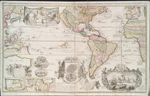
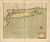
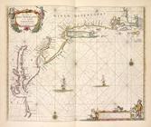
Middle part of Long Island So…
Tidal currents of Long Island…
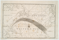
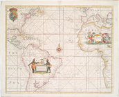
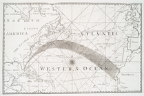
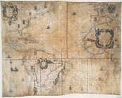
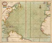
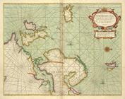
[A Chart of the
Atlantic
or Western
Ocean
]
note:
…
Atlantic
Seaboard.
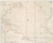
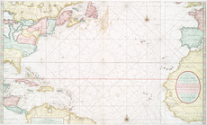
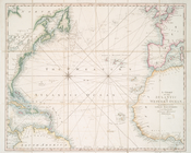
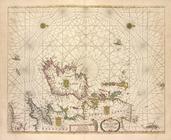
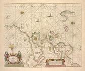
A Generall chart of the Western
Ocean
.
note:
…
Atlantic
Seaboard.
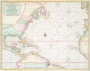
A Generall chart for the West…
note:
Covers
Atlantic
Ocean
between N 550
Ocean
Atlantique, ou, Mer du Nord : ou
note:
Covers the
Atlantic
Ocean
from N 56º to S 6º. …
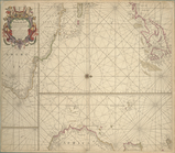
A new generall chart for the …
note:
Covers the
Atlantic
Ocean
between N 56º…
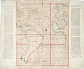
… and Southern
Oceans
: …
note:
Covers North and South
Atlantic
Oceans
.
… & Southern
Oceans
: shewing
note:
Covers North and South
Atlantic
Oceans
.
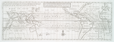
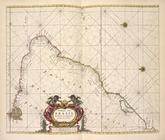
The Western
Ocean
.
note:
Chart of the
Atlantic
Ocean
with rhumb
A chart of the
Atlantic
Ocean
. I sheet.
note:
…
Atlantic
Seaboard.
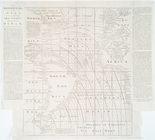
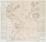
Annual passage of the herring…
note:
Map of North
Atlantic
Ocean
.
… in the western & southern
oceans
note:
Shows North and South
Atlantic
Oceans
A New generall chart for the …
note:
Covers the
Atlantic
Ocean
between N 550
A general chart of the West I…
note:
Covers the
Atlantic
Ocean
, adjacent
Chart of the
Atlantic
Ocean
.
note:
…
Atlantic
Seaboard.
A new generall chart for the …
note:
…
Atlantic
Seaboard.
A view of ye general & coasti…
note:
…
Atlantic
Seaboard.
A Chart of the
Atlantic
or Western
Ocean
Nieuwe wassende graade zee ka…
Ocean
Atlantique, ou, Mer du Nord : ou
note:
Koeman, C.
Atlantes
Neerlandici, IV, 430
Paskaert waer in de graden de…
note:
Koeman.
Atlantes
Neerlandici, IV, p. 372.
… map of the
Atlantic
or Western
Ocean
.
Carte nouvelle de la mer du S…
note:
Covers the Pacific and
Atlantic
oceans
Chart of the
Atlantic
Ocean
note:
…
Atlantic
Seaboard.
Chart of the Gulf Stream
note:
…
Atlantic
Seaboard.
Carta general del Oceano Atla…
note:
…
Atlantic
Seaboard.
… of the Western or
Atlantic
Ocean
note:
…
Atlantic
Seaboard.
West-Indische paskaert: waer …
note:
…
Atlantic
Seaboard.
A chart of the
Atlantic
or Western
Ocean
note:
…
Atlantic
Seaboard.
m
A chart of the
Atlantic
or Western
Ocean
note:
Shows North
Atlantic
Ocean
.
Chart of the
Atlantic
Ocean
note:
Nautical chart of the North
Atlantic
Ocean
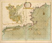
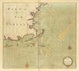
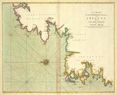
Part of New England, New York…
A large draught of New Englan…
A new and correct chart from …
Paskaarte om achter Yrlandt o…
Pas-caart van Hispangien, ver…
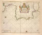
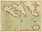
De cust van Barbaria, Gualata…
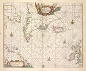
Pascaerte van Groen-landt,Ysl…
Pascaerte van Vlaemsche, Sout…
Pas caerte van Nieu Nederland…
Paskaart van Brazil van Rio d…
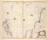
Pascaart van Europa.
Part of NEW ENGLAND
A new chart of the trading pa…
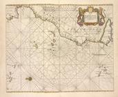
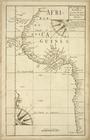
A draught of the coast of Afr…
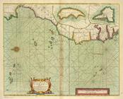
A generall chart from ENGLAND…
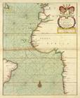
A chart of the coast of BARBA…
A Generall chart of the NORTH…
A chart of the NORTH-WEST coa…