Click to visit the main New York Public Library Homepage
The New York Public Library
Digital Collections
About Digital Collections
Browse
Search only public domain materials
Items
Collections
Divisions
Home
Search
Browse
About
Search only public domain materials
Items
Collections
Divisions
Digital Collections
Using Images
Using Data
Collections
Charting America: Maps from the Lawrence H. Slaughter Collection and Others
Charting America: Maps from the Lawrence H. Slaughter Collection and Others
Navigation
Filters
Charting America: Maps from the Lawrence H. Slaughter Collection and Others
Previous
The south part of Virginia, now the north part of Carolina
0
Atlases, gazetteers, guidebooks and other books
377
Maps of the World
16
Maps of the Oceans
24
Maps of North and South America
23
Maps of North America.
551
Maps of New York City and State
1340
Lawrence H. Slaughter Collection of English maps, charts, globes, books and atlases
1020
John H. Levine Collection
60
More
Show filters
Hide filters
Show Only Public Domain
topic
Local transit
94
Administrative and political divisions
87
Piers
74
Railroads
61
City planning
55
More
Less
name
Valentine, D. T. (David Thomas), 1801-1869
26
New York (N.Y.). Common Council
21
Rand McNally and Company
16
G.W. & C.B. Colton & Co
13
Hayward, George, b. ca. 1800
13
More
Less
collection
Maps of New York City and State
340
Lawrence H. Slaughter Collection of English maps, charts, globes, books and atlases
6
Atlases, gazetteers, guidebooks and other books
1
place
x
Manhattan (New York, N.Y.)
New York (N.Y.)
318
New York (State)
283
New York
150
Bronx (New York, N.Y.)
54
More
Less
genre
Maps
345
Manuscript maps
31
Cadastral maps
16
Tourist maps
3
Aerial views
2
More
Less
publisher
producer not identified
10
publisher not identified
9
Rand, McNally & Co
8
G.W. & C.B. Colton & Co
6
Matthews-Northrup Co
5
More
Less
division
Map Division
346
Manuscripts and Archives Division
1
type
cartographic
346
still image
4
text
4
Date Range
to
347 results found for:
x
New York (N.Y.)?tab=filter
Filtering on:
x
Place
: Manhattan (New York, N.Y.)
Sort by:
Relevance
Title
Date created
Date digitized
Sequence
… for the
new
draft
use:
… partner (e.g.,
New
York
… of
New
York
…
use:
… partner (e.g.,
New
York
Carl Schurz Park
use:
… partner (e.g.,
New
York
Park between 35th and 36th St…
use:
… partner (e.g.,
New
York
Hagstrom's map of lower
New
York
City …
use:
… partner (e.g.,
New
York
m
Riverside Park
use:
… partner (e.g.,
New
York
m
Map of Manhattan showing the …
use:
… partner (e.g.,
New
York
Block sketch 1679,
New
York
City
use:
… partner (e.g.,
New
York
m
Hammond's complete map of
New
York
City
use:
… partner (e.g.,
New
York
Colonial Park
use:
… partner (e.g.,
New
York
Rand McNally Map of Brooklyn
use:
… partner (e.g.,
New
York
City Hall Park
use:
… partner (e.g.,
New
York
m
Tentative height districts, M…
use:
… partner (e.g.,
New
York
m
Tentative use districts, Manh…
use:
… partner (e.g.,
New
York
Freight terminal map of
New
York
…
use:
… partner (e.g.,
New
York
Center of
New
York
, first city of the world
use:
… partner (e.g.,
New
York
New
-
York
City, County, and vicinity …
use:
… partner (e.g.,
New
York
Sketch map of the city of
New
York
use:
… partner (e.g.,
New
York
New
map
use:
… partner (e.g.,
New
York
Map of the Harlem River and S…
use:
… partner (e.g.,
New
York
Hammond's
new
guide map of Manhattan
use:
… partner (e.g.,
New
York
…,
New
York
City
use:
… partner (e.g.,
New
York
m
… of the city of
New
York
use:
… partner (e.g.,
New
York
m
Rand-McNally standard map of …
use:
… partner (e.g.,
New
York
m
Hagstrom's map of upper
New
York
house
use:
… partner (e.g.,
New
York
Williams' map of boroughs of …
use:
… partner (e.g.,
New
York
Map of boroughs of Manhattan …
use:
… partner (e.g.,
New
York
m
Hammond's
new
guide map of Manhattan
use:
… partner (e.g.,
New
York
m
Data for population from cens…
use:
… partner (e.g.,
New
York
m
… of
New
York
City
use:
… partner (e.g.,
New
York
m
… and island of
New
York
use:
… partner (e.g.,
New
York
m
Topographical map of
New
York
City, county
use:
… partner (e.g.,
New
York
… of
New
York
…
use:
… partner (e.g.,
New
York
City guide
use:
… partner (e.g.,
New
York
Map of
New
York
City …
use:
… partner (e.g.,
New
York
Hagstrom's
New
York
house-number and subway
use:
… partner (e.g.,
New
York
m
Financial district map of
New
York
City …
use:
… partner (e.g.,
New
York
m
Borough of Manhattan, 300 foo…
use:
… partner (e.g.,
New
York
Map of the borough of Manhatt…
use:
… partner (e.g.,
New
York
Block no. 86 : confidential r…
use:
… partner (e.g.,
New
York
m
Street guide of Manhattan and…
use:
… partner (e.g.,
New
York
…, City of
New
York
…
use:
… partner (e.g.,
New
York
Greater
New
York
's Census districts, 1920
use:
… partner (e.g.,
New
York
m
… commercial map of greater
New
York
use:
… partner (e.g.,
New
York
Hagstrom's map of ...
New
York
house-number
use:
… partner (e.g.,
New
York
Map of Morningside Park
use:
… partner (e.g.,
New
York
m
Map of original grants and fa…
use:
… partner (e.g.,
New
York
m
…, in the City of
New
-
York
use:
… partner (e.g.,
New
York
m
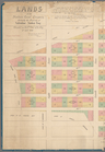
Lands of the Harlaem Canal Co…
use:
… partner (e.g.,
New
York
Upper Manhattan, comprising t…
use:
… partner (e.g.,
New
York
1
2
Previous
Next
1
2
Previous
Next