Click to visit the main New York Public Library Homepage
The New York Public Library
Digital Collections
About Digital Collections
Browse
Search only public domain materials
Items
Collections
Divisions
Home
Search
Browse
About
Search only public domain materials
Items
Collections
Divisions
Digital Collections
Using Images
Using Data
Collections
Charting America: Maps from the Lawrence H. Slaughter Collection and Others
Charting America: Maps from the Lawrence H. Slaughter Collection and Others
Navigation
Filters
Charting America: Maps from the Lawrence H. Slaughter Collection and Others
Previous
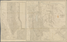
The south part of Virginia, now the north part of Carolina
0
Atlases, gazetteers, guidebooks and other books
377
Maps of the World
16
Maps of the Oceans
24
Maps of North and South America
23
Maps of North America.
551
Maps of New York City and State
1340
Lawrence H. Slaughter Collection of English maps, charts, globes, books and atlases
1020
John H. Levine Collection
60
More
Show filters
Hide filters
Show Only Public Domain
topic
Railroads
156
Real property
116
Local transit
74
Administrative and political divisions
68
Landowners
62
More
Less
name
Rand McNally and Company
25
Ohman, August R
23
Dripps, M. (Matthew)
19
Welcke, Robert A
18
C.S. Hammond & Company
17
More
Less
collection
Maps of New York City and State
520
Atlases, gazetteers, guidebooks and other books
2
Lawrence H. Slaughter Collection of English maps, charts, globes, books and atlases
2
place
x
New York
New York (State)
524
New York (N.Y.)
224
Brooklyn (New York, N.Y.)
172
Manhattan (New York, N.Y.)
150
More
Less
genre
Maps
523
Cadastral maps
35
Manuscript maps
26
Aerial views
10
Topographic maps
9
More
Less
publisher
publisher not identified
30
The Company
21
publisher unknown
20
M. Dripps
14
G.W. & C.B. Colton & Co
13
More
Less
division
Map Division
522
Manuscripts and Archives Division
2
type
cartographic
519
text
10
still image
7
Date Range
to
524 results found
Filtering on:
x
Place
: New York
Sort by:
Title
Date created
Date digitized
Sequence
m
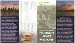
Hudson River Park, Hudson Riv…
m
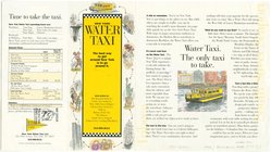
New York Water Taxi : the bes…
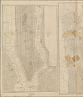
Vingboons map of Manhattan, 1…
m
Hagstrom's map of Queens N.Y.…
m
Shell street guide of Brookly…
City of New Manhattan : propo…
m
Map of original grants and fa…
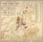
Industrial map of New York Ci…
m
Hagstrom's map of Brooklyn (N…
m
Hammond's complete map of Bro…
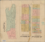
Map of the borough of Brookly…
Hagstrom's map of ... New Yor…
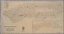
Health map of Manhattan: prep…
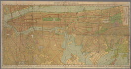
Transportation lines connecti…
m
Map of the borough of Brookly…
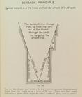
Setback principle
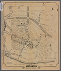
Fieldston, Riverdale-on-Hudso…
Queens Borough, City of New Y…
Hammond's new guide map of Ma…
Block distribution of childre…
Social map of the Lower East …
Freight terminal map of the P…
Railroads in Manhattan, Jerse…
m
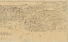
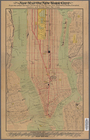
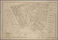
Map of New York City
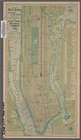
New York City
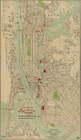
Map of the northern part of t…
m
Map of the northern part of t…
Rand, McNally & Co.'s new han…
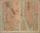
Map of the boroughs of Manhat…
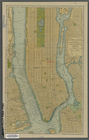
The lower part of New York Ci…
m
Library map 1908
m
1907 Library map of Manhattan…
Freight terminal map of New Y…
m
1907 Library map of Manhattan…
m
Population and school attenda…
Map of the southern part of t…
m
1906 Library map of Manhattan…
m
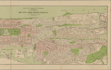
The United Electric Light and…
m
City of New York, boroughs of…
m
Map of northern part of New Y…
Map showing the 19th Assembly…
m
New York: south part of the B…
m
Property identification map o…
m
1905 Library map of Manhattan…
The Home Life Publishing Co.,…
m
Boroughs of Manhattan and the…
Map of northern part of New Y…
Borough of Manhattan: 23rd As…
m
New map of New York City: fro…
m
Center of New York, first cit…
1
2
3
Previous
Next
1
2
3
Previous
Next