Click to visit the main New York Public Library Homepage
The New York Public Library
Digital Collections
About Digital Collections
Browse
Search only public domain materials
Items
Collections
Divisions
Home
Search
Browse
About
Search only public domain materials
Items
Collections
Divisions
Digital Collections
Using Images
Using Data
Collections
Charting America: Maps from the Lawrence H. Slaughter Collection and Others
Charting America: Maps from the Lawrence H. Slaughter Collection and Others
Navigation
Filters
Charting America: Maps from the Lawrence H. Slaughter Collection and Others
Previous
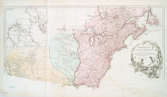
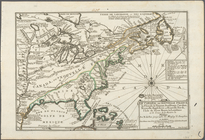
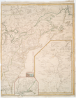
The south part of Virginia, now the north part of Carolina
0
Atlases, gazetteers, guidebooks and other books
377
Maps of the World
16
Maps of the Oceans
24
Maps of North and South America
23
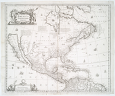
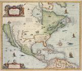
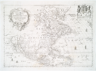
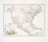
Maps of North America.
551
Maps of New York City and State
1340
Lawrence H. Slaughter Collection of English maps, charts, globes, books and atlases
1020
John H. Levine Collection
60
More
Show filters
Hide filters
Show Only Public Domain
topic
Colonies
22
Geography
6
History
6
Atlases
4
Maps in education
4
More
Less
name
Moll, Herman, -1732
12
Zatta, Antonio, fl. 1757-1797
12
Lotter, Matthäus Albrecht, 1741-1810
8
Lotter, Tobias Conrad, 1717-1777
8
Bowles, John, 1701-1779
7
More
Less
collection
Lawrence H. Slaughter Collection of English maps, charts, globes, books and atlases
114
John H. Levine Collection
17
Maps of New York City and State
6
Maps of the Oceans
2
place
x
North America
America
24
Great Britain
24
United States
17
North America -- Maps -- Early works to 1800
13
More
Less
genre
Maps
139
publisher
Presso Antonio Zatta
12
s.n
8
Tobias Conrad Lotter?
5
Printed for Timothy Childe at the White Hart at the West-end of St. Paul's Church-yard
4
Chez l'auteur, aux Galeries du Louvre
3
More
Less
division
Map Division
138
type
cartographic
138
text
2
Date Range
to
139 results found for:
x
North America?tab=filter
Filtering on:
x
Place
: North America
Sort by:
Relevance
Title
Date created
Date digitized
Sequence
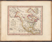
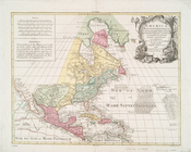
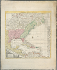
World on gnomonic projection …
Western Coast of
North
America
British possessions in
North
America
and United
North
America
, including the West Indies
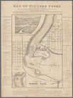
Map of Niagara Falls, and gui…
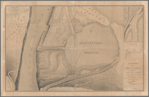
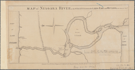
Map of the River Niagara and …
topic:
Indians of
North
America
Survey for a ship canal aroun…
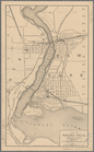
Map of Niagara Falls, suspens…
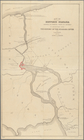
Map of Niagara River or the s…
note:
Oriented with
north
to left.
Map of historic Niagara: show…
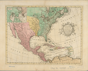
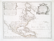
A new and accurate map of
North
America
note:
LC Maps of
North
America
, 1750-1789, 108
L'Amerique septentrionale : d…
note:
Tooley, R.V. Mapping of
America
, p. 19
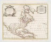
America
Septentrionalis concinnata juxta
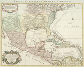
Carte du Mexique et de la Flo…
note:
Covers
North
America
from the Atlantic
America
Septentrionalis a Domino d'Anville
note:
… of
North
America
, 1750-1789
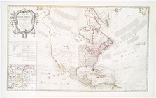
A new map of
North
America
from the latest
note:
LC Maps of
North
America
, 1750-1789, 106
… empire in
North
America
note:
Phillips. Maps of
America
, p. 575
Carte nouvelle de l'Amerique …
note:
LC Maps of
North
America
, 1750-1789, 141
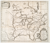
Carte de la Nouvelle France: …
Virginia et Nova Francia
abstract:
Covers eastern
North
America
from
A new map of ye
north
parts of
America
note:
Covers eastern and central
North
America
Le Canada, ou Nouvelle France…
note:
… of
America
to 1860
North
America
from the French of Mr. D'Anville :…
note:
LC Maps of
North
America
, 1750-1789, 1237
Amerique septentrionale : sui…
Partie orientale du Canada ou…
note:
Shows eastern
North
America
from Labrador
Amerique septentrionale : sui…
note:
… edge:
America
.
Carte du Canada et de la Loui…
note:
LC Maps of
North
America
, 1750-1789, 72
Canada et Louisiane
note:
LC Maps of
North
America
, 1750-1789, 34
Carte d'un tres grand pais no…
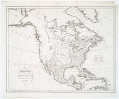
A general map of
North
America
: drawn
Repraesentatio
Americae
Borealis :…
note:
Tooley, R.V. Mapping of
America
, p. 132
A new & correct map of the tr…
L'Amerique septentrionale, ou…
Amerique septentrionale : div…
America
Septentrionalis.
note:
Burden, P.D. Mapping of
North
America
America
septentrionalis.
note:
… of
North
America
, 245
A new mapp of
America
Septentrionale
note:
Tooley. The mapping of
America
, p. 119, pl. 40
L'Amérique septentrionale
note:
LC Maps of
North
America
, 1750-1789, 76
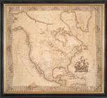
A new map of
North
America
note:
… that "
North
America
is divided
L'Amerique Septentrionale : d…
note:
Phillips. Maps of
America
, p. 564
North
America
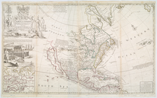
A new and correct map of
North
America
note:
LC Maps of
North
America
, 1750-1789, 158
m
Amérique Septentrionale publi…
note:
Phillips. Maps of
America
, p. 571
This map of
North
America
according to ye
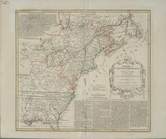
Carte de la Nouvelle York : y…
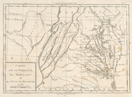
Carte de la Virginie, du Mary…
note:
Research catalog of maps of
America
to 1860
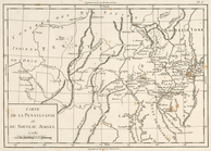
Carte de la Pensylvanie et du…
note:
Research catalog of maps of
America
to 1860
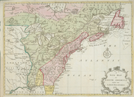
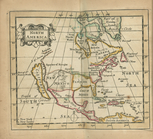
A map of Florida and ye Great…
note:
Covers eastern
North
America
from
North
America
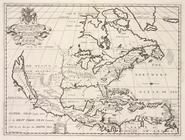
A new map of
North
America
shewing its
collection:
North
America
.