Click to visit the main New York Public Library Homepage
The New York Public Library
Digital Collections
About Digital Collections
Browse
Search only public domain materials
Items
Collections
Divisions
Home
Search
Browse
About
Search only public domain materials
Items
Collections
Divisions
Digital Collections
Using Images
Using Data
Collections
Charting America: Maps from the Lawrence H. Slaughter Collection and Others
Charting America: Maps from the Lawrence H. Slaughter Collection and Others
Navigation
Filters
Charting America: Maps from the Lawrence H. Slaughter Collection and Others
Previous
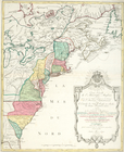
The south part of Virginia, now the north part of Carolina
0
Atlases, gazetteers, guidebooks and other books
377
Maps of the World
16
Maps of the Oceans
24
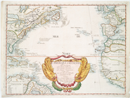
Maps of North and South America
23
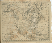
Maps of North America.
551
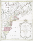
Maps of New York City and State
1340
Lawrence H. Slaughter Collection of English maps, charts, globes, books and atlases
1020
John H. Levine Collection
60
More
Show filters
Hide filters
Show Only Public Domain
topic
Colonies
18
Discovery and exploration
3
History
2
Atlases
1
Geography
1
More
Less
name
Jefferys, Thomas, d. 1771
3
Moll, Herman, -1732
3
Bowles, John, 1701-1779
2
Childe, Timothy
2
Green, John, fl. 1730-1753
2
More
Less
collection
x
Lawrence H. Slaughter Collection of English maps, charts, globes, books and atlases
place
x
America
North America
18
Great Britain
14
France
7
Early works to 1800
4
More
Less
genre
Maps
30
publisher
Printed for W. Strahan, and T. Becket and Co
2
Tobias Conrad Lotter?
2
... Sold ... by Tho. Bowles, print and map-seller in St. Paul's-Churchyard
1
At the Presses of S. Hall, and Thomas & Andrews, and sold by E. Larkin, and the other booksellers in Boston; by Gaine & Ten Eyck, and S. Campbell, New-York; [etc.,etc.]
1
Chez Daumont..
1
More
Less
division
Map Division
29
type
cartographic
29
text
2
Date Range
to
30 results found for:
x
North America?tab=filter
Filtering on:
x
Place
: America
x
Collection
: 6a373d50-c5d3-012f-a6fb-58d385a7bc34
Sort by:
Relevance
Title
Date created
Date digitized
Sequence
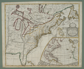
… of the British dominions in
North
America
: from the first
… of the British dominions in
North
America
, according
m
North
America
divided into its
note:
…:
North
America
divided
m
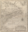
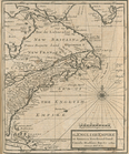
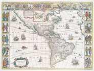
A new map of the
north
parts of
America
America
.
note:
…, P.D. Mapping of
North
America
, 360
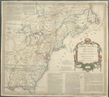
The English empire in
America
, Newfound-land
The English empire in
America
, Newfound-land
note:
Covers eastern
North
America
.
North
America
from the French of Mr. D'Anville
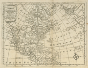
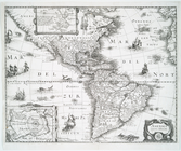
An accurate map of
North
America
note:
… settlements in
America
A new map of
North
America
shewing all
L'Ameriqve françoise, ou son …
note:
Covers
North
Carte du Canada et de la Loui…
note:
LC Maps of
North
America
, 1750-1789, 72
… empire in
North
America
note:
Phillips. Maps of
America
, p. 575
Carte nouvelle de l'Amerique …
Carte nouvelle de l'Amerique …
A new map of the English empire in
America
note:
…, Africa and
America
.
North
America
from the French of Mr. D'Anville :…
note:
LC Maps of
North
America
, 1750-1789, 1237
….
America
as settled
note:
LC Maps of
North
America
, 1750-1789, 92
m
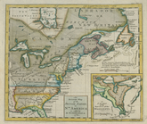
The British colonies in
North
America
.
note:
LC Maps of
North
America
, 1750-1789, 732
Carte des possessions anglois…
note:
LC Maps of
North
America
, 1750-1789, 153
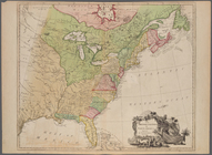
A new map of the
north
parts of
America
Tabula nouarum insularum, qua…
note:
Burden, P.D. Mapping of
North
America
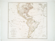
A chart of
North
and South
America
note:
… of
North
and South
America
m
A chart of
North
and South
America
note:
… settlements in
North
America
America
divided into
North
and South
A General map of
America
divided into
North
America
, nouiter delineata.
note:
Described in Burden's Mapping of
North
America
… of
America
: divided into
North
and South and West
note:
Includes inset "The supplement to
North
America
Americae
nova tabula
note:
Burden, P. D. Mapping of
North
America
Guyane, Terra ferme, Isles an…
note:
…
North
America
as far
north
as Delaware Bay.
End of results
|
Top