Click to visit the main New York Public Library Homepage
The New York Public Library
Digital Collections
About Digital Collections
Browse
Search only public domain materials
Items
Collections
Divisions
Home
Search
Browse
About
Search only public domain materials
Items
Collections
Divisions
Digital Collections
Using Images
Using Data
Collections
Charting America: Maps from the Lawrence H. Slaughter Collection and Others
Charting America: Maps from the Lawrence H. Slaughter Collection and Others
Navigation
Filters
Charting America: Maps from the Lawrence H. Slaughter Collection and Others
Previous
The south part of Virginia, now the north part of Carolina
0
Atlases, gazetteers, guidebooks and other books
377
Maps of the World
16
Maps of the Oceans
24
Maps of North and South America
23
Maps of North America.
551
Maps of New York City and State
1340
Lawrence H. Slaughter Collection of English maps, charts, globes, books and atlases
1020
John H. Levine Collection
60
More
Show filters
Hide filters
Show Only Public Domain
topic
Railroads
57
Administrative and political divisions
55
Real property
34
Local transit
28
Railroads, Elevated
27
More
Less
name
Dripps, M. (Matthew)
16
Watson, Gaylord
10
Rand McNally and Company
9
A. Brown & Co
8
J.B. Beers & Co
7
More
Less
collection
Maps of New York City and State
201
place
x
Brooklyn (New York, N.Y.)
New York (State)
149
New York
132
New York (N.Y.)
56
Brooklyn
49
More
Less
genre
Maps
201
Cadastral maps
10
Manuscript maps
6
Mass transit
4
Tourist maps
3
More
Less
publisher
publisher not identified
16
M. Dripps
11
The Company
10
Lain & Co
7
s.n
7
More
Less
division
Map Division
200
Manuscripts and Archives Division
1
type
cartographic
201
text
1
Date Range
to
201 results found for:
x
Niagara Canal (N.Y. : Proposed) -- Maps?tab=filter
Filtering on:
x
Place
: Brooklyn (New York, N.Y.)
Sort by:
Relevance
Title
Date created
Date digitized
Sequence
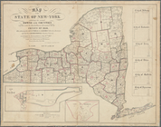
Map
of the State of New-York exhibiting
note:
…. Hayward, 120 Water St.
N.Y
.
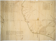
Map
of a tract of land called the Nyack
note:
… to Early
Maps
of the Middle
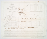
Map
of a farm at Fort Hamilton
note:
… to Early
Maps
of the Middle
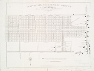
Map
of 285 sections of ground at Flatbush, L.I
note:
… to Early
Maps
of the Middle
Map
of 995 lots of the Rapelje propy
note:
… to Early
Maps
of the Middle
Hayward's
map
note:
… to Early
Maps
of the Middle
…, Kings County,
N
.
Y
note:
… to Early
Maps
of the Middle
Map
of the city of Brooklyn, and village
note:
… to Early
Maps
of the Middle
Map
of property on Brooklyn Heights, or
note:
… to Early
Maps
of the Middle
m
Map
of the city of Brooklyn, as laid out
note:
… to Early
Maps
of the Middle
Map
and plan to illustrate the battle of Long
note:
… to Early
Maps
of the Middle
… at the Merchants' Exchange,
N
.
Y
.
note:
… to Early
Maps
of the Middle
Map
showing the original high and low
Map
of Newtown Creek and vicinity
note:
Extracted from: Brooklyn (New York,
N.Y
Map
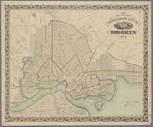
of the borough of Brooklyn published
Map
of the cities of Brooklyn, Williamsburg
Map
of the City of Williamsburg with part
Map
of the Cities of Brooklyn and Williamsburg
note:
Contains also small
map
of vicinity of New
m
Map
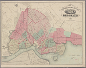
of Consolidated City Brooklyn.
Map
showing a part of Brooklyn, with pencil
m
Map
of the City of Williamsburg and town
m
Map
of lots near Prospect Park.
Phelp's new
map
of the city of Brooklyn
note:
… catalog of the
Map
m
New
map
of the city of Brooklyn as consolidated
note:
… catalog of the
Map
m
Map
of the city of Brooklyn 1863
Map
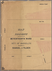
of property situated in the 17th ward
m
Map
of property situated in the 17th ward
Map
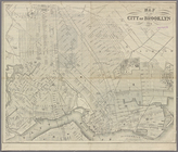
of the consolidated city of Brooklyn
note:
… catalog of the
Map
Map
of the consolidated city of Brooklyn
topic:
Canals
m
Map
of the city of Brooklyn
abstract:
…,
N.Y
.) showing
m
Map
of Brooklyn and vicinity
Map
of the consolidated city of Brooklyn
topic:
Canals
m
Map
of Brooklyn and vicinity
Map
of the consolidated city of Brooklyn
topic:
Canals
m
Map
of Brooklyn and vicinity
Map
of the consolidated city of Brooklyn
topic:
Canals
m
Map
of Brooklyn Ferry, in 1766-7
note:
… catalog of the
Map
m
Watson's new
map
of the city of Brooklyn
note:
… catalog of the
Map
Map
of the consolidated city of Brooklyn
topic:
Canals
Map
of Brooklyn and vicinity
m
Map
of Kings County
N
.
Y
.
collection:
Map
of Kings County
N.Y
.
Map
of the city of Brooklyn, 1869
topic:
Canals
m
Map
of Brooklyn and vicinity
Map
of the city of Brooklyn
topic:
Canals
Map
of the county of Kings, showing the ward
Map
of the county of Kings, showing
m
Fire Department
map
of the city of Brooklyn, 1870
m
Map
of the city of Brooklyn. [Distance shown
m
Map
showing
note:
… catalog of the
Map
m
Map
of the city of Brooklyn
topic:
Canals