Click to visit the main New York Public Library Homepage
The New York Public Library
Digital Collections
About Digital Collections
Browse
Search only public domain materials
Items
Collections
Divisions
Home
Search
Browse
About
Search only public domain materials
Items
Collections
Divisions
Digital Collections
Using Images
Using Data
Collections
Charting America: Maps from the Lawrence H. Slaughter Collection and Others
Charting America: Maps from the Lawrence H. Slaughter Collection and Others
Navigation
Filters
Charting America: Maps from the Lawrence H. Slaughter Collection and Others
Previous
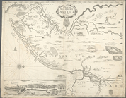
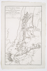
The south part of Virginia, now the north part of Carolina
0
Atlases, gazetteers, guidebooks and other books
377
Maps of the World
16
Maps of the Oceans
24
Maps of North and South America
23
Maps of North America.
551
Maps of New York City and State
1340
Lawrence H. Slaughter Collection of English maps, charts, globes, books and atlases
1020
John H. Levine Collection
60
More
Show filters
Hide filters
Show Only Public Domain
topic
City planning
123
Administrative and political divisions
118
Local transit
103
Railroads
96
Piers
77
More
Less
name
New York (N.Y.). Common Council
90
Valentine, D. T. (David Thomas), 1801-1869
32
Burr, David H., 1803-1875
22
Ohman, August R
21
Rand McNally and Company
19
More
Less
collection
Maps of New York City and State
609
Lawrence H. Slaughter Collection of English maps, charts, globes, books and atlases
36
John H. Levine Collection
4
Atlases, gazetteers, guidebooks and other books
3
place
x
New York (N.Y.)
New York (State)
408
Manhattan (New York, N.Y.)
318
New York
224
Brooklyn (New York, N.Y.)
75
More
Less
genre
Maps
648
Manuscript maps
36
Cadastral maps
24
Aerial views
9
Topographic maps
5
More
Less
publisher
s.n
18
publisher not identified
16
G.W. & C.B. Colton & Co
14
Museum of the American Indian, Heye Foundation
12
producer not identified
10
More
Less
division
Map Division
651
Manuscripts and Archives Division
1
type
cartographic
645
still image
13
text
10
Date Range
to
652 results found for:
x
Maps?tab=filter
Filtering on:
x
Place
: New York (N.Y.)
Sort by:
Relevance
Title
Date created
Date digitized
Sequence
A
map
of the State of New York : exhibiting
note:
Map
printed on 4 sheets, pieced together.
Distance
map
of the state of New York
note:
… of the
map
.
m
Map
of New York exhibiting the post offices
note:
LC Railroad
maps
, 259
A
Map
of the country round Philadelphia
note:
… to Early
Maps
of the Middle
m
Map
of the route of the proposed New York & Erie
note:
…
maps
.
A new
map
of New England and New York
Map
of the state of New York : showing
note:
… to Early
Maps
of the Middle
Map
of the state of New York : showing
note:
… to Early
Maps
of the Middle
Map
of the state of New York : showing
note:
… to Early
Maps
of the Middle
Map
of the state of New York : with parts
note:
… to Early
Maps
of the Middle
Map
of the state of New York with part
note:
Creek, A.
Maps
of the Genesee Valley & Finger
Map
of the state of New York
note:
… to Early
Maps
of the Middle
m
Map
of the state of New-York : with parts
note:
… to Early
Maps
of the Middle
m
A new and exact
map
of the dominions of the King
note:
… to Early
Maps
of the Middle
New-York
note:
… to Early
Maps
of the Middle
New York
note:
Copy in
Map
Div. (Atlas cases): Myers
New-York
note:
… to Early
Maps
of the Middle
The Empire State, New York : …
note:
… to Early
Maps
of the Middle
Carte de la route des lacs de…
note:
… to Early
Maps
of the Middle
Distance
map
of the state of New York
note:
Prime meridian on
map
: Washington
A
map
of New England, New York, New
note:
… to Early
Maps
of the Middle
Map
of the State of New-York exhibiting
note:
…. Leventhal
Map
Center website
m
Asher & Adams' new topographical
map
of the state
note:
Mapping
the Nation (NEH grant, 2015-2018)…
Chart of Long Island Sound, 1…
note:
Copy in
Map
Div. 97-6448 in Lawrence H
Entrance to New York Bay from…
note:
Copy in
Map
Div. 97-6448 in Lawrence H
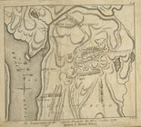
The engagement on the White P…
collection:
… of English
maps
, charts
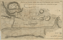
Plan of the position which th…
collection:
… of English
maps
, charts
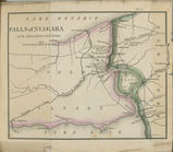
Falls of Niagara and adjacent…
note:
Copy in
Map
Div. 97-6445 has 654 p.
m
Map
of the state of New-York
note:
Mapping
the Nation (NEH grant, 2015-2018)…
m
The State of New York: from n…
note:
…: Meteorological
map
of the state
m
The State of New York: from n…
note:
…: Meteorological
map
of the state
m
The State of New York: from n…
note:
…: Meteorological
map
of the state
Map
of New Netherland with a view of New
note:
Title in English;
map
in Dutch.
Bowles's new pocket
map
of the following
note:
… Evans, his
map
A mapp of New Jersey in Ameri…
collection:
Charts and
maps
Theatre de la guerre en Améri…
note:
LC
Maps
of North America, 1750-1789, 154
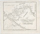
A chart of Delaware Bay and R…
note:
… to Early
Maps
of the Middle
A chart of Delaware Bay and R…
note:
… to Early
Maps
of the Middle
A chart of Delaware Bay and R…
note:
… to Early
Maps
of the Middle
Baye de la Delaware avec les …
note:
… recommending the
map
A chart of Delawar River from…
note:
LC
Maps
of North America, 1750-1789, 1369
The bay and river of Delaware
note:
… to Early
Maps
of the Middle
A Chart of ye coast of New En…
note:
… to Early
Maps
of the Middle
A chart of the sea coast of N…
note:
… to Early
Maps
of the Middle
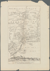
The country twenty five miles…
note:
Described in: Research Catalog of
Maps
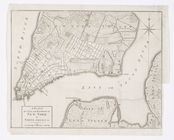
A plan of New York Island, wi…
collection:
Charts and
maps
Île de New-York, partie de Lo…
note:
… to Early
Maps
of the Middle
A chart of New York Harbour :…
note:
… to Early
Maps
of the Middle
[A chart of New York Island &…
note:
2nd state according to LC
Maps
of North
A Plan of the city and enviro…
collection:
Charts and
maps
1
2
3
Previous
Next
1
2
3
Previous
Next