Click to visit the main New York Public Library Homepage
The New York Public Library
Digital Collections
About Digital Collections
Browse
Search only public domain materials
Items
Collections
Divisions
Home
Search
Browse
About
Search only public domain materials
Items
Collections
Divisions
Digital Collections
Using Images
Using Data
Collections
Charting America: Maps from the Lawrence H. Slaughter Collection and Others
Charting America: Maps from the Lawrence H. Slaughter Collection and Others
Navigation
Filters
Charting America: Maps from the Lawrence H. Slaughter Collection and Others
Previous
The south part of Virginia, now the north part of Carolina
0
Atlases, gazetteers, guidebooks and other books
377
Maps of the World
16
Maps of the Oceans
24
Maps of North and South America
23
Maps of North America.
551
Maps of New York City and State
1340
Lawrence H. Slaughter Collection of English maps, charts, globes, books and atlases
1020
John H. Levine Collection
60
More
Show filters
Hide filters
Show Only Public Domain
topic
Real property
294
Railroads
284
Administrative and political divisions
260
Landowners
208
Local transit
117
More
Less
name
Rand McNally and Company
36
Dripps, M. (Matthew)
32
G.W. & C.B. Colton & Co
31
Smith, Robert Pearsall, 1827-1898
30
Welcke, Robert A
26
More
Less
collection
Maps of New York City and State
1210
Lawrence H. Slaughter Collection of English maps, charts, globes, books and atlases
12
Atlases, gazetteers, guidebooks and other books
2
place
x
New York (State)
New York
520
New York (N.Y.)
408
Manhattan (New York, N.Y.)
283
Brooklyn (New York, N.Y.)
196
More
Less
genre
Maps
1221
Cadastral maps
179
Manuscript maps
59
Road maps
27
Topographic maps
22
More
Less
publisher
publisher not identified
95
G.W. & C.B. Colton & Co
29
The Company
23
M. Dripps
21
publisher unknown
20
More
Less
division
Map Division
1222
Manuscripts and Archives Division
2
type
cartographic
1215
still image
18
text
12
Date Range
to
1,224 results found for:
x
New York (N.Y.)?tab=filter
Filtering on:
x
Place
: New York (State)
Sort by:
Relevance
Title
Date created
Date digitized
Sequence
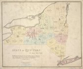
State of
New
-
York
for Spafford's gazetteer
use:
… partner (e.g.,
New
York
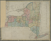
A map of the state of
New
York
: compiled
use:
… partner (e.g.,
New
York
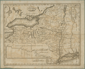
A map of the State of
New
York
: exhibiting
use:
… partner (e.g.,
New
York
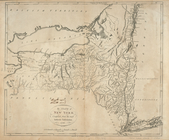
… for the report of the
New
York
use:
… partner (e.g.,
New
York
Distance map of the state of
New
York
use:
… partner (e.g.,
New
York
m
Map of
New
York
exhibiting the post offices
use:
… partner (e.g.,
New
York
Map of
New
-
York
use:
… partner (e.g.,
New
York
Map of the State of
New
York
use:
… partner (e.g.,
New
York
Map of the State of
New
York
use:
… partner (e.g.,
New
York
Map of the State of
New
York
use:
… partner (e.g.,
New
York
Map of the meetings constituting
New
York
Yearly
use:
… partner (e.g.,
New
York
m
Map of the route of the proposed
New
York
& Erie
use:
… partner (e.g.,
New
York
Map of the state of
New
York
: compiled
use:
… partner (e.g.,
New
York
Map of the state of
New
York
: compiled
use:
… partner (e.g.,
New
York
Map of the state of
New
York
: compiled
use:
… partner (e.g.,
New
York
New
England and
New
York
use:
… partner (e.g.,
New
York
Map of the state of
New
York
: showing
use:
… partner (e.g.,
New
York
Map of the state of
New
York
: showing
use:
… partner (e.g.,
New
York
Map of the state of
New
York
: showing
use:
… partner (e.g.,
New
York
Map of the state of
New
York
: with parts
use:
… partner (e.g.,
New
York
Map of the state of
New
York
use:
… partner (e.g.,
New
York
Map of the state of
New
York
use:
… partner (e.g.,
New
York
Map of the state of
New
York
with part
use:
… partner (e.g.,
New
York
Map of the state of
New
York
use:
… partner (e.g.,
New
York
m
Map of the state of
New
-
York
: with parts
use:
… partner (e.g.,
New
York
… Erie,
New
York
& Boston
use:
… partner (e.g.,
New
York
Neueste Karte von
New
York
: mit seinen
use:
… partner (e.g.,
New
York
New
-
York
use:
… partner (e.g.,
New
York
New
-
York
use:
… partner (e.g.,
New
York
State of
New
York
: in Senate Jany. 7th, 1836
use:
… partner (e.g.,
New
York
State of
New
York
divided into senatorial
use:
… partner (e.g.,
New
York
State of
New
York
, Jany. 1, 1824
use:
… partner (e.g.,
New
York
The Empire State,
New
York
: with its
use:
… partner (e.g.,
New
York
The state of
New
York
, compiled from
use:
… partner (e.g.,
New
York
The state of
New
York
from the most
use:
… partner (e.g.,
New
York
The state of
New
York
from the most
use:
… partner (e.g.,
New
York
The tourist's map of the state of
New
York
use:
… partner (e.g.,
New
York
… in
New
York
recognized
use:
… partner (e.g.,
New
York
m
A
new
township map of the state of
New
York
use:
… partner (e.g.,
New
York
m
New
York
use:
… partner (e.g.,
New
York
Map of the State of
New
York
use:
… partner (e.g.,
New
York
… Nouvelle
York
:
y
-compris les terres cédées du
N
use:
… partner (e.g.,
New
York
Distance map of the state of
New
York
use:
… partner (e.g.,
New
York
Squire's map of the state of
New
York
use:
… partner (e.g.,
New
York
Map of the province of
New
York
as divided
use:
… partner (e.g.,
New
York
m
Preliminary geologic map of
New
York
use:
… partner (e.g.,
New
York
… of
New
York
showing
use:
… partner (e.g.,
New
York
… of
New
York
showing
use:
… partner (e.g.,
New
York
… of
New
York
showing
use:
… partner (e.g.,
New
York
[Map of]
New
York
[State]
use:
… partner (e.g.,
New
York
1
2
3
4
5
Previous
Next
1
2
3
4
5
Previous
Next