Click to visit the main New York Public Library Homepage
The New York Public Library
Digital Collections
About Digital Collections
Browse
Search only public domain materials
Items
Collections
Divisions
Home
Search
Browse
About
Search only public domain materials
Items
Collections
Divisions
Digital Collections
Using Images
Using Data
Collections
Charting America: Maps from the Lawrence H. Slaughter Collection and Others
Charting America: Maps from the Lawrence H. Slaughter Collection and Others
Navigation
Filters
Charting America: Maps from the Lawrence H. Slaughter Collection and Others
Previous
The south part of Virginia, now the north part of Carolina
0
Atlases, gazetteers, guidebooks and other books
377
Maps of the World
16
Maps of the Oceans
24
Maps of North and South America
23
Maps of North America.
551
Maps of New York City and State
1340
Lawrence H. Slaughter Collection of English maps, charts, globes, books and atlases
1020
John H. Levine Collection
60
More
Show filters
Hide filters
Show Only Public Domain
topic
Railroads
254
Administrative and political divisions
249
Real property
246
Landowners
176
Local transit
96
More
Less
name
Rand McNally and Company
33
Dripps, M. (Matthew)
30
G.W. & C.B. Colton & Co
29
Smith, Robert Pearsall, 1827-1898
27
Welcke, Robert A
18
More
Less
collection
Maps of New York City and State
921
Lawrence H. Slaughter Collection of English maps, charts, globes, books and atlases
8
Atlases, gazetteers, guidebooks and other books
1
place
x
New York (State)
New York
362
New York (N.Y.)
305
Manhattan (New York, N.Y.)
216
Brooklyn (New York, N.Y.)
152
More
Less
genre
Maps
930
Cadastral maps
147
Manuscript maps
45
Road maps
22
Geological maps
19
More
Less
publisher
publisher not identified
58
G.W. & C.B. Colton & Co
31
M. Dripps
20
The Company
19
s.n
17
More
Less
division
Map Division
928
Manuscripts and Archives Division
2
type
cartographic
927
still image
8
text
5
Date Range
to
930 results found for:
x
North Hempstead (N.Y. : Town) -- Maps?tab=filter
Filtering on:
x
Place
: New York (State)
Sort by:
Relevance
Title
Date created
Date digitized
Sequence
m
…
map
of the province of New-York in
North
collection:
…
map
of the province of New-York in
North
America
A
map
of the State of New York
A
map
of the State of New York
A
map
of the state of New York : compiled
note:
… to Early
Maps
of the Middle
A
map
of the state
note:
… to Early
Maps
of the Middle
A
map
of the State
note:
…
N.Y
.'s wards
A
map
prepared
note:
… to Early
Maps
of the Middle
An Accurate
map
of New York in
North
note:
Jolly D.C.
Maps
of America, in periodicals
Distance
map
note:
… of the
map
.
m
Map
of New York exhibiting the post offices
note:
LC Railroad
maps
, 259
Map
of New-York
note:
… to Early
Maps
of the Middle
Map
of the State of New York
note:
… to Early
Maps
of the Middle
Map
of the State of New York
note:
… to Early
Maps
of the Middle
Map
of the State of New York
note:
… to Early
Maps
of the Middle
Map
of the meetings constituting New York Yearly
note:
… to Early
Maps
of the Middle
m
Map
of the route of the proposed New York & Erie
note:
…
maps
.
m
Map
of the state of New York
note:
Accompanied by: Alphabetical list of
towns
Map
of the state of New York
note:
… to Early
Maps
of the Middle
Map
of the state of New York : compiled
note:
… -- Vicinity of New York --
Map
Map
of the state of New York : compiled
note:
… -- Vicinity of New York --
Map
Map
of the state of New York : compiled
note:
Insets:
Map
of the Hudson River from New
Map
of the state of New York : compiled
note:
… -- Vicinity of New York --
Map
Map
of the state of New York : compiled
note:
… -- and
Map
of the Hudson
Map
of the state
note:
… to Early
Maps
of the Middle
Map
of the state
note:
… to Early
Maps
of the Middle
Map
of the state
note:
… to Early
Maps
of the Middle
Map
of the state
note:
… to Early
Maps
of the Middle
Map
of the state
note:
… to Early
Maps
of the Middle
Map
of the state of New York : with parts
note:
… to Early
Maps
of the Middle
Map
of the state of New York
note:
… to Early
Maps
of the Middle
Map
of the state of New York
note:
… to Early
Maps
of the Middle
Map
of the state of New York with part
note:
Creek, A.
Maps
of the Genesee Valley & Finger
Map
of the state of New York
note:
… to Early
Maps
of the Middle
m
Map
of the state of New-York : with parts
note:
… to Early
Maps
of the Middle
Map
shewing
note:
… to Early
Maps
of the Middle
… counties,
towns
, cities
note:
…: Population of the
towns
The tourist's
map
of the state of New York
note:
… to Early
Maps
of the Middle
m
A new township
map
of the state of New York
note:
engraved by Fisk & Russell,
N.Y
.
Map
of the State of New York
note:
… 71°52ʹ/
N
45°40ʹ--
N
40°10
… Nouvelle York :
y
-compris les terres cédées du
N
note:
… to Early
Maps
of the Middle
Distance
map
of the state of New York
note:
… 1:1,000,000 (W 80°--W 72°/
N
45°--
N
40°)…
Squire's
map
of the state of New York
note:
… 71°52ʹ/
N
45°01ʹ--
N
40°30
Map
of the province
note:
Photocopy of a manuscript
map
dated: 10th
m
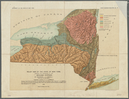
Preliminary geologic
map
of New York
note:
Includes inset
map
of Long Island
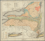
Relief
map
of the state of New York
note:
NYPL
Map
Div. copy has accession no
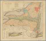
Economic and geologic
map
of the state
note:
NYPL
Map
Div. copy has accession no
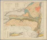
Economic and geologic
map
of the state
note:
NYPL
Map
Div. copy has accession no
Economic and geologic
map
of the state
note:
NYPL
Map
Div. copy has accession no
[
Map
of] New York [State]
note:
Mapping
the Nation (NEH grant, 2015-2018)…
Colton's railroad & township
map
of the state
note:
… for the southern dist. of
N
. York."…
1
2
3
4
Previous
Next
1
2
3
4
Previous
Next