Click to visit the main New York Public Library Homepage
The New York Public Library
Digital Collections
About Digital Collections
Browse
Search only public domain materials
Items
Collections
Divisions
Home
Search
Browse
About
Search only public domain materials
Items
Collections
Divisions
Digital Collections
Using Images
Using Data
Collections
Charting America: Maps from the Lawrence H. Slaughter Collection and Others
Charting America: Maps from the Lawrence H. Slaughter Collection and Others
Navigation
Filters
Charting America: Maps from the Lawrence H. Slaughter Collection and Others
Previous
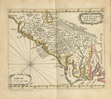
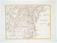
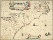
The south part of Virginia, now the north part of Carolina
0
Atlases, gazetteers, guidebooks and other books
377
Maps of the World
16
Maps of the Oceans
24
Maps of North and South America
23
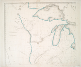
Maps of North America.
551
Maps of New York City and State
1340
Lawrence H. Slaughter Collection of English maps, charts, globes, books and atlases
1020
John H. Levine Collection
60
More
Show filters
Hide filters
Show Only Public Domain
topic
Coasts
2
Atlases, British
1
Beavers
1
History
1
West Indies, British
1
name
Blaeu, Joan, 1596-1673
2
Blaeu, Willem Janszoon, 1571-1638
2
Cóvens et Mortier
2
Godbid, Anne
2
Playford, John, ca. 1655-1685 or 6
2
More
Less
collection
Lawrence H. Slaughter Collection of English maps, charts, globes, books and atlases
13
John H. Levine Collection
2
place
x
North Carolina
Virginia
10
South Carolina
9
Maryland
5
Georgia
4
More
Less
genre
Maps
15
publisher
Chez Cóvens & Mortier
2
Printed by A. Godbid and J. Playford, for John Seller ...,
2
... Sold ... by Tho. Bowles, print and map-seller in St. Paul's-Churchyard
1
A. Zatta,
1
Ihon Wechel?
1
More
Less
division
Map Division
15
type
cartographic
15
Date Range
to
15 results found for:
x
North Carolina?tab=filter
Filtering on:
x
Place
: North Carolina
Sort by:
Relevance
Title
Date created
Date digitized
Sequence
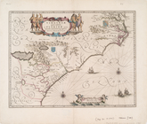
Carolina
newly discribed
abstract:
Covers as far
north
m
… continent of
North
America
note:
… part of
North
America
…, Maryland &
Carolina
, from C
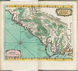
Carolina
newly discribed
note:
Covers as far
north
as southern Virginia
…
Carolina
Settentrionale.
A New map of Virginia.
note:
… and
North
Carolina
.
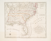
United States of Nth. America…
…
Carolina
Settentrionale.
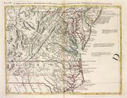
Carte de la Louisiane, Maryla…
note:
LC Maps of
North
America, 1750-1789, 1386
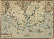
Virginiae partis australis, e…
Carte de la Louisiane, Maryla…
note:
LC Maps of
North
America, 1750-1789, 1386
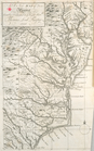
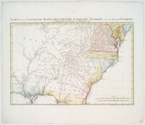
… of Virginia,
North
Carolina
, South
Carolina
note:
Kendall, H.P. Early maps of
Carolina
83.
Virginiae partis australis et…
note:
Burden, P.D. Mapping of
North
America
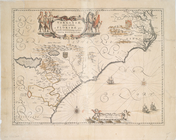
Americae pars, nunc Virginia …
note:
Oriented with
north
to the right.
Virginiae partis australis, e…
End of results
|
Top