Click to visit the main New York Public Library Homepage
The New York Public Library
Digital Collections
About Digital Collections
Browse
Search only public domain materials
Items
Collections
Divisions
Home
Search
Browse
About
Search only public domain materials
Items
Collections
Divisions
Digital Collections
Using Images
Using Data
Collections
Charting America: Maps from the Lawrence H. Slaughter Collection and Others
Charting America: Maps from the Lawrence H. Slaughter Collection and Others
Navigation
Filters
Charting America: Maps from the Lawrence H. Slaughter Collection and Others
Previous
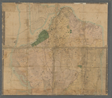
The south part of Virginia, now the north part of Carolina
0
Atlases, gazetteers, guidebooks and other books
377
Maps of the World
16
Maps of the Oceans
24
Maps of North and South America
23
Maps of North America.
551
Maps of New York City and State
1340
Lawrence H. Slaughter Collection of English maps, charts, globes, books and atlases
1020
John H. Levine Collection
60
More
Show filters
Hide filters
Show Only Public Domain
topic
Real property
15
Landowners
14
Railroads
8
Administrative and political divisions
6
Buildings
3
More
Less
name
Dripps, M. (Matthew)
29
Magrane, T
4
Harrison, J. F
2
Korff Brothers
2
Bache, A. D. (Alexander Dallas), 1806-1867
1
More
Less
collection
Maps of New York City and State
29
place
New York (State)
21
New York
14
Brooklyn (New York, N.Y.)
11
New York (N.Y.)
7
New York Metropolitan Area
5
More
Less
genre
Maps
29
Cadastral maps
5
Topographic maps
2
Nautical charts
1
publisher
x
M. Dripps
division
Map Division
29
type
cartographic
29
Date Range
to
29 results found for:
x
New York (N.Y.)?tab=filter
Filtering on:
x
Publisher
: M. Dripps
Sort by:
Relevance
Title
Date created
Date digitized
Sequence
m
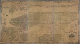
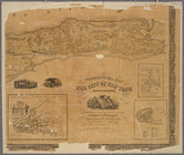
Topographical map of
New
York
City, County
use:
… partner (e.g.,
New
York
m
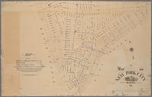
Map of Tarrytown, Irvington e…
use:
… partner (e.g.,
New
York
m
…, Long Island,
N
.
Y
.
use:
… partner (e.g.,
New
York
m
… County,
N
.
Y
.
use:
… partner (e.g.,
New
York
m
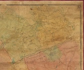
Map of Geneva, Ontario Co.,
N
.
Y
.
use:
… partner (e.g.,
New
York
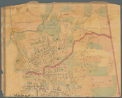
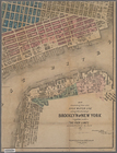
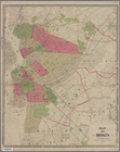
Map of the cities of Brooklyn…
use:
… partner (e.g.,
New
York
m
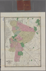
Map of Brooklyn and vicinity
use:
… partner (e.g.,
New
York
m
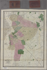
Map of Brooklyn and vicinity
use:
… partner (e.g.,
New
York
m
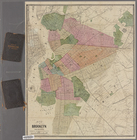
Map of Brooklyn and vicinity
use:
… partner (e.g.,
New
York
Map of Brooklyn and vicinity
use:
… partner (e.g.,
New
York
m
Map of Brooklyn and vicinity
use:
… partner (e.g.,
New
York
Map of Brooklyn and vicinity
use:
… partner (e.g.,
New
York
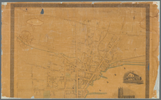
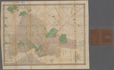
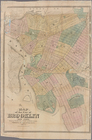
Map of the city of Brooklyn,
New
York
use:
… partner (e.g.,
New
York
m
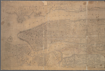
Topographical map of the city…
use:
… partner (e.g.,
New
York
m
Topographical map of the City of
New
York
use:
… partner (e.g.,
New
York
m
Topographical map of
New
York
City, County
use:
… partner (e.g.,
New
York
m
… the shores of Brooklyn &
New
York
together
use:
… partner (e.g.,
New
York
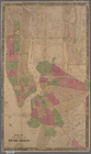
Map of the cities of
New
York
and Brooklyn
use:
… partner (e.g.,
New
York
m
Map of
New
York
City
use:
… partner (e.g.,
New
York
m
Topographical map of
New
York
City, county
use:
… partner (e.g.,
New
York
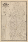
Map of Long Island City, Queens Co.
N
.
Y
.
use:
… partner (e.g.,
New
York
m
… Island (Richmond Co.)
N
.
Y
use:
… partner (e.g.,
New
York
… and rivers around
New
York
use:
… partner (e.g.,
New
York
m
Map of the five cities of
New
York
use:
… partner (e.g.,
New
York
New
York
and vicinity
use:
… partner (e.g.,
New
York
New
York
and vicinity
use:
… partner (e.g.,
New
York
Map of
New
York
and vicinity
use:
… partner (e.g.,
New
York
Topographical map of
New
York
City, County
use:
… partner (e.g.,
New
York
m
Topographical map of
New
York
and vicinity …
use:
… partner (e.g.,
New
York
End of results
|
Top