Click to visit the main New York Public Library Homepage
The New York Public Library
Digital Collections
About Digital Collections
Browse
Search only public domain materials
Items
Collections
Divisions
Home
Search
Browse
About
Search only public domain materials
Items
Collections
Divisions
Digital Collections
Using Images
Using Data
Collections
Charting America: Maps from the Lawrence H. Slaughter Collection and Others
Charting America: Maps from the Lawrence H. Slaughter Collection and Others
Navigation
Filters
Charting America: Maps from the Lawrence H. Slaughter Collection and Others
Previous
The south part of Virginia, now the north part of Carolina
0
Atlases, gazetteers, guidebooks and other books
377
Maps of the World
16
Maps of the Oceans
24
Maps of North and South America
23
Maps of North America.
551
Maps of New York City and State
1340
Lawrence H. Slaughter Collection of English maps, charts, globes, books and atlases
1020
John H. Levine Collection
60
More
Show filters
Hide filters
Show Only Public Domain
topic
Administrative and political divisions
11
Railroads
9
Maps
4
Real property
3
Canals
2
More
Less
name
Montrésor, John, 1736-1799
6
Andrews, Peter, active 1765-1782
4
Dury, Andrew
4
Faden, William, 1749-1836
3
Jefferys & Faden (London, England)
3
More
Less
collection
x
Maps of New York City and State
place
New York (State)
24
New England
11
Northeastern States
8
New York (N.Y.)
5
Middle Atlantic States
4
More
Less
genre
Maps
32
Facsimiles
2
Early maps
1
Early works to 1800
1
Manuscript maps
1
More
Less
publisher
publisher not identified
7
A. Dury ..
4
Walker Lith. & Pub. Co
2
Chez Le Rouge, Ingr. Geog du Roi rue des Grands Augustins
1
Chez Le Rouge, Ingr. Geog du Roi rue des Grands Augustins,
1
More
Less
division
Map Division
32
type
cartographic
32
Date Range
to
32 results found for:
x
New England?tab=filter
Filtering on:
x
Rights
: Public Domain
x
Collection
: Maps of New York City and State
Sort by:
Relevance
Title
Date created
Date digitized
Sequence
Province de
New
-York : en 4 feuilles
use:
… partner (e.g.,
New
York
… in
New
York recognized
use:
… partner (e.g.,
New
York
Map of the province of
New
York as divided
use:
… partner (e.g.,
New
York
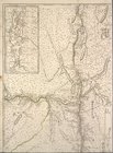
Map shewing the location of t…
use:
… partner (e.g.,
New
York
Map of the state of
New
York
use:
… partner (e.g.,
New
York
… of
New
York
use:
… partner (e.g.,
New
York
… of
New
York
use:
… partner (e.g.,
New
York
… of
New
York in North
use:
… partner (e.g.,
New
York
… of
New
York in North
use:
… partner (e.g.,
New
York
Map of
New
Netherland
use:
… partner (e.g.,
New
York
Map of the meetings constituting
New
-York Yearly
use:
… partner (e.g.,
New
York
m
Niev Nederlandt
use:
… partner (e.g.,
New
York
… to the province of
New
York
use:
… partner (e.g.,
New
York
Map of
New
York,
New
England
use:
… partner (e.g.,
New
York
…, and
New
England
.
use:
… partner (e.g.,
New
York
…, and
New
England
.
use:
… partner (e.g.,
New
York
…, and
New
England
.
use:
… partner (e.g.,
New
York
…, and
New
England
.
use:
… partner (e.g.,
New
York
m
Province de
New
-York : en 4 feuilles
use:
… partner (e.g.,
New
York
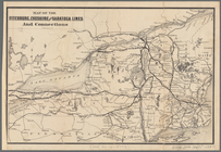
Map of the Fitchburg, Cheshir…
use:
… partner (e.g.,
New
York
… of the
New
York, Ontario, & Western R. R. and
New
York
use:
… partner (e.g.,
New
York
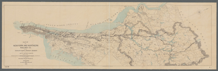
Map of the
New
York and Northern Railway Co
use:
… partner (e.g.,
New
York
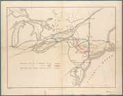
A map of the county between C…
use:
… partner (e.g.,
New
York
Kaart van Nieuw Nederland: be…
use:
… partner (e.g.,
New
York
Plan of the city of
New
York in North
use:
… partner (e.g.,
New
York
m
Plan of the city of
New
York in North
use:
… partner (e.g.,
New
York
… of
New
York
use:
… partner (e.g.,
New
York
m
New
York
use:
… partner (e.g.,
New
York
Freight terminal map of
New
York
use:
… partner (e.g.,
New
York
…, from Sandy Hook to
New
use:
… partner (e.g.,
New
York
Freight terminal map of
New
York …
use:
… partner (e.g.,
New
York
A plan of
New
York
use:
… partner (e.g.,
New
York
End of results
|
Top