Click to visit the main New York Public Library Homepage
The New York Public Library
Digital Collections
About Digital Collections
Browse
Search only public domain materials
Items
Collections
Divisions
Home
Search
Browse
About
Search only public domain materials
Items
Collections
Divisions
Digital Collections
Using Images
Using Data
Collections
Charting America: Maps from the Lawrence H. Slaughter Collection and Others
Charting America: Maps from the Lawrence H. Slaughter Collection and Others
Navigation
Filters
Charting America: Maps from the Lawrence H. Slaughter Collection and Others
Previous
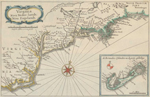
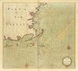
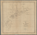
The south part of Virginia, now the north part of Carolina
0
Atlases, gazetteers, guidebooks and other books
377
Maps of the World
16
Maps of the Oceans
24
Maps of North and South America
23
Maps of North America.
551
Maps of New York City and State
1340
Lawrence H. Slaughter Collection of English maps, charts, globes, books and atlases
1020
John H. Levine Collection
60
More
Show filters
Hide filters
Show Only Public Domain
topic
Maps in education
101
Atlases
71
Historical geography
61
Geography, Ancient
59
Atlases, British
48
More
Less
name
Faden, William, 1749-1836
64
Sheldonian Theatre
44
Wells, Edward, 1667-1727
44
Palmer, W. (William), 1739-1812
30
Thornton, Samuel
17
More
Less
collection
Lawrence H. Slaughter Collection of English maps, charts, globes, books and atlases
176
Maps of New York City and State
32
Atlases, gazetteers, guidebooks and other books
25
John H. Levine Collection
9
Maps of North and South America
1
place
England
110
Great Britain
76
Maps
52
New England
40
New York (State)
30
More
Less
genre
Maps
234
Nautical charts
17
Directories
3
Book covers
2
Facsimiles
2
More
Less
publisher
Published by Wm. Faden, geographer to His Majesty, and His R.H. the Prince of Wales
58
Printed at the Theater,
41
Chapman and Hall
7
publisher not identified
7
... Sold ... by Tho. Bowles, print and map-seller in St. Paul's-Churchyard
6
More
Less
division
Map Division
243
type
cartographic
231
text
10
still image
3
Date Range
to
243 results found for:
x
New England?tab=filter
Filtering on:
x
Rights
: Public Domain
Sort by:
Relevance
Title
Date created
Date digitized
Sequence
Virginia, Nieu Neder-landt, N…
use:
… partner (e.g.,
New
York
Novi Belgii Novaeque Angliae …
use:
… partner (e.g.,
New
York
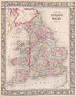
England
& Wales
use:
… partner (e.g.,
New
York
Nova Belgica et Anglia Nova.
use:
… partner (e.g.,
New
York
Nova Anglia, Novum Belgium, e…
use:
… partner (e.g.,
New
York
…
England
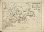
, Vermont,
New
York
use:
… partner (e.g.,
New
York
A
new
and compendious map of
England
use:
… partner (e.g.,
New
York
… over
England
and other
use:
… partner (e.g.,
New
York
Carte de la Nouvelle Angleterre :
New
use:
… partner (e.g.,
New
York
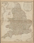
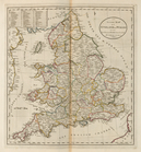
County map of
England
and Wales.
use:
… partner (e.g.,
New
York
An accurate map of
England
and Wales
use:
… partner (e.g.,
New
York
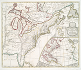
A
new
map of the English empire in America : …
use:
… partner (e.g.,
New
York
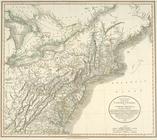
A
new
map of part
use:
… partner (e.g.,
New
York
A generall chart from
ENGLAND
to cape
use:
… partner (e.g.,
New
York
A
new
and correct chart from
England
use:
… partner (e.g.,
New
York
A
new
chart
use:
… partner (e.g.,
New
York
A large draught of
New
England
,
New
York
use:
… partner (e.g.,
New
York
Part of
NEW
ENGLAND
use:
… partner (e.g.,
New
York
Part of
New
England
,
New
York, east
New
use:
… partner (e.g.,
New
York
A chart of the sea coast from
ENGLAND
use:
… partner (e.g.,
New
York
A
new
and correct large draught PLYMOUTH
use:
… partner (e.g.,
New
York
A large draught of the ISLE o…
use:
… partner (e.g.,
New
York
A
new
and correct
use:
… partner (e.g.,
New
York
A Large Draught of the DOWNES
use:
… partner (e.g.,
New
York
HARWICH Woodbridg and Handsor…
use:
… partner (e.g.,
New
York
The River Humber
use:
… partner (e.g.,
New
York
… of
ENGLAND
from South
use:
… partner (e.g.,
New
York
BURLINGTON BAY, Scarbrouth an…
use:
… partner (e.g.,
New
York
A
new
and correct
use:
… partner (e.g.,
New
York
A chart of the Seacoasts of
ENGLAND
use:
… partner (e.g.,
New
York
m
… Scotland,
New
England
,
New
use:
… partner (e.g.,
New
York
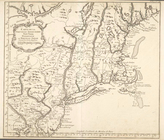
A plan of
New
York
use:
… partner (e.g.,
New
York
Freight terminal map of
New
York …
use:
… partner (e.g.,
New
York
…, from Sandy Hook to
New
use:
… partner (e.g.,
New
York
Freight terminal map of
New
York
use:
… partner (e.g.,
New
York
m
New
York
use:
… partner (e.g.,
New
York
… of
New
York
use:
… partner (e.g.,
New
York
m
Plan of the city of
New
York in North
use:
… partner (e.g.,
New
York
Plan of the city of
New
York in North
use:
… partner (e.g.,
New
York
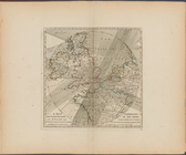
Pas caerte van Nieu Nederland…
use:
… partner (e.g.,
New
York
Pascaerte van Vlaemsche, Sout…
use:
… partner (e.g.,
New
York
Pascaarte van Engelant, van't…
use:
… partner (e.g.,
New
York
Kaart van Nieuw Nederland: be…
use:
… partner (e.g.,
New
York
A map of the county between C…
use:
… partner (e.g.,
New
York
Map of the
New
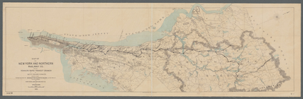
York and Northern Railway Co
use:
… partner (e.g.,
New
York
… of the
New
York, Ontario, & Western R. R. and
New
York
use:
… partner (e.g.,
New
York
Map of the Fitchburg, Cheshir…
use:
… partner (e.g.,
New
York
m
Province de
New
-York : en 4 feuilles
use:
… partner (e.g.,
New
York
…, and
New
England
.
use:
… partner (e.g.,
New
York
…, and
New
England
.
use:
… partner (e.g.,
New
York