Click to visit the main New York Public Library Homepage
The New York Public Library
Digital Collections
About Digital Collections
Browse
Search only public domain materials
Items
Collections
Divisions
Home
Search
Browse
About
Search only public domain materials
Items
Collections
Divisions
Digital Collections
Using Images
Using Data
Collections
Charting America: Maps from the Lawrence H. Slaughter Collection and Others
Charting America: Maps from the Lawrence H. Slaughter Collection and Others
Navigation
Filters
Charting America: Maps from the Lawrence H. Slaughter Collection and Others
Previous
The south part of Virginia, now the north part of Carolina
0
Atlases, gazetteers, guidebooks and other books
377
Maps of the World
16
Maps of the Oceans
24
Maps of North and South America
23
Maps of North America.
551
Maps of New York City and State
1340
Lawrence H. Slaughter Collection of English maps, charts, globes, books and atlases
1020
John H. Levine Collection
60
More
Show filters
Hide filters
Show Only Public Domain
topic
Geography
79
Administrative and political divisions
58
Road maps
53
Nautical charts
31
Maps
30
More
Less
name
Moll, Herman, -1732
82
Tiebout, Cornelius, 1777-1832
54
Colles, Christopher, 1738-1816
53
Childe, Timothy
47
Falconer, Robert, active 1700
47
More
Less
collection
Lawrence H. Slaughter Collection of English maps, charts, globes, books and atlases
344
Maps of New York City and State
251
John H. Levine Collection
26
Atlases, gazetteers, guidebooks and other books
3
Maps of North and South America
3
More
Less
place
New York (N.Y.)
139
New York (State)
139
United States
137
Middle Atlantic States
98
Manhattan (New York, N.Y.) -- Maps
59
More
Less
genre
Maps
625
Title pages
4
Early works to 1800
2
Facsimiles
1
Posters
1
More
Less
publisher
Printed for Timothy Childe at the White Hart at the West-end of St. Paul's Church-yard
47
... Sold ... by Tho. Bowles, print and map-seller in St. Paul's-Churchyard
32
Printed for J. Stockdale
26
s.n
26
M. Carey
15
More
Less
division
Map Division
628
type
cartographic
615
text
19
still image
8
Date Range
to
630 results found for:
x
Middle Atlantic States?tab=filter
Filtering on:
x
Rights
: Public Domain
Sort by:
Relevance
Title
Date created
Date digitized
Sequence
… and
states
: also
note:
… to Early Maps of the
Middle
Atlantic
Seaboard.
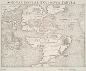
Novae insvlae XXVI nova tabvla
note:
… to Early Maps of the
Middle
Atlantic
Seaboard.
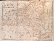
State
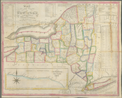
of New-York for Spafford's gazetteer
note:
… to Early Maps of the
Middle
Atlantic
Seaboard.
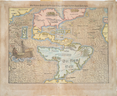
Die Neüwen Inseln so hinder H…
note:
… to Early Maps of the
Middle
Atlantic
Seaboard.
Isothermal chart, or, View of…
note:
…. Woodbridge of the
state
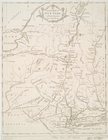
Nouvelle carte de la Pensylva…
note:
… to Early Maps of the
Middle
Atlantic
Seaboard.
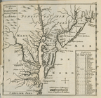
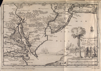
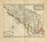
Nouvelle carte de la Caroline
note:
Covers
Atlantic
states
of U.S. from
A map of the
state
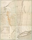
of New York : compiled
note:
… to Early Maps of the
Middle
Atlantic
Seaboard.
… of the United
States
of America
note:
… to Early Maps of the
Middle
Atlantic
Seaboard.
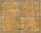
A map of the
state
of New York : exhibiting
note:
… to Early Maps of the
Middle
Atlantic
Seaboard.
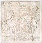
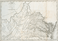
The
state
of Virginia : from the best
note:
… to Early Maps of the
Middle
Atlantic
Seaboard.
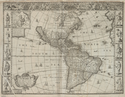
America with those known part…
note:
… to Early Maps of the
Middle
Atlantic
Seaboard.
… : & the present
state
of the work
note:
… to Early Maps of the
Middle
Atlantic
Seaboard.
An Accurate map of New York i…
note:
Covers New York
State
as far west
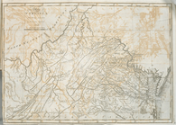
The
state
of Virginia : from the best
note:
… to Early Maps of the
Middle
Atlantic
Seaboard.
… of the
state
of New York
note:
… in the
state
-- City of New
m
Map of New York exhibiting th…
note:
… to Early Maps of the
Middle
Atlantic
Seaboard.
Map of New-York : on the impr…
note:
…, of the
State
of Connecticut."…
A Map of the country round Ph…
note:
… to Early Maps of the
Middle
Atlantic
Seaboard.
Map of the
State
of New York
note:
… to Early Maps of the
Middle
Atlantic
Seaboard.
D'Engelze volkplanting in Vir…
Map of the
State
of New York
note:
… to Early Maps of the
Middle
Atlantic
Seaboard.
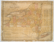
Map of the
State
of New York
note:
… to Early Maps of the
Middle
Atlantic
Seaboard.
Map of the meetings constitut…
note:
… to Early Maps of the
Middle
Atlantic
Seaboard.
m
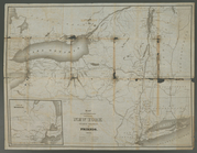
Map of the route of the propo…
note:
Shows New York
state
from Westchester
m
Map of the
state
of New York
note:
… of the
state
of New York."…
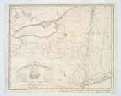
Carte de la Nouvelle York : y…
note:
… to Early Maps of the
Middle
Atlantic
Seaboard.
Map of the
state
of New York
note:
… to Early Maps of the
Middle
Atlantic
Seaboard.
Map of the
state
of New York : compiled
note:
… to Early Maps of the
Middle
Atlantic
Seaboard.
Map of the
state
of New York : compiled
note:
… to Early Maps of the
Middle
Atlantic
Seaboard.
Map of the
state
of New York : compiled
note:
… to Early Maps of the
Middle
Atlantic
Seaboard.
Map of the
state
of New York : compiled
note:
… to Early Maps of the
Middle
Atlantic
Seaboard.
Map of the
state
of New York : compiled
note:
… to Early Maps of the
Middle
Atlantic
Seaboard.
Map of the
state
of New York : showing
note:
… the New York
state
line
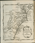
Carolina newly discribed
note:
… to Early Maps of the
Middle
Atlantic
Seaboard.
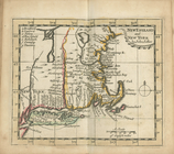
New England and New York
note:
… to Early Maps of the
Middle
Atlantic
Seaboard.
Map of the
state
of New York : showing
note:
… the New York
State
line
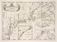
Part of North America: compre…
Map of the
state
of New York : showing
note:
… York
state
line
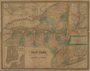
A new map of the most conside…
Map of the
state
of New York : showing
note:
… the New York
State
line
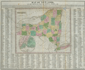
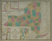
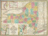
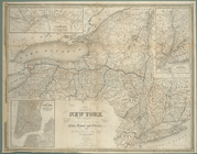
Map of the
state
of New York : showing
note:
Includes population statistics for the
state
A chart of the sea coasts of …
note:
… to Early Maps of the
Middle
Atlantic
Seaboard.
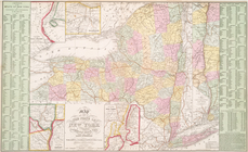
Map of the
state
of New York : with parts
note:
… to Early Maps of the
Middle
Atlantic
Seaboard.
Map of the
state
of New York
note:
… to Early Maps of the
Middle
Atlantic
Seaboard.
Map of the
state
of New York
note:
… to Early Maps of the
Middle
Atlantic
Seaboard.
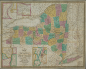
Map of the
state
of New York with part
note:
… to Early Maps of the
Middle
Atlantic
Seaboard.
Map of the
state
of New York
note:
… to Early Maps of the
Middle
Atlantic
Seaboard.
m
…
states
which belong
note:
… to Early Maps of the
Middle
Atlantic
Seaboard.
m
Map of the
state
of New-York : with parts
note:
… to Early Maps of the
Middle
Atlantic
Seaboard.
1
2
3
Previous
Next
1
2
3
Previous
Next