Click to visit the main New York Public Library Homepage
The New York Public Library
Digital Collections
About Digital Collections
Browse
Search only public domain materials
Items
Collections
Divisions
Home
Search
Browse
About
Search only public domain materials
Items
Collections
Divisions
Digital Collections
Using Images
Using Data
Collections
Charting America: Maps from the Lawrence H. Slaughter Collection and Others
Charting America: Maps from the Lawrence H. Slaughter Collection and Others
Navigation
Filters
Charting America: Maps from the Lawrence H. Slaughter Collection and Others
Previous
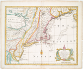
The south part of Virginia, now the north part of Carolina
0
Atlases, gazetteers, guidebooks and other books
377
Maps of the World
16
Maps of the Oceans
24
Maps of North and South America
23
Maps of North America.
551
Maps of New York City and State
1340
Lawrence H. Slaughter Collection of English maps, charts, globes, books and atlases
1020
John H. Levine Collection
60
More
Show filters
Hide filters
Show Only Public Domain
topic
Administrative and political divisions
2
Nautical charts
2
Coasts
1
Description and travel
1
Early works to 1800
1
More
Less
name
Sauthier, Claude Joseph
4
Brion de la Tour, Louis, 1743-1803
2
Esnauts et Rapilly
2
Holland, Samuel, 1728-1801
2
Pownall, Thomas, 1722-1805
2
More
Less
collection
x
Lawrence H. Slaughter Collection of English maps, charts, globes, books and atlases
place
Northeastern States
12
Northeastern States -- Maps -- Early works to 1800
9
New Jersey
4
New York (State)
4
New Jersey -- Administrative and political divisions -- Maps -- Early works to 1800
3
More
Less
genre
Maps
19
publisher
M. A. Lotter
2
s.n.,
2
A. Dury ... ,
1
At the Presses of S. Hall, and Thomas & Andrews, and sold by E. Larkin, and the other booksellers in Boston; by Gaine & Ten Eyck, and S. Campbell, New-York; [etc.,etc.]
1
By J. van Schoonhoven en Comp. en G. van den Brink, Janz
1
More
Less
division
Map Division
19
type
cartographic
19
Date Range
to
19 results found for:
x
Northeastern States?tab=filter
Filtering on:
x
Collection
: Lawrence H. Slaughter Collection of English maps, charts, globes, books and atlases
Sort by:
Relevance
Title
Date created
Date digitized
Sequence
Part of North America: compre…
Nieuwe en nauwkeurige kaart v…
…
States
of America
A map of that part of America…
note:
…, Delaware, and
northeastern
… independent
states
of North
Carte de la partie nord, des …
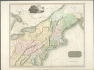
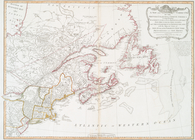
Northern provinces of the United
States
Carte du théatre de la guerre…
Carte du théatre de la guerre…
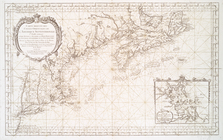
Carte reduite des costes orie…
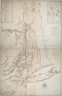
A new and accurate map of New…
… : with the adjacent
states
of New
note:
Shows boundaries of
states
.
m
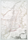
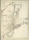
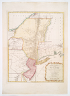
The provinces of New York, an…
Carte des troubles de l'Améri…
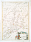
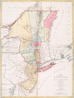
A map of the Province of New …
The provinces of New York, an…
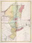
Mappa geographica Provinciae …
A map of the provinces of New…
m
A map of the provinces of New…
End of results
|
Top