Click to visit the main New York Public Library Homepage
The New York Public Library
Digital Collections
About Digital Collections
Browse
Search only public domain materials
Items
Collections
Divisions
Home
Search
Browse
About
Search only public domain materials
Items
Collections
Divisions
Digital Collections
Using Images
Using Data
Collections
Charting America: Maps from the Lawrence H. Slaughter Collection and Others
Charting America: Maps from the Lawrence H. Slaughter Collection and Others
Navigation
Filters
Charting America: Maps from the Lawrence H. Slaughter Collection and Others
Previous
The south part of Virginia, now the north part of Carolina
0
Atlases, gazetteers, guidebooks and other books
377
Maps of the World
16
Maps of the Oceans
24
Maps of North and South America
23
Maps of North America.
551
Maps of New York City and State
1340
Lawrence H. Slaughter Collection of English maps, charts, globes, books and atlases
1020
John H. Levine Collection
60
More
Show filters
Hide filters
Show Only Public Domain
topic
History
5
Nautical charts
4
Colonies
2
West Indies, British
2
Administrative and political divisions
1
More
Less
name
Moll, Herman, -1732
3
Seller, Jeremiah
3
Cóvens et Mortier
2
Keith, William, Sir, 1680-1749
2
Le Maire, François, 1675-1748
2
More
Less
collection
x
Lawrence H. Slaughter Collection of English maps, charts, globes, books and atlases
place
America
6
West Indies
6
North America
5
United States
5
Atlantic Ocean
4
More
Less
genre
Maps
22
publisher
... Mathew Albert and George Frederick Lotter
2
At the Presses of S. Hall, and Thomas & Andrews, and sold by E. Larkin, and the other booksellers in Boston; by Gaine & Ten Eyck, and S. Campbell, New-York; [etc.,etc.]
2
Chez Jean Cóvens et Corneille Mortier, geographes
2
Printed at the expence of the Society for the encouragement of learning, by S. Richardson ..
2
s.n
2
More
Less
division
Map Division
22
type
cartographic
21
still image
1
Date Range
to
22 results found for:
x
West (U.S.)?tab=filter
Filtering on:
x
Collection
: Lawrence H. Slaughter Collection of English maps, charts, globes, books and atlases
Sort by:
Relevance
Title
Date created
Date digitized
Sequence
A new generall chart for the
West
note:
… and
S
100.
Part of North America: compre…
collection:
… the
West
-India navigation
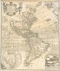
A new and correct map of Amer…
note:
Copy 1: With bookplate of Revd.
S
. Harper.
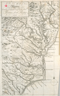
A New map of Virginia.
note:
Copy 1: With bookplate of Revd.
S
. Harper.
Castrum Mauritij Ad Ripam Fluminis
S
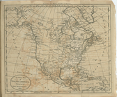
A new map of North America sh…
collection:
… of the
West
-India islands
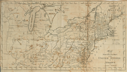
Map of the northern part of t…
collection:
… of the
West
-India islands
m
Map of the state of Virginia
note:
… of Richmond from the
West
.
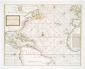
A Generall chart for the
West
Indies : according
note:
… and
S
140.
A new generall chart for the
West
note:
… and
S
14º, adjacent
A new generall chart for the
West
note:
… and
S
14º, adjacent
A New generall chart for the
West
note:
… and
S
100.
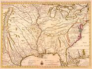
Carte de la Louisiane et du c…
note:
… the transmississippi
West
, 99
Carte de la Louisiane et du c…
note:
… the transmississippi
West
, 99
A new and accurate map of the…
note:
…"Longitude
west
North America from the French…
note:
…"Published according to Act by Tho[ma]
s
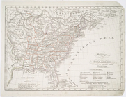
Vereinigte Staaten in Nord Am…
note:
Covers
U.S
. as far
west
as the Great
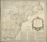
A Map of Carolana and of the …
note:
Covers
U.S
. as far
west
as the Rocky
… with the
West
India Islands
note:
…"N.B. The letters E, F,
S
, D, Da, annexed
… with the
West
India Islands
note:
…"N.B. The letters E, F,
S
, D, Da, annexed
A chart of North and South Am…
note:
…, and the
West
Indies -- Chart
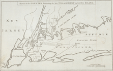
Sketch of the country illustr…
abstract:
…., on the
west
and south
End of results
|
Top