Click to visit the main New York Public Library Homepage
The New York Public Library
Digital Collections
About Digital Collections
Browse
Search only public domain materials
Items
Collections
Divisions
Home
Search
Browse
About
Search only public domain materials
Items
Collections
Divisions
Digital Collections
Using Images
Using Data
Collections
Charting America: Maps from the Lawrence H. Slaughter Collection and Others
Charting America: Maps from the Lawrence H. Slaughter Collection and Others
Navigation
Filters
Charting America: Maps from the Lawrence H. Slaughter Collection and Others
Previous
The south part of Virginia, now the north part of Carolina
0
Atlases, gazetteers, guidebooks and other books
377
Maps of the World
16
Maps of the Oceans
24
Maps of North and South America
23
Maps of North America.
551
Maps of New York City and State
1340
Lawrence H. Slaughter Collection of English maps, charts, globes, books and atlases
1020
John H. Levine Collection
60
More
Show filters
Hide filters
Show Only Public Domain
topic
Administrative and political divisions
6
Piers
2
Real property
2
Canals
1
Docks
1
More
Less
name
Hooker, William
6
Phelps, Humphrey (19th cent.)
4
Atwood, John M., approximately 1818-
3
Ensigns & Thayer
3
Faden, William, 1749-1836
2
More
Less
collection
x
Maps of New York City and State
place
New York (N.Y.)
13
Manhattan (New York, N.Y.) -- Maps
12
New York (N.Y.) -- Maps
10
New York (N.Y.) -- Administrative and political divisions -- Maps
7
New York (State)
6
More
Less
genre
Maps
22
publisher
W. Hooker
4
Published by Ensign & Thayer, 50 Ann St.,
2
W. Hooker,
2
s.n
2
J.F.W. Des Barres, Esqr
1
More
Less
division
Map Division
22
type
cartographic
22
text
5
Date Range
to
22 results found for:
x
South Atlantic States?tab=filter
Filtering on:
x
Collection
: Maps of New York City and State
Sort by:
Relevance
Title
Date created
Date digitized
Sequence
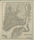
The Empire
State
, New York : with its
note:
Ill.: [
State
seal in cartouche] -- Evacuation
m
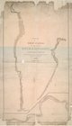
Survey for a ship canal to co…
note:
Direction arrows pointing
south
.
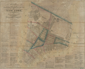
Map of property New York Dock…
note:
… waterfront
south
from Fulton
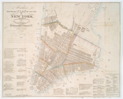
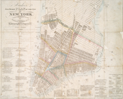
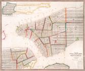
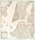
Hooker's new pocket plan of t…
note:
…
south
of 15th street on the west and
south
of 31st
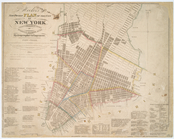
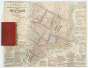
Hooker's new pocket plan of t…
note:
…
south
of 15th street on the west and
south
of 31st
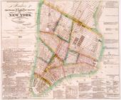
Hooker's new pocket plan of t…
note:
…
south
of 15th Street on the west side and
south
Hooker's new pocket plan of t…
note:
…
south
of 15th street on the west and
south
of 31st
m
Hooker's new pocket plan of t…
note:
…
south
of 15th Street on the west side and
south
Hooker's new pocket plan of t…
note:
…
south
of 15th Street on the west side and
south
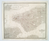
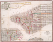
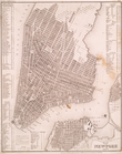
Map of the city of New York :…
note:
Covers Manhattan
south
of 32nd St.
Map of the city of New York :…
note:
Covers Manhattan
south
of 32nd St.
Map of the city of New York :…
note:
Covers Manhattan
south
of 32nd St.
Map of the city of New York :…
note:
Covers Manhattan
south
of 14th St.
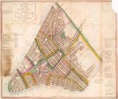
Map of the city of New York, …
note:
Covers Manhattan
south
of 51st St.
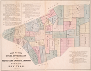
Map of the local boundaries o…
note:
Covers Manhattan
south
of 42nd St.
Map of the proposed widening …
note:
…. on the
south
, up to Rector St
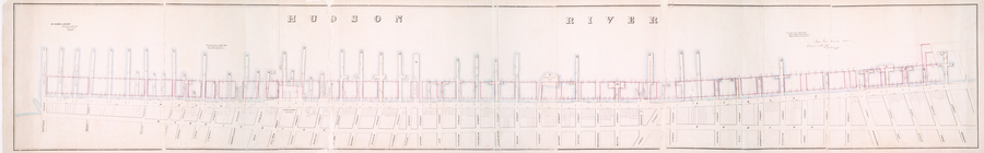
Map of wharves and piers on N…
note:
…
Atlantic
Seaboard.
New-York.
note:
…
south
of 17th St. on the west and
south
of 31st
Plan of the city of New York …
note:
… of interest, and "A
south
west
m
Plan of the city of New York …
note:
… of interest, and "A
south
west
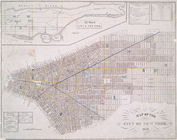
Plan von New-York, 1844.
note:
…
south
of 24th St. on the west and
south
of 37th
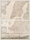
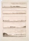
Views of the entrance to New …
note:
….] The
south
shore of Long
End of results
|
Top