Click to visit the main New York Public Library Homepage
The New York Public Library
Digital Collections
About Digital Collections
Browse
Search only public domain materials
Items
Collections
Divisions
Home
Search
Browse
About
Search only public domain materials
Items
Collections
Divisions
Digital Collections
Using Images
Using Data
Collections
Charting America: Maps from the Lawrence H. Slaughter Collection and Others
Charting America: Maps from the Lawrence H. Slaughter Collection and Others
Navigation
Filters
Charting America: Maps from the Lawrence H. Slaughter Collection and Others
Previous
The south part of Virginia, now the north part of Carolina
0
Atlases, gazetteers, guidebooks and other books
377
Maps of the World
16
Maps of the Oceans
24
Maps of North and South America
23
Maps of North America.
551
Maps of New York City and State
1340
Lawrence H. Slaughter Collection of English maps, charts, globes, books and atlases
1020
John H. Levine Collection
60
More
Show filters
Hide filters
Show Only Public Domain
topic
Atlases, British
15
Geography
15
Cosmography
2
Ethnology
2
Physical geography
2
More
Less
name
Mitchell, S. Augustus (Samuel Augustus), 1792-1868
42
Dunn, Samuel, d. 1794
15
Sayer, Robert, 1725-1794
15
Carey, Mathew, 1760-1839
10
Manning, Thomas S
10
More
Less
collection
x
Atlases, gazetteers, guidebooks and other books
place
Bronx (New York, N.Y.)
1
East Indies
1
England
1
Maritime Provinces
1
New York
1
More
Less
genre
Maps
69
Registers (Lists)
3
Tables of contents
1
publisher
S. A. Mitchell, jr
42
Printed for Robert Sayer, No. 53, Fleet-Street
15
M. Carey
10
J. Harrison
2
A. J. Johnson & co
1
More
Less
division
Map Division
73
type
cartographic
69
text
4
still image
1
Date Range
to
73 results found for:
x
Greenburgh (N.Y. : Town) -- Maps?tab=filter
Filtering on:
x
Collection
: Atlases, gazetteers, guidebooks and other books
Sort by:
Relevance
Title
Date created
Date digitized
Sequence
A
Map
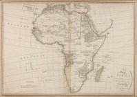
of Africa drawn & engraved from D
collection:
A
Map
of Africa drawn & engraved from
Map
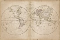
of the world
Map
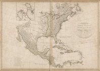
of North America, published under
Map
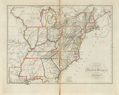
of the United States of America
A correct
map
of Virginia
A
map
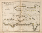
of the French part of St. Domingo
A
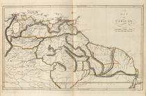
map
of Caracas
A
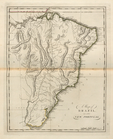
map
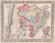
of Brazil, now called New
An accurate
map
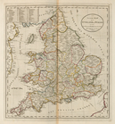
of England and Wales
A
map
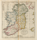
of Ireland according to the best
An accurate
map
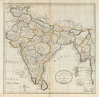
of Hindostan or India, from
A new and accurate
map
of New South Wales
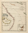
A
map
of the discoveries made by Capts
Map
of the world on the mercator projection
Map
of North America. Showing its
County
map
of Nova Scotia, New Brunswick
Map
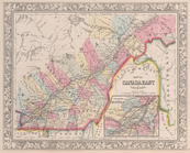
of Canada East in counties; Environs
Map
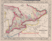
of Canada West in counties.
Map
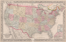
of the United States, and territories
County
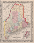
map
of the State of Maine
County
map
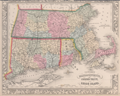
of Massachusetts, Connecticut
County
map
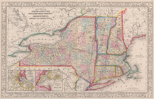
of the States of New York, New
County
map
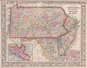
of Pennsylvania, New Jersey
County
map
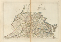
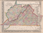
of Virginia and West Virginia.
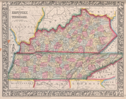
County
map
of Kentucky and Tennessee.
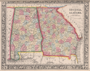
County
map
of Georgia and Alabama.
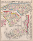
County
map
of North Carolina,
Map
of South
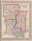
Map
of Louisiana, Mississippi, and Arkansas.
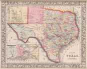
County
map
of Texas ; Galveston Bay and vicinity
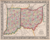
County
map
of Ohio and Indiana.
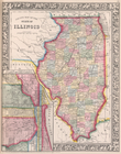
County
map
of the State of Illinois ; Plan
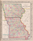
County
map
of the States of Iowa
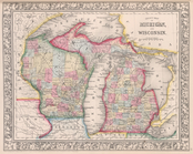
County
map
of Michigan, and Wisconsin.
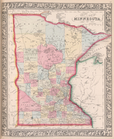
County
map
of Minnesota.
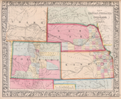
Map
of Kansas, Nebraska, and Colorado
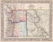
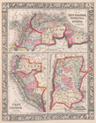
Map
of Oregon, Washington and part of Idaho.
County
map
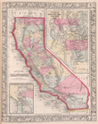
California;
Map
note:
…, Arizona - see
Map
Map
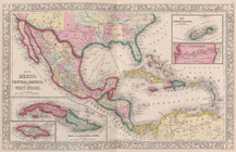
of Mexico
Map
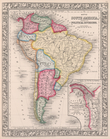
of South
Map
of New Granada
Map
of Brazil
Map
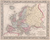
of Europe, showing its gt. political
…, Sweden, and Norway ;
Map
of Denmark;
Map
of Holland
Map
of France, Spain, and Portugal
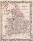
County
map
of England and Wales.
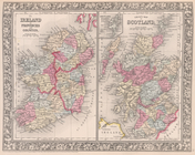
County
map
of Scotland ; Shetland Islands
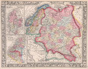
Map
of the Austrian Empire, Italian States
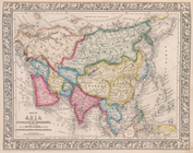
Map
of Asia, showing gt. political
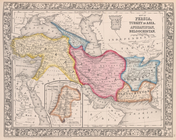
Map
of Persia, Turkey in Asia
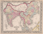
Map
of Hindoostan, Farther India, China