Click to visit the main New York Public Library Homepage
The New York Public Library
Digital Collections
About Digital Collections
Browse
Search only public domain materials
Items
Collections
Divisions
Home
Search
Browse
About
Search only public domain materials
Items
Collections
Divisions
Digital Collections
Using Images
Using Data
Collections
Charting America: Maps from the Lawrence H. Slaughter Collection and Others
Charting America: Maps from the Lawrence H. Slaughter Collection and Others
Navigation
Filters
Charting America: Maps from the Lawrence H. Slaughter Collection and Others
Previous
The south part of Virginia, now the north part of Carolina
0
Atlases, gazetteers, guidebooks and other books
377
Maps of the World
16
Maps of the Oceans
24
Maps of North and South America
23
Maps of North America.
551
Maps of New York City and State
1340
Lawrence H. Slaughter Collection of English maps, charts, globes, books and atlases
1020
John H. Levine Collection
60
More
Show filters
Hide filters
Show Only Public Domain
topic
x
Administrative and political divisions
Railroads
85
Landowners
46
Real property
45
Canals
38
More
Less
name
G.W. & C.B. Colton & Co
20
G.W. & C.B. Colton & Co
13
Dripps, M. (Matthew)
10
Disturnell, John, 1801-1877
9
J.B. Beers & Co
9
More
Less
collection
Maps of New York City and State
278
Lawrence H. Slaughter Collection of English maps, charts, globes, books and atlases
4
place
New York (State)
249
New York (N.Y.)
94
Manhattan (New York, N.Y.)
72
New York
62
Brooklyn (New York, N.Y.)
55
More
Less
genre
Maps
282
Cadastral maps
28
Road maps
8
Manuscript maps
2
Aerial views
1
More
Less
publisher
G.W. & C.B. Colton & Co
17
publisher not identified
13
Engraved, printed and published by G.W. & C.B. Colton & Co
6
M. Dripps
6
J.B. Beers & Co
5
More
Less
division
Map Division
281
Manuscripts and Archives Division
1
type
cartographic
281
still image
2
text
2
Date Range
to
282 results found for:
x
Greenburgh (N.Y. : Town) -- Maps?tab=filter
Filtering on:
x
Topic
: Administrative and political divisions
Sort by:
Relevance
Title
Date created
Date digitized
Sequence
m
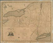
A chorographical
map
of the province
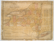
A
map
of the State of New York
A
map
of the State of New York
A
map
of the State
note:
…
N.Y
.'s wards
Distance
map
note:
… of the
map
.
Map
of the State of New York
note:
… to Early
Maps
of the Middle
Map
of the State of New York
note:
… to Early
Maps
of the Middle
Map
of the State of New York
note:
… to Early
Maps
of the Middle
Map
of the state of New York
note:
… to Early
Maps
of the Middle
Map
of the state of New York : compiled
note:
… -- Vicinity of New York --
Map
Map
of the state of New York : compiled
note:
… -- Vicinity of New York --
Map
Map
of the state of New York : compiled
note:
… -- Vicinity of New York --
Map
Map
of the state
note:
… to Early
Maps
of the Middle
Map
of the state
note:
… to Early
Maps
of the Middle
Map
of the state
note:
… to Early
Maps
of the Middle
Map
of the state
note:
… to Early
Maps
of the Middle
Map
of the state
note:
… to Early
Maps
of the Middle
Map
of the state of New York
note:
… to Early
Maps
of the Middle
Map
of the state of New York
note:
… to Early
Maps
of the Middle
Map
of the state of New York
note:
… to Early
Maps
of the Middle
m
Map
of the state of New-York : with parts
note:
… to Early
Maps
of the Middle
… counties,
towns
, cities
note:
…: Population of the
towns
The tourist's
map
of the state of New York
note:
… to Early
Maps
of the Middle
m
A new township
map
of the state of New York
note:
engraved by Fisk & Russell,
N.Y
.
Distance
map
of the state of New York
note:
… 1:1,000,000 (W 80°--W 72°/
N
45°--
N
40°)…
Squire's
map
of the state of New York
note:
… 71°52ʹ/
N
45°01ʹ--
N
40°30
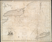
Map
of the province
note:
Photocopy of a manuscript
map
dated: 10th
Map
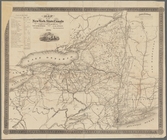
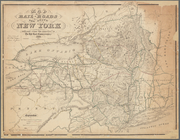
of the rail-roads of the State
note:
Map
within decorative border.
Map
of the State
note:
…. Hayward, 120 Water St.
N.Y
.
Map
of the state of New York
note:
Mapping
the Nation (NEH grant, 2015-2018)…
Map
of the rail roads of the state
note:
Also shows counties, principal cities and
towns
Revised
map
of the rail roads of the State
note:
Mapping
the Nation (NEH grant, 2015-2018)…
Map
of the rail roads of the State
note:
Shows counties, principal cities and
towns
Map
of the New York state canals completed
note:
Mapping
the Nation (NEH grant, 2015-2018)…
Engineers
map
of the state of New York
note:
Map
within decorative border.
m
Map
of the state of New-York
note:
Mapping
the Nation (NEH grant, 2015-2018)…
m
New
map
of the state of New York
note:
Shows counties, principal cities and
towns
m
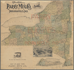
Colton's new township railroad
map
note:
Shows counties and
towns
, completed
Map
of New York
note:
Shows counties, principal cities and
towns
Colton's railroad & township
map
of the state
note:
Shows counties, principal cities and
towns
Map
of the rail-roads of the State
note:
Mapping
the Nation (NEH grant, 2015-2018)…
Map
of the state of New-York showing its
note:
Mapping
the Nation (NEH grant, 2015-2018)…
Map
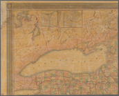
of the rail-roads of the state
note:
Map
also shows lakes, canals, drainage
m
New railroad, county and township
map
note:
Colored to show county and
town
Map
of New York State
note:
Shows counties, principal cities and
towns
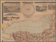
…, county and township
map
note:
… insets: [
Map
Map
of the state
note:
Mapping
the Nation (NEH grant, 2015-2018)…
Grover & Baker's
map
of the state
note:
Map
within decorative border.
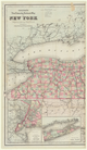
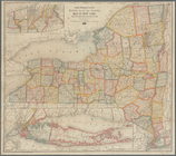
Map
of the State of New York
note:
Shows principal cities and
towns
Map
showing the position of the Albany
note:
Mapping
the Nation (NEH grant, 2015-2018)…
1
2
Previous
Next
1
2
Previous
Next