Click to visit the main New York Public Library Homepage
The New York Public Library
Digital Collections
About Digital Collections
Browse
Search only public domain materials
Items
Collections
Divisions
Home
Search
Browse
About
Search only public domain materials
Items
Collections
Divisions
Digital Collections
Using Images
Using Data
Collections
Charting America: Maps from the Lawrence H. Slaughter Collection and Others
Charting America: Maps from the Lawrence H. Slaughter Collection and Others
Navigation
Filters
Charting America: Maps from the Lawrence H. Slaughter Collection and Others
Previous
The south part of Virginia, now the north part of Carolina
0
Atlases, gazetteers, guidebooks and other books
377
Maps of the World
16
Maps of the Oceans
24
Maps of North and South America
23
Maps of North America.
551
Maps of New York City and State
1340
Lawrence H. Slaughter Collection of English maps, charts, globes, books and atlases
1020
John H. Levine Collection
60
More
Show filters
Hide filters
Show Only Public Domain
topic
x
Administrative and political divisions
Maps
21
Canals
11
Altitudes
10
Charts, diagrams, etc
9
More
Less
name
Smith, J. Calvin (John Calvin)
7
Burr, David H., 1803-1875
6
Disturnell, John, 1801-1877
6
Sherman & Smith
6
Hooker, William
5
More
Less
collection
Maps of New York City and State
53
Lawrence H. Slaughter Collection of English maps, charts, globes, books and atlases
5
place
New York (State)
35
New York (N.Y.)
29
Brooklyn (New York, N.Y.)
11
Brooklyn (New York, N.Y.) -- Maps
10
Erie Canal (N.Y.)
9
More
Less
genre
Maps
58
Posters
1
publisher
W. Hooker
3
s.n
3
J. Disturnell
2
Published by A. Finley
2
Published by J. Disturnell, 102 Broadway
2
More
Less
division
Map Division
58
type
cartographic
58
text
6
Date Range
to
58 results found for:
x
Middle Atlantic States?tab=filter
Filtering on:
x
Topic
: Administrative and political divisions
Sort by:
Relevance
Title
Date created
Date digitized
Sequence
… of the
state
of New York
note:
… in the
state
-- City of New
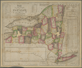
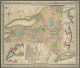
Map of the
State
of New York
note:
… to Early Maps of the
Middle
Atlantic
Seaboard.
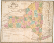
Map of the
State
of New York
note:
… to Early Maps of the
Middle
Atlantic
Seaboard.
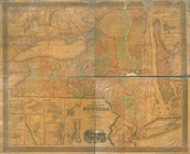
Map of the
State
of New York
note:
… to Early Maps of the
Middle
Atlantic
Seaboard.
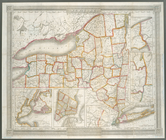
Map of the
state
of New York
note:
… to Early Maps of the
Middle
Atlantic
Seaboard.
Map of the
state
of New York : compiled
note:
… to Early Maps of the
Middle
Atlantic
Seaboard.
Map of the
state
of New York : compiled
note:
… to Early Maps of the
Middle
Atlantic
Seaboard.
Map of the
state
of New York : compiled
note:
… to Early Maps of the
Middle
Atlantic
Seaboard.
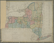
Map of the
state
of New York : showing
note:
… the New York
state
line
Map of the
state
of New York : showing
note:
… the New York
State
line
Map of the
state
of New York : showing
note:
… York
state
line
Map of the
state
of New York : showing
note:
… the New York
State
line
Map of the
state
of New York : showing
note:
Includes population statistics for the
state
Map of the
state
of New York
note:
… to Early Maps of the
Middle
Atlantic
Seaboard.
Map of the
state
of New York
note:
… to Early Maps of the
Middle
Atlantic
Seaboard.
Map of the
state
of New York
note:
… to Early Maps of the
Middle
Atlantic
Seaboard.
m
Map of the
state
of New-York : with parts
note:
… to Early Maps of the
Middle
Atlantic
Seaboard.
Neueste Karte von New York : …
note:
… to Early Maps of the
Middle
Atlantic
Seaboard.
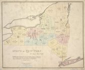
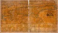
New York
note:
… to Early Maps of the
Middle
Atlantic
Seaboard.
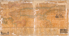
New-York
note:
From the author's Atlas of the
state
New-York
note:
… to Early Maps of the
Middle
Atlantic
Seaboard.
State
of New York
note:
… to Early Maps of the
Middle
Atlantic
Seaboard.
State
of New York : in Senate Jany. 7th, 1836
note:
… to Early Maps of the
Middle
Atlantic
Seaboard.
State
of New York divided into senatorial
note:
… to Early Maps of the
Middle
Atlantic
Seaboard.
The Empire
State
, New York : with its
note:
Ill.: [
State
seal in cartouche] -- Evacuation
The
state
of New York from the most
note:
… to Early Maps of the
Middle
Atlantic
Seaboard.
The tourist's map of the
state
of New York
note:
… to Early Maps of the
Middle
Atlantic
Seaboard.
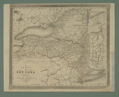
Map of the
state
of New York
m
Map of the
state
of Virginia
note:
…, Governor of the
state
A map of the
State
of New York
note:
… of the
state
."…
The provinces of New York, an…
note:
… to Early Maps of the
Middle
Atlantic
Seaboard.
The provinces of New York, an…
note:
… to Early Maps of the
Middle
Atlantic
Seaboard.
A map of the provinces of New…
note:
… to Early Maps of the
Middle
Atlantic
Seaboard.
Map of the western part of the
state
note:
Insets: Profile of the western and
middle
m
Map of the city of Albany
note:
… to Early Maps of the
Middle
Atlantic
Seaboard.
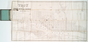
Troy, N.Y., from actual survey
note:
… to Early Maps of the
Middle
Atlantic
Seaboard.
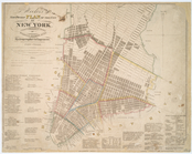
Map of the city and county of…
note:
… to Early Maps of the
Middle
Atlantic
Seaboard.
Map of the city and county of…
note:
… to Early Maps of the
Middle
Atlantic
Seaboard.
Map of the country thirty mil…
note:
… to Early Maps of the
Middle
Atlantic
Seaboard.
m
Sidney's map of twelve miles …
note:
… to Early Maps of the
Middle
Atlantic
Seaboard.
Hayward's map of the city of …
note:
… to Early Maps of the
Middle
Atlantic
Seaboard.
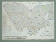
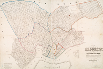
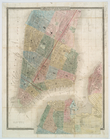
Map of the city of Brooklyn, …
note:
… to Early Maps of the
Middle
Atlantic
Seaboard.
m
… of the
state
of New York : made
note:
… to Early Maps of the
Middle
Atlantic
Seaboard.
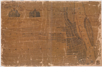
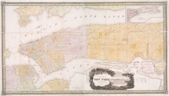
City of New York
note:
… to Early Maps of the
Middle
Atlantic
Seaboard.
City of New-York
note:
… to Early Maps of the
Middle
Atlantic
Seaboard.
City of New-York
note:
… to Early Maps of the
Middle
Atlantic
Seaboard.
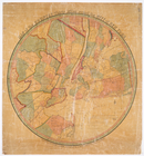
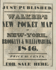
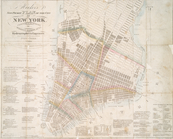
Hooker's new pocket plan of t…
note:
…, of the
state
of N. York."…
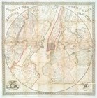
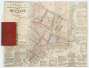
Hooker's new pocket plan of t…
note:
…, of the
state
of N. York."…
m
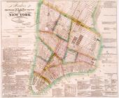
Hooker's new pocket plan of t…
note:
… to Early Maps of the
Middle
Atlantic
Seaboard.
Hooker's new pocket plan of t…
note:
… to Early Maps of the
Middle
Atlantic
Seaboard.