Click to visit the main New York Public Library Homepage
The New York Public Library
Digital Collections
About Digital Collections
Browse
Search only public domain materials
Items
Collections
Divisions
Home
Search
Browse
About
Search only public domain materials
Items
Collections
Divisions
Digital Collections
Using Images
Using Data
Collections
Charting America: Maps from the Lawrence H. Slaughter Collection and Others
Charting America: Maps from the Lawrence H. Slaughter Collection and Others
Navigation
Filters
Charting America: Maps from the Lawrence H. Slaughter Collection and Others
Previous
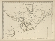
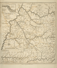
The south part of Virginia, now the north part of Carolina
0
Atlases, gazetteers, guidebooks and other books
377
Maps of the World
16
Maps of the Oceans
24
Maps of North and South America
23
Maps of North America.
551
Maps of New York City and State
1340
Lawrence H. Slaughter Collection of English maps, charts, globes, books and atlases
1020
John H. Levine Collection
60
More
Show filters
Hide filters
Show Only Public Domain
topic
x
Geography
Atlases, British
15
Atlases
7
Cosmography
2
World maps
2
More
Less
name
Morse, Jedidiah, 1761-1826
24
Stockdale, John, 1749?-1814
24
Dunn, Samuel, d. 1794
15
Sayer, Robert, 1725-1794
15
Society for the Diffusion of Useful Knowledge (Great Britain)
7
More
Less
collection
Lawrence H. Slaughter Collection of English maps, charts, globes, books and atlases
38
Atlases, gazetteers, guidebooks and other books
15
place
United States
24
Great Britain
9
Delaware
1
East Indies
1
England
1
More
Less
genre
Maps
44
Book covers
2
Directories
2
Tables of contents
2
Geological maps
1
More
Less
publisher
Printed for J. Stockdale
24
Printed for Robert Sayer, No. 53, Fleet-Street
15
Chapman and Hall
7
Printed for Timothy Childe at the White Hart at the West-end of St. Paul's Church-yard
3
Printed for John Cary
2
More
Less
division
Map Division
53
type
cartographic
43
text
7
still image
3
Date Range
to
53 results found for:
x
Islip (N.Y. : Town) -- Maps?tab=filter
Filtering on:
x
Topic
: Geography
Sort by:
Relevance
Title
Date created
Date digitized
Sequence
A system of geography with new
maps
note:
… to Early
Maps
of the Middle
Map
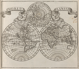
of the world.
note:
… to Early
Maps
of the Middle
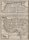
Barbary and Bildulgerid ; A
map
of Zaara
note:
… to Early
Maps
of the Middle
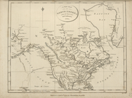
A new
map
of North America from the latest
note:
… to Early
Maps
of the Middle
A new
map
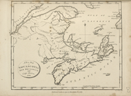
of Upper and Lower Canada, 1794.
note:
… to Early
Maps
of the Middle
A new
map
of Nova Scotia, New Brunswick
note:
… to Early
Maps
of the Middle
A
map
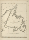
of Newfoundland.
note:
… to Early
Maps
of the Middle
A
map
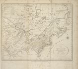
of the northern and middle states
note:
… to Early
Maps
of the Middle
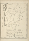
A
map
of Vermont.
note:
… to Early
Maps
of the Middle
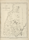
A
map
of New Hampshire.
note:
… to Early
Maps
of the Middle
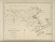
A
map
of Massachusets [sic] from
note:
… to Early
Maps
of the Middle
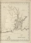
A
map
of Rhode Island.
note:
… to Early
Maps
of the Middle
A
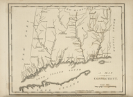
map
of Connecticut.
note:
… to Early
Maps
of the Middle
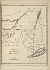
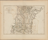
A
map
of the State of New York.
note:
… to Early
Maps
of the Middle
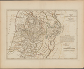
A
map
of New Jersey …
note:
… to Early
Maps
of the Middle
A
map
of Pennsylvania, from the best
note:
… to Early
Maps
of the Middle
A
map
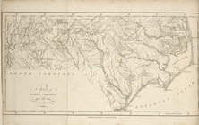
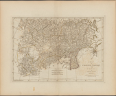
of the states of Virginia, North Carolina
note:
… to Early
Maps
of the Middle
Map
of Virginia, Maryland and Delaware …
note:
… to Early
Maps
of the Middle
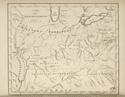
A
map
of the Back Settlements.
note:
… to Early
Maps
of the Middle
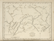
A
map
of Kentucky, drawn from actual
note:
… to Early
Maps
of the Middle
A
map
of North Carolina, from the best
note:
… to Early
Maps
of the Middle
A
map
of the Tennessee Government, 1794.
note:
… to Early
Maps
of the Middle
A
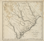
map
of South Carolina, from the best
note:
… to Early
Maps
of the Middle
A
map
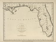
of the East and West Florida.
note:
… to Early
Maps
of the Middle
A
map
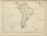
of South America and the adjacent
note:
… to Early
Maps
of the Middle
A
map
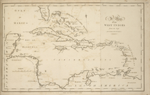
of the West Indies, from the best
note:
… to Early
Maps
of the Middle
A
map
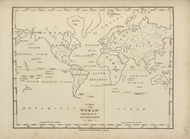
of the world, exhibiting all the new
note:
… to Early
Maps
of the Middle
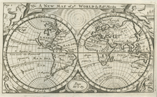
A new
map
of ye world
topic:
World
maps
m
Maps
of the Society for the Diffusion of Useful
Maps
of the Society for the Diffusion of Useful
Maps
of the Society for the Diffusion of Useful
m
Maps
of the Society for the Diffusion of Useful
m
Maps
of the Society for the Diffusion of Useful
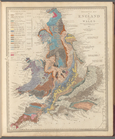
Geological
map
of England and Wales
m
Maps
of the Society for the Diffusion of Useful
m
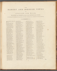
The market and borough
towns
in England
m
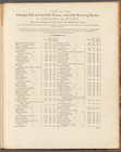
…-
towns
collection:
… and sub-post-
towns
Map
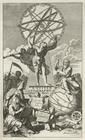
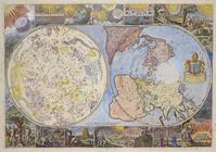
of the heavens and the earth
note:
Variant of Shirley, R.W.
Mapping
The contents of the
maps
in cosmography
A
map
exhibiting the dark shadow of the moon
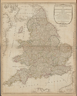
A new and compendious
map
of England
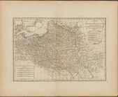
A new
map
of the Kingdom of Poland with all
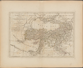
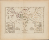
A
map
of Turkey in Asia, containing
note:
… of Jan[uar]
y
1788.
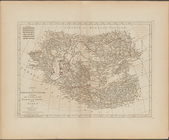
A
map
of independent Tartary
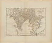
A complete
map
of the East Indies, exhibiting
A
map
of Chinese Tartary, with Corea
A compleat
map
of the Holy Land ; adapted
Part IId. of the compleat
map
of the Holy
A
map
of the countries and places
A
map
of Abyssinia and Nubia