Click to visit the main New York Public Library Homepage
The New York Public Library
Digital Collections
About Digital Collections
Browse
Search only public domain materials
Items
Collections
Divisions
Home
Search
Browse
About
Search only public domain materials
Items
Collections
Divisions
Digital Collections
Using Images
Using Data
Collections
Charting America: Maps from the Lawrence H. Slaughter Collection and Others
Charting America: Maps from the Lawrence H. Slaughter Collection and Others
Navigation
Filters
Charting America: Maps from the Lawrence H. Slaughter Collection and Others
Previous
The south part of Virginia, now the north part of Carolina
0
Atlases, gazetteers, guidebooks and other books
377
Maps of the World
16
Maps of the Oceans
24
Maps of North and South America
23
Maps of North America.
551
Maps of New York City and State
1340
Lawrence H. Slaughter Collection of English maps, charts, globes, books and atlases
1020
John H. Levine Collection
60
More
Show filters
Hide filters
Show Only Public Domain
topic
x
History
Long Island, Battle of, New York, N.Y., 1776
4
Indians of North America
3
Chronology
2
Lakes
2
More
Less
name
Barber, J
2
Brasier, William (British artist, active 18th century)
2
Faden, William, 1749-1836
2
Hawkes, W
2
Hayward, George, approximately 1800-
2
More
Less
collection
Lawrence H. Slaughter Collection of English maps, charts, globes, books and atlases
11
Maps of New York City and State
11
place
North America
6
United States
6
New York (N.Y.)
5
New York (State)
5
Middle Atlantic States
3
More
Less
genre
Maps
22
Early maps
1
Early works to 1800
1
Facsimiles
1
publisher
publisher not identified
3
Printed at the expence of the Society for the encouragement of learning, by S. Richardson ..
2
Printed for Robt. Sayer & Jno. Bennett
2
Printed for Robt. Sayer and Jno. Bennett
2
... W. Hawkes (successor to T. Kitchin), No. 59, Holborn Hill
1
More
Less
division
Map Division
22
type
cartographic
21
still image
1
text
1
Date Range
to
22 results found for:
x
North America?tab=filter
Filtering on:
x
Topic
: History
Sort by:
Relevance
Title
Date created
Date digitized
Sequence
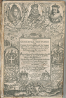
The generall historie of Virg…
topic:
Indians of
North
America
North
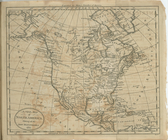
America
from the French of Mr. D'Anville
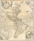
Carte d'une partie de l'Améri…
A new and correct map of
America
: laid
note:
… -- Georgia -- The
North
Pole.
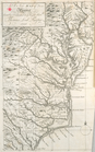
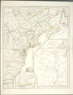
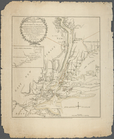
A New map of Virginia.
note:
… and
North
Carolina.
A new map of
North
America
shewing all
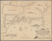
A mappe of Colonel Römers voy…
topic:
Indians of
North
America
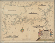
A mappe of Colonel Römers voy…
topic:
Indians of
North
America
Theatre de la guerre en Améri…
note:
LC Maps of
North
America
, 1750-1789, 154
The Theatre of war in
North
America
.
note:
… colonies in
North-America
… Jerseys in Nord
America
im
note:
Covers New York State as far
north
The country twenty five miles…
note:
… in
North
America
," distance
The seat of action between th…
note:
LC Maps of
North
America
, 1750-1789, 1146
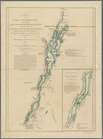
A survey of Lake Champlain: i…
note:
…'s forces in
North
America
A survey of Lake Champlain: i…
note:
…'s forces in
North
America
Map of historic Niagara: show…
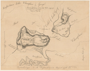
Ticonderoga and its dependenc…
note:
Oriented with
north
toward the right.
The seat of action between th…
note:
LC Maps of
North
America
, 1750-1789, 1146
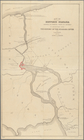
A plan of New York Island, wi…
note:
LC Maps of
North
America
, 1750-1789, 1144
A plan of New York Island, wi…
note:
LC Maps of
North
America
, 1750-1789, 1144
The Country twenty five miles…
note:
… in
North
America
," distance
Plan of the position taken by…
note:
Oriented with
north
to the right.
End of results
|
Top