Click to visit the main New York Public Library Homepage
The New York Public Library
Digital Collections
About Digital Collections
Browse
Search only public domain materials
Items
Collections
Divisions
Home
Search
Browse
About
Search only public domain materials
Items
Collections
Divisions
Digital Collections
Using Images
Using Data
Collections
Charting America: Maps from the Lawrence H. Slaughter Collection and Others
Charting America: Maps from the Lawrence H. Slaughter Collection and Others
Navigation
Filters
Charting America: Maps from the Lawrence H. Slaughter Collection and Others
Previous
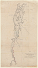
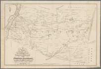
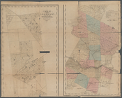
The south part of Virginia, now the north part of Carolina
0
Atlases, gazetteers, guidebooks and other books
377
Maps of the World
16
Maps of the Oceans
24
Maps of North and South America
23
Maps of North America.
551
Maps of New York City and State
1340
Lawrence H. Slaughter Collection of English maps, charts, globes, books and atlases
1020
John H. Levine Collection
60
More
Show filters
Hide filters
Show Only Public Domain
topic
x
Landowners
Real property
136
Administrative and political divisions
46
Railroads
22
Villages
14
More
Less
name
Smith, Robert Pearsall, 1827-1898
25
Dripps, M. (Matthew)
16
Gillette, John E
7
J.B. Beers & Co
7
French, J. H. (John Homer), 1824-1888
5
More
Less
collection
Maps of New York City and State
181
Lawrence H. Slaughter Collection of English maps, charts, globes, books and atlases
1
place
New York (State)
176
New York
53
New York (N.Y.)
38
Brooklyn (New York, N.Y.)
20
Manhattan (New York, N.Y.)
18
More
Less
genre
Maps
182
Cadastral maps
96
Manuscript maps
13
Facsimiles
2
Topographic maps
2
More
Less
publisher
publisher not identified
15
M. Dripps
13
J.B. Beers & Co
7
Hyde & Company
5
Common Council
3
More
Less
division
Map Division
182
type
cartographic
181
still image
6
text
3
Date Range
to
182 results found for:
x
North Hempstead (N.Y. : Town) -- Maps?tab=filter
Filtering on:
x
Topic
: Landowners
Sort by:
Relevance
Title
Date created
Date digitized
Sequence
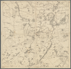
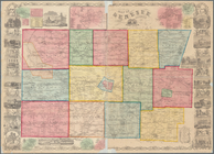
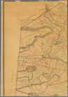
Map
of the province
note:
Photocopy of a manuscript
map
dated: 10th
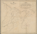
Map
no. III : [to accompany A bill
note:
… in the
town
of Elizabeth
m
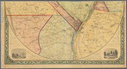
Topographical
map
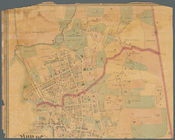
of New York City, County
note:
… in Manhattan, New York (
N.Y
A
map
of the Manor Renselaerwick
note:
NYPL
Map
Div. copy has accession no
… Scottsville,
N
.
Y
. as the road was opened to Leroy,
N
.
Y
note:
Oriented with
north
toward the upper right.
Map
of French & English grants on Lake
note:
Mapping
the Nation (NEH grant, 2015-2018)…
Map
showing the Adirondack Lake regions
note:
Also shows cities,
towns
, and names
Map
of the head waters of the rivers
note:
Mapping
the Nation (NEH grant, 2015-2018)…
Map
of the head waters of the rivers
note:
Reduced version of the
map
lithographed
A
map
of part of the land in the Royal Grant
note:
…"Reduced one fifth from the original
map
."…
Map
of Dobbs Ferry and Hastings
note:
Map
also shows street names, roads
m
Map
of the vicinity of Albany and Troy
note:
Shows counties, principal cities and
towns
…, Westchester,
N
.
Y
.
note:
… Exchange Place,
N.Y
.
m
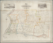
Map
of Tarrytown, Irvington etc, Westchester
note:
Maps
show landowners, roards, railroads
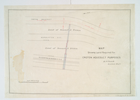
Map
showing land required for Croton
note:
… Croton Aqueduct and
N.Y
m
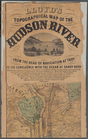
Lloyd's Topographical
map
of the Hudson
note:
…,
towns
, villages
m
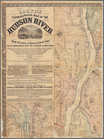
Lloyd's topographical
map
of the Hudson
note:
…,
towns
, villages
m
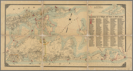
Map
of Long Island
note:
…, Brooklyn,
N.Y
."…
m
Map
of Long Island
note:
…. Fulton St., Brooklyn,
N.Y
… situations of the
towns
note:
…. Albany,
N.Y
. 1883.
Map
of the
town
of Niagara
note:
… of Niagara Falls (
N.Y
.).
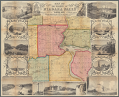
Map
of the vicinity of Niagara Falls
note:
…, and Cayuga Counties,
N.Y
. &c."…
m
Map
of Dutchess County, New-York from
note:
… to Early
Maps
of the Middle
Map
of West Chester County, New York
note:
Mapping
the Nation (NEH grant, 2015-2018)…
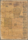
Untitled manuscript
map
of Great Nine
note:
… 74°02ʹ47ʺ--W 73°27ʹ44ʺ/
N
41°56ʹ59ʺ--
N
41°24ʹ47ʺ)…
m
Map
of Albany County, New York
note:
by Jay Gould, Roxbury
N.Y
. and I.B
m
Map
of Cayuga and Seneca Counties, New York
note:
… county
map
showing
towns
(townships), numbered
town
m
Map
of Allegany Co.,
N
.
Y
.
note:
LC copy hand colored to emphasize
town
m
Map
of Ontario County, New York
note:
by S.
N
. Beers, assisted by D.G. Beers.
m
Map
of Dutchess Co., New York
note:
Mapping
the Nation (NEH grant, 2015-2018)…
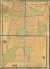
Map
of Broome County, New York
note:
General-content county
map
showing
Map
of Chenango County, New York
note:
Also includes insets of
towns
m
Map
of Clinton Co., New York
note:
NYPL
Map
Div. copy
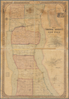
Map
of Erie County, New York
note:
…,
N.Y
., &c.
A
map
of the
towns
of Livingston, Germantown
note:
… regional
map
of 3
towns
(townships) in
N.Y
. State
Map
of Genesee County, New York
note:
Shows
town
boundaries, roads, railroads
m
Map
of Genesee County, New York
note:
Shows
town
boundaries, roads, railroads
Map
of Oswego County, New York
note:
… of
maps
of the counties
m
Map
of the highlands of the Hudson
note:
by James P. Kirby, E.C., Newburgh,
N.Y
m
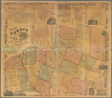
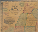
Map
of Otsego Co., New York
note:
County
map
showing cities and townships
Map
of Sullivan County, New York
note:
County
map
showing cities and townships
Map
of Seneca County, New York
note:
General-content county
map
showing
towns
Map
of Saratoga Co., New York
note:
Shows cities and
towns
, landowners, roads
Map
of Rockland Co
note:
County
map
, showing cities and
towns
Topographical
map
of Seneca County,
N
.
Y
.
note:
Shows cities and
towns
, military survey
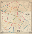
Map
of Orleans County, New York
note:
County
map
showing
town
boundaries, roads
Map
of the County of St. Lawrence
note:
Cadastral
map
showing numbered lots
m
Map
of Monroe County, New York
note:
Hand colored to emphasize
town
(township
A topographical
map
of Steuben Co., New York
note:
… insets small-
towns
Map
of the county of Herkimer
note:
Shows
towns
, post offices, flouring mills