Click to visit the main New York Public Library Homepage
The New York Public Library
Digital Collections
About Digital Collections
Browse
Search only public domain materials
Items
Collections
Divisions
Home
Search
Browse
About
Search only public domain materials
Items
Collections
Divisions
Digital Collections
Using Images
Using Data
Collections
Charting America: Maps from the Lawrence H. Slaughter Collection and Others
Charting America: Maps from the Lawrence H. Slaughter Collection and Others
Navigation
Filters
Charting America: Maps from the Lawrence H. Slaughter Collection and Others
Previous
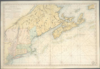
The south part of Virginia, now the north part of Carolina
0
Atlases, gazetteers, guidebooks and other books
377
Maps of the World
16
Maps of the Oceans
24
Maps of North and South America
23
Maps of North America.
551
Maps of New York City and State
1340
Lawrence H. Slaughter Collection of English maps, charts, globes, books and atlases
1020
John H. Levine Collection
60
More
Show filters
Hide filters
Show Only Public Domain
topic
x
Nautical charts
Pilot guides
5
Coasts
4
Harbors
3
Trade routes
3
More
Less
name
Des Barres, Joseph F. W. (Joseph Frederick Wallet), 1729-1824
7
Blunt, Edmund M. (Edmund March), 1770-1862
5
Blunt, G. W. (George William), 1802-1878
5
Hooker, William
5
Fisher, Joshua, 1707-1783
4
More
Less
collection
Lawrence H. Slaughter Collection of English maps, charts, globes, books and atlases
36
Maps of New York City and State
6
Maps of the Oceans
4
John H. Levine Collection
3
Atlases, gazetteers, guidebooks and other books
1
place
New York (N.Y.)
16
Atlantic Coast (North America)
15
New Jersey
14
Maps
7
New York Harbor (N.Y. and N.J.)
7
More
Less
genre
Maps
50
Nautical charts
3
Early works to 1800
1
Prints
1
publisher
Pub. by E.M. Blunt for W. Hooker
5
By Pieter Goos, op de Texelse Kay, naest de Rams-koy, in de Zee-Spiegel
2
Publish'd ... by I.F.W. Des Barres Esqr.,
2
Publish'd by J.F.W. Des Barres Esqr
2
Published ... by Andrew Dury, Duke's Court, St. Martins Lane
2
More
Less
division
Map Division
50
type
cartographic
50
still image
1
Date Range
to
50 results found for:
x
America?tab=filter
Filtering on:
x
Topic
: Nautical charts
Sort by:
Relevance
Title
Date created
Date digitized
Sequence
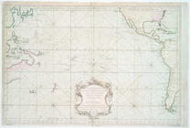
A general chart of the West I…
note:
… coast of South
America
.
A chart of the West Indies fr…
Pascaerte vande Vlaemsche, So…
Pascaerte van Westindien : de…
note:
Covers coast of North
America
as far
Chart of Long Island Sound, 1…
collection:
… of North and South
America
Entrance to New York Bay from…
collection:
… of North and South
America
Nautical chart of Little Egg …
collection:
… of North and South
America
The Bay and river of Delaware
collection:
… of North and South
America
Chart of the entrance to Ches…
collection:
… of North and South
America
West-Indische paskaert: waer …
… and
America
, likewise
note:
… Empire in
America
."…
… and
America
, likewise
note:
… Empire in
America
."…
A chart of the coast of New Y…
note:
LC Maps of North
America
, 1750-1789, 766
… States of North
America
A new and accurate chart (fro…
note:
… and harbours of North
America
A chart of the coast of
America
: from
A new generall chart for the …
note:
… coast of South
America
. …
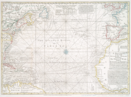
A new chart of the Atlantic o…
note:
Variant of Phillips. Maps of
America
, p. 128
Terra nova, ac maris tractus …
note:
… North
America
… and
America
A chart of the Atlantick Ocea…
note:
Covers east coast of North
America
from
Pas kaart van West Indien : b…
note:
… coast of North
America
Paskaert waer in de graden de…
collection:
… en
America
, in 't
A new chart of
America
with the harbors
A chart of Delaware Bay and R…
note:
LC Maps of North
America
, 1750-1789, 1355
A chart of Delaware Bay and R…
note:
LC Maps of North
America
, 1750-1789, 1359
A chart of Delaware Bay and R…
note:
LC Maps of North
America
, 1750-1789, 1359
Baye de la Delaware avec les …
note:
LC Maps of North
America
, 1750-1789, 1357
Carte de la baye et riviere d…
note:
LC maps of North
America
, 1750-1789, 1229
A chart of Delawar River from…
note:
LC Maps of North
America
, 1750-1789, 1369
A chart of the sea coast of N…
The coast of Nova Scotia, New…
note:
LC Maps of North
America
, 1750-1789, 205
The coast of Nova Scotia, New…
note:
… Maps of North
America
m
The provinces of New York, an…
note:
LC Maps of North
America
, 1750-1789, 1045
[A chart of New York Island &…
note:
…
America
, 1750-1789. …
A chart of New York Island & …
note:
…
America
, 1750-1789.
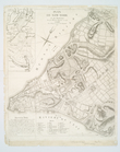
A plan of the city of New-Yor…
note:
…
America
, and Colonel
A chart of the bar of Sandy H…
note:
LC Maps of North
America
, 1750-1789, 1293
To the independent mariners of
America
Carte reduite des mers compri…
note:
Covers eastern North
America
as far
Chart and plan of the harbour…
note:
Phillips. Maps of
America
, p. 528
Plan de New-York et des envir…
note:
Phillips. Maps of
America
, p. 524
A chart of New York Harbour :…
note:
LC Maps of North
America
, 1750-1789, 1232
A chart of New York Harbour :…
note:
LC Maps of North
America
, 1750-1789, 1232
A chart of the bar of Sandy H…
note:
LC Maps of North
America
, 1750-1789, 1293
m
Map of New-York Bay and Harbo…
note:
Phillips. Maps of
America
, p. 543
… and
America
, likewise
m
Sable Island
Carte réduite des côtes orien…
note:
LC Maps of North
America
, 1750-1789, 215
… and South
America
.
note:
Covers Atlantic coast of North
America
End of results
|
Top