Click to visit the main New York Public Library Homepage
The New York Public Library
Digital Collections
About Digital Collections
Browse
Search only public domain materials
Items
Collections
Divisions
Home
Search
Browse
About
Search only public domain materials
Items
Collections
Divisions
Digital Collections
Using Images
Using Data
Collections
Charting America: Maps from the Lawrence H. Slaughter Collection and Others
Charting America: Maps from the Lawrence H. Slaughter Collection and Others
Navigation
Filters
Charting America: Maps from the Lawrence H. Slaughter Collection and Others
Previous
The south part of Virginia, now the north part of Carolina
0
Atlases, gazetteers, guidebooks and other books
377
Maps of the World
16
Maps of the Oceans
24
Maps of North and South America
23
Maps of North America.
551
Maps of New York City and State
1340
Lawrence H. Slaughter Collection of English maps, charts, globes, books and atlases
1020
John H. Levine Collection
60
More
Show filters
Hide filters
Show Only Public Domain
topic
x
Railroads
Canals
10
Maps
8
Administrative and political divisions
7
name
Disturnell, John, 1801-1877
5
Sherman & Smith
5
Smith, J. Calvin (John Calvin)
5
New York and Erie Railroad Company
3
New York & Oswego Midland Railroad
2
More
Less
collection
Maps of New York City and State
18
place
New York (State)
17
New York (N.Y.)
6
Middle Atlantic States
3
New England
3
New Jersey
2
More
Less
genre
Maps
18
publisher
H.S. Tanner
2
J. Disturnell
2
Published by J. Disturnell, 102 Broadway
2
David Burr
1
J. Disturnell,
1
More
Less
division
Map Division
18
type
cartographic
18
Date Range
to
18 results found for:
x
Middle Atlantic States?tab=filter
Filtering on:
x
Topic
: Railroads
Sort by:
Relevance
Title
Date created
Date digitized
Sequence
… : & the present
state
of the work
note:
… to Early Maps of the
Middle
Atlantic
Seaboard.
m
Map of New York exhibiting th…
note:
… to Early Maps of the
Middle
Atlantic
Seaboard.
m
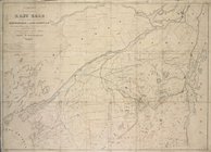
Map of the route of the propo…
note:
Shows New York
state
from Westchester
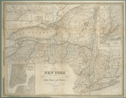
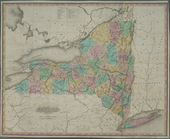
Map of the
state
of New York : showing
note:
… the New York
state
line
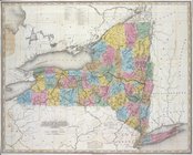
Map of the
state
of New York : showing
note:
… the New York
State
line
Map of the
state
of New York : showing
note:
… York
state
line
Map of the
state
of New York : showing
note:
… the New York
State
line
Map of the
state
of New York : showing
note:
Includes population statistics for the
state
Map shewing the rail roads be…
note:
… to Early Maps of the
Middle
Atlantic
Seaboard.
New York
note:
… to Early Maps of the
Middle
Atlantic
Seaboard.
New York
note:
… to Early Maps of the
Middle
Atlantic
Seaboard.
New York
note:
… to Early Maps of the
Middle
Atlantic
Seaboard.
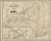
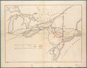
Map shewing the location of t…
note:
by Van R. Richmond,
State
Engr. & Surv.
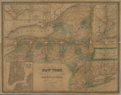
Map of the
state
of New York
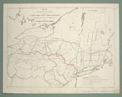
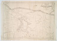
Route of the Albany & West St…
note:
… to Early Maps of the
Middle
Atlantic
Seaboard.
… of the
State
of New York
note:
… to Early Maps of the
Middle
Atlantic
Seaboard.
Map showing route of the New …
collection:
Maps of New York City and
State
m
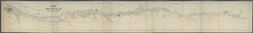
Map of the Hudson River Rail …
note:
… to Early Maps of the
Middle
Atlantic
Seaboard.
End of results
|
Top