Click to visit the main New York Public Library Homepage
The New York Public Library
Digital Collections
About Digital Collections
Browse
Search only public domain materials
Items
Collections
Divisions
Home
Search
Browse
About
Search only public domain materials
Items
Collections
Divisions
Digital Collections
Using Images
Using Data
Collections
Charting America: Maps from the Lawrence H. Slaughter Collection and Others
Charting America: Maps from the Lawrence H. Slaughter Collection and Others
Navigation
Filters
Charting America: Maps from the Lawrence H. Slaughter Collection and Others
Previous
The south part of Virginia, now the north part of Carolina
0
Atlases, gazetteers, guidebooks and other books
377
Maps of the World
16
Maps of the Oceans
24
Maps of North and South America
23
Maps of North America.
551
Maps of New York City and State
1340
Lawrence H. Slaughter Collection of English maps, charts, globes, books and atlases
1020
John H. Levine Collection
60
More
Show filters
Hide filters
Show Only Public Domain
topic
x
Railroads
Administrative and political divisions
85
Canals
46
Local transit
43
Roads
42
More
Less
name
Rand McNally and Company
22
G.W. & C.B. Colton & Co
19
Weed, Parsons & Co
12
Colton, G. Woolworth (George Woolworth), 1827-1901
10
Dripps, M. (Matthew)
10
More
Less
collection
Maps of New York City and State
264
place
New York (State)
254
New York
127
New York (N.Y.)
79
Brooklyn (New York, N.Y.)
57
Manhattan (New York, N.Y.)
49
More
Less
genre
Maps
264
Cadastral maps
17
Road maps
10
Manuscript maps
5
Tourist maps
5
More
Less
publisher
G.W. & C.B. Colton & Co
22
publisher not identified
16
The Company
13
Rand McNally & Co
8
Lain & Co
7
More
Less
division
Map Division
262
Manuscripts and Archives Division
2
type
cartographic
263
still image
1
Date Range
to
264 results found for:
x
North Hempstead (N.Y. : Town) -- Maps?tab=filter
Filtering on:
x
Topic
: Railroads
Sort by:
Relevance
Title
Date created
Date digitized
Sequence
A
map
prepared
note:
… to Early
Maps
of the Middle
m
Map
of New York exhibiting the post offices
note:
LC Railroad
maps
, 259
m
Map
of the route of the proposed New York & Erie
note:
…
maps
.
Map
of the state
note:
… to Early
Maps
of the Middle
Map
of the state
note:
… to Early
Maps
of the Middle
Map
of the state
note:
… to Early
Maps
of the Middle
Map
of the state
note:
… to Early
Maps
of the Middle
Map
of the state
note:
… to Early
Maps
of the Middle
Map
shewing
note:
… to Early
Maps
of the Middle
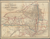
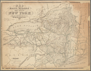
Colton's railroad & township
map
of the state
note:
… for the southern dist. of
N
. York."…
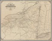
Map
of the rail-roads of the State
note:
Map
within decorative border.
Map
of New York State showing the route
note:
Waters - Son, engs.,
N.Y
.
Map
shewing the location of the
N
.
Y
note:
Map
of New York
Map
shewing the location of the
N
.
Y
note:
Mapping
the Nation (NEH grant, 2015-2018)…
Map
of the state of New York
note:
Mapping
the Nation (NEH grant, 2015-2018)…
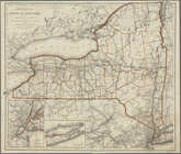
Map
of the rail roads of the state
note:
Also shows counties, principal cities and
towns
Revised
map
of the rail roads of the State
note:
Mapping
the Nation (NEH grant, 2015-2018)…
Map
of the rail roads of the State
note:
Mapping
the Nation (NEH grant, 2015-2018)…
Map
of the rail roads of the State
note:
Shows counties, principal cities and
towns
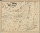
Map
of the New York state canals completed
note:
Mapping
the Nation (NEH grant, 2015-2018)…
Engineers
map
of the state of New York
note:
Map
within decorative border.
m
Map
of the rail-roads of the state
note:
Mapping
the Nation (NEH grant, 2015-2018)…
m
New
map
of the state of New York
note:
Shows counties, principal cities and
towns
m
Colton's new township railroad
map
note:
Shows counties and
towns
, completed
Colton's railroad & township
map
of the state
note:
Map
within decorative border.
Map
of New York
note:
Shows counties, principal cities and
towns
Colton's railroad & township
map
of the state
note:
Shows counties, principal cities and
towns
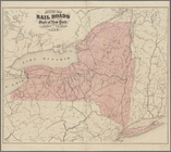
Map
of the rail-roads of the State
note:
Mapping
the Nation (NEH grant, 2015-2018)…
Map
of the state of New-York showing its
note:
Mapping
the Nation (NEH grant, 2015-2018)…
Map
of the rail-roads of the state
note:
Map
also shows lakes, canals, drainage
m
New railroad, county and township
map
note:
Colored to show county and
town
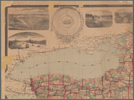
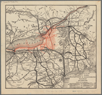
Map
of the Rome, Watertown and Ogdensburg
note:
Mapping
the Nation (NEH grant, 2015-2018)…
…, county and township
map
note:
… insets: [
Map
Map
of the state
note:
Mapping
the Nation (NEH grant, 2015-2018)…
m
Post route
map
of the State of New York
note:
Mapping
the Nation (NEH grant, 2015-2018)…
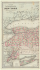
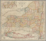
Map
of the State of New York
note:
Shows principal cities and
towns
Map
showing the position of the Albany
note:
Mapping
the Nation (NEH grant, 2015-2018)…
Map
of the state
note:
Mapping
the Nation (NEH grant, 2015-2018)…
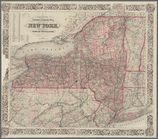
Map
of the State of New York
note:
Shows principal cities and
towns
Map
of the State of New-York
note:
Mapping
the Nation (NEH grant, 2015-2018)…
Mitchell's county and township
map
of the state
note:
title engd. by W.Williams,
map
engraver
Map
of the rail roads of the state
note:
Also shows counties, principal cities and
towns
Map
of the rail roads of the state
note:
Also shows counties, principal cities and
towns
Railroad
map
of the State of New York
note:
… Warren St., New York,
N.Y
.
Revised
map
of the rail roads of the State
note:
Shows counties, principal cities and
towns
Revised
map
of the rail roads of the State
note:
Mapping
the Nation (NEH grant, 2015-2018)…
Map
of the rail roads and canals
note:
Also shows counties, principal cities and
towns
Map
of the rail roads of the State
note:
Mapping
the Nation (NEH grant, 2015-2018)…
Map
of the railroads of the State
note:
Mapping
the Nation (NEH grant, 2015-2018)…
Map
no. I, New Netherland
note:
…"
Map
no. I."…
1
2
Previous
Next
1
2
Previous
Next