Click to visit the main New York Public Library Homepage
The New York Public Library
Digital Collections
About Digital Collections
Browse
Search only public domain materials
Items
Collections
Divisions
Home
Search
Browse
About
Search only public domain materials
Items
Collections
Divisions
Digital Collections
Using Images
Using Data
Collections
Charting America: Maps from the Lawrence H. Slaughter Collection and Others
Charting America: Maps from the Lawrence H. Slaughter Collection and Others
Navigation
Filters
Charting America: Maps from the Lawrence H. Slaughter Collection and Others
Previous
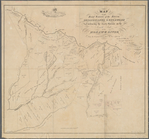
The south part of Virginia, now the north part of Carolina
0
Atlases, gazetteers, guidebooks and other books
377
Maps of the World
16
Maps of the Oceans
24
Maps of North and South America
23
Maps of North America.
551
Maps of New York City and State
1340
Lawrence H. Slaughter Collection of English maps, charts, globes, books and atlases
1020
John H. Levine Collection
60
More
Show filters
Hide filters
Show Only Public Domain
topic
x
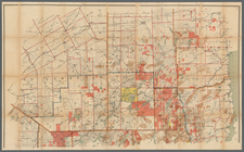
Real property
Landowners
162
Administrative and political divisions
49
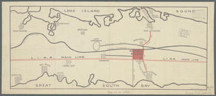
Railroads
23
Estate
16
More
Less
name
Dripps, M. (Matthew)
20
Miller & Co
16
Smith, Robert Pearsall, 1827-1898
16
Welcke, Robert A
11
J.B. Beers & Co
7
More
Less
collection
Maps of New York City and State
296
Lawrence H. Slaughter Collection of English maps, charts, globes, books and atlases
2
Atlases, gazetteers, guidebooks and other books
1
place
New York (State)
294
New York
116
New York (N.Y.)
55
Brooklyn (New York, N.Y.)
46
Manhattan (New York, N.Y.)
24
More
Less
genre
Maps
299
Cadastral maps
160
Manuscript maps
23
Aerial views
3
Facsimiles
3
More
Less
publisher
publisher not identified
36
M. Dripps
15
s.n
10
publisher unknown
8
J.B. Beers & Co
7
More
Less
division
Map Division
299
type
cartographic
296
still image
7
text
2
Date Range
to
299 results found for:
x
New York (N.Y.)?tab=filter
Filtering on:
x
Topic
: Real property
Sort by:
Relevance
Title
Date created
Date digitized
Sequence
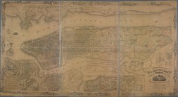
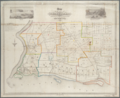
Map of the province of
New
York
as divided
use:
… partner (e.g.,
New
York
… in the chancery of
New
-Jersey
use:
… partner (e.g.,
New
York
… of
New
York
in North
use:
… partner (e.g.,
New
York
… of
New
York
in North
use:
… partner (e.g.,
New
York
… of
New
York
use:
… partner (e.g.,
New
York
Plan of the city of Washingto…
use:
… partner (e.g.,
New
York
m
Topographical map of
New
York
City, County
use:
… partner (e.g.,
New
York
A map of the Manor Renselaerw…
use:
… partner (e.g.,
New
York
… of Erie,
N
.
Y
use:
… partner (e.g.,
New
York
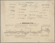
Map of Rensselaers Wyck, anno…
use:
… partner (e.g.,
New
York
… Scottsville,
N
.
Y
. as the road was opened to Leroy,
N
.
Y
use:
… partner (e.g.,
New
York
m
Map of the Adirondack Forest …
use:
… partner (e.g.,
New
York
… of northern
New
York
use:
… partner (e.g.,
New
York
Map of French & English grant…
use:
… partner (e.g.,
New
York
Map showing the Adirondack La…
use:
… partner (e.g.,
New
York
Map of Hamilton, St. Lawrence…
use:
… partner (e.g.,
New
York
Map of Hamilton, St. Lawrence…
use:
… partner (e.g.,
New
York
Map of the head waters of the…
use:
… partner (e.g.,
New
York
Map of the head waters of the…
use:
… partner (e.g.,
New
York
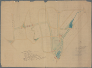
Map of Shelter Island showin…
use:
… partner (e.g.,
New
York
… of
New
York
called Macomb
use:
… partner (e.g.,
New
York
… and Chautaqua counties,
New
York
use:
… partner (e.g.,
New
York
A map of part of the land in …
use:
… partner (e.g.,
New
York
Map of Dobbs Ferry and Hastin…
use:
… partner (e.g.,
New
York
m
…, Suffolk Co.,
N
.
Y
.
use:
… partner (e.g.,
New
York
…, Westchester,
N
.
Y
.
use:
… partner (e.g.,
New
York
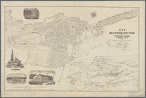
Map of Westminster Park of th…
use:
… partner (e.g.,
New
York
… County,
N
.
Y
.
use:
… partner (e.g.,
New
York
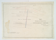
Map showing land required for…
use:
… partner (e.g.,
New
York
m
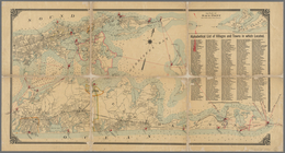
Map of Long Island: based upo…
use:
… partner (e.g.,
New
York
m
Map of Long Island: based upo…
use:
… partner (e.g.,
New
York
A plott of ye situations of t…
use:
… partner (e.g.,
New
York
Map of Long Island: showing t…
use:
… partner (e.g.,
New
York
Map of the River Niagara and …
use:
… partner (e.g.,
New
York
Map of the town of Niagara
use:
… partner (e.g.,
New
York
Map of the vicinity of Niagar…
use:
… partner (e.g.,
New
York
m
…, Long Island,
N
.
Y
.
use:
… partner (e.g.,
New
York
m
New
map of St. Lawrence County,
N
.
Y
use:
… partner (e.g.,
New
York
… County,
New
York
use:
… partner (e.g.,
New
York
m
… County,
N
.
Y
use:
… partner (e.g.,
New
York
m
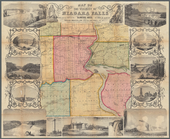
Map of Albany County,
New
York
use:
… partner (e.g.,
New
York
m
Map of Cayuga and Seneca Counties,
New
York
use:
… partner (e.g.,
New
York
m
Map of Dutchess Co.,
New
York
use:
… partner (e.g.,
New
York
Map of Broome County,
New
York
use:
… partner (e.g.,
New
York
Map of Chenango County,
New
York
use:
… partner (e.g.,
New
York
m
Map of Clinton Co.,
New
York
use:
… partner (e.g.,
New
York
Map of Erie County,
New
York
use:
… partner (e.g.,
New
York
Onondaga County & adjacent te…
use:
… partner (e.g.,
New
York
Map of Oswego County,
New
York
use:
… partner (e.g.,
New
York
m
Map of the highlands of the H…
use:
… partner (e.g.,
New
York
1
2
Previous
Next
1
2
Previous
Next