Click to visit the main New York Public Library Homepage
The New York Public Library
Digital Collections
About Digital Collections
Browse
Search only public domain materials
Items
Collections
Divisions
Home
Search
Browse
About
Search only public domain materials
Items
Collections
Divisions
Digital Collections
Using Images
Using Data
Collections
Charting America: Maps from the Lawrence H. Slaughter Collection and Others
Charting America: Maps from the Lawrence H. Slaughter Collection and Others
Navigation
Filters
Charting America: Maps from the Lawrence H. Slaughter Collection and Others
Previous
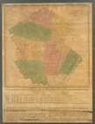
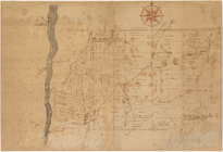
The south part of Virginia, now the north part of Carolina
0
Atlases, gazetteers, guidebooks and other books
377
Maps of the World
16
Maps of the Oceans
24
Maps of North and South America
23
Maps of North America.
551
Maps of New York City and State
1340
Lawrence H. Slaughter Collection of English maps, charts, globes, books and atlases
1020
John H. Levine Collection
60
More
Show filters
Hide filters
Show Only Public Domain
topic
Administrative and political divisions
282
Railroads
264
Real property
249
Landowners
181
City planning
102
More
Less
name
New York (N.Y.). Common Council
85
Mitchell, S. Augustus (Samuel Augustus), 1792-1868
49
Wells, Edward, 1667-1727
41
Moll, Herman, -1732
40
Dripps, M. (Matthew)
39
More
Less
collection
Maps of New York City and State
1370
Lawrence H. Slaughter Collection of English maps, charts, globes, books and atlases
221
Atlases, gazetteers, guidebooks and other books
73
John H. Levine Collection
11
Maps of the World
5
More
Less
place
New York (State)
922
New York (N.Y.)
454
New York
358
Manhattan (New York, N.Y.)
244
Brooklyn (New York, N.Y.)
205
More
Less
genre
Maps
1673
Cadastral maps
151
Manuscript maps
52
Topographic maps
24
Road maps
23
More
Less
publisher
publisher not identified
72
S. A. Mitchell, jr
42
Printed at the Theater,
38
G.W. & C.B. Colton & Co
33
... Sold ... by Tho. Bowles, print and map-seller in St. Paul's-Churchyard
28
More
Less
division
Map Division
1684
Manuscripts and Archives Division
2
type
cartographic
1666
text
19
still image
13
Date Range
to
1,686 results found for:
Greenburgh (N.Y. : Town) -- Maps?tab=filter
Sort by:
Relevance
Title
Date created
Date digitized
Sequence
Results 501 - 550
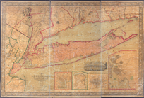
m
Map
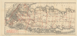
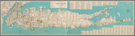
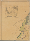
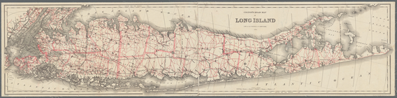
of Long Island with the environs of New-York
note:
… to Early
Maps
of the Middle
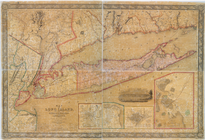
m
Map
of Long Island with the environs of New-York
note:
… to Early
Maps
of the Middle
m
Military
map
of Cuba
note:
… and
towns
of Cuba at scale
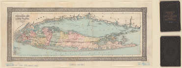
Traveller's
map
of Long Island.
note:
… to Early
Maps
of the Middle
m
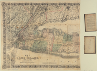
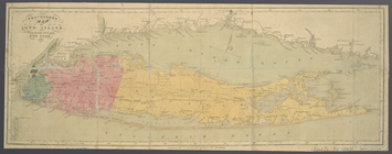
Map
of Long Island and the southern part
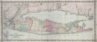
m
Map
of Long Island
note:
…, Brooklyn,
N.Y
."…
m
Map
of Long Island
note:
…. Fulton St., Brooklyn,
N.Y
m
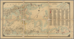
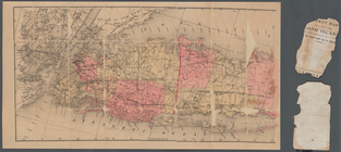
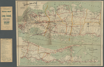
Colton's road
map
of Long Island
note:
Shows roads, railroads, cities and
towns
Map
of Long Island
note:
…., Brooklyn,
N.Y
."…
Map
of Long Island
note:
… Vesey St.
N.Y
."…
m
Colton's new
map
of Long Island
note:
Mapping
the Nation (NEH grant, 2015-2018)…
A plott of ye situations of the
towns
note:
…. Albany,
N.Y
. 1883.
m
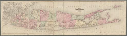
Map
of Long Island
note:
Shows counties, cities and
towns
, roads
Map
of Long Island
note:
….,
N.Y
.
Colton's road
map
of Long Island
note:
Shows roads, railroads, cities and
towns
Travellers
map
of Long Island
note:
Map
within decorative border.
m
Map
of Long Island and the southern part
note:
Map
within decorative border.
m
Map
of Long Island and adjacent areas
note:
Facsimile of a manuscript
map
.
m
Hagstom's
map
of Long Island New York
note:
…ʹ/
N
41°11ʹ--
N
40°32ʹ).
m
Hagstrom's
map
of Long Island New York …
note:
…"
Map
No. 2520A." Includes indexes.
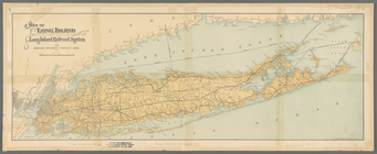
Map
of Long Island showing the Long Island
Map
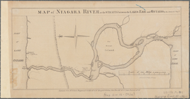
of part of Niagara River
note:
… to Early
Maps
of the Middle
Map
of Niagara River or the straits
note:
Mapping
the Nation (NEH grant, 2015-2018)…
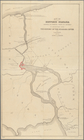
Map
of historic Niagara
note:
Predominantly uncolored
map
with shore
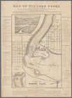
Map
of Niagara Falls, and guide table
note:
Mapping
the Nation (NEH grant, 2015-2018)…
Map
of the River Niagara and vicinity
note:
Mapping
the Nation (NEH grant, 2015-2018)…
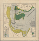
Map
of New York State reservation
note:
Includes 2 inset
maps
: [Niagara Falls
Map
of Niagara Falls, suspension bridge
note:
Mapping
the Nation (NEH grant, 2015-2018)…
Map
of the
town
of Niagara
note:
… of Niagara Falls (
N.Y
.).
Map
of the vicinity of Niagara Falls
note:
…, and Cayuga Counties,
N.Y
. &c."…
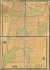
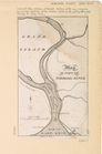
A
map
of the British Empire in America …
note:
… -- Charles
Town
-- Bermuda
m
Map
of Dutchess County, New-York from
note:
… to Early
Maps
of the Middle
Map
of the county of Sullivan
note:
At head of the
map
: No. 10.
Map
of the county of Westchester
note:
… to Early
Maps
of the Middle
m
…, Long Island,
N
.
Y
.
note:
Cadastral
map
showing property owners
Allegany Co.,
N
.
Y
. to accompany Child's Gazetteer
note:
Mapping
the Nation (NEH grant, 2015-2018)…
m
New
map
of St. Lawrence County,
N
.
Y
note:
Mapping
the Nation (NEH grant, 2015-2018)…
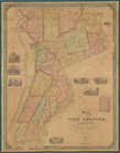
Map
of West Chester County, New York
note:
Mapping
the Nation (NEH grant, 2015-2018)…
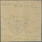
Untitled manuscript
map
of Great Nine
note:
… 74°02ʹ47ʺ--W 73°27ʹ44ʺ/
N
41°56ʹ59ʺ--
N
41°24ʹ47ʺ)…
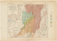
Preliminary geologic
map
of Albany
note:
…, State Geologist ;
N
Geologic
map
of parts of Beekman
note:
Map
shows roads, railroads and
town
lines.
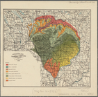
Geological
map
of a part of Chenango
note:
Mapping
the Nation (NEH grant, 2015-2018)…
Geological
map
of Onondaga County
note:
Mapping
the Nation (NEH grant, 2015-2018)…
m
Map
of the
town
note:
Cadastral
map
.
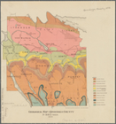
Geologic
map
of Orange County,
N
.
Y
.
note:
Mapping
the Nation (NEH grant, 2015-2018)…
m
Map
of Albany County, New York
note:
by Jay Gould, Roxbury
N.Y
. and I.B
m
Map
of Cayuga and Seneca Counties, New York
note:
… county
map
showing
towns
(townships), numbered
town
m
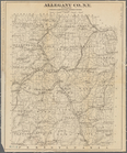
Map
of Allegany Co.,
N
.
Y
.
note:
LC copy hand colored to emphasize
town
m
Map
of Ontario County, New York
note:
by S.
N
. Beers, assisted by D.G. Beers.
m
Map
of Dutchess Co., New York
note:
Mapping
the Nation (NEH grant, 2015-2018)…
1
2
3
4
5
6
7
Previous
Next
1
2
3
4
5
6
7
Previous
Next