Click to visit the main New York Public Library Homepage
The New York Public Library
Digital Collections
About Digital Collections
Browse
Search only public domain materials
Items
Collections
Divisions
Home
Search
Browse
About
Search only public domain materials
Items
Collections
Divisions
Digital Collections
Using Images
Using Data
Collections
Charting America: Maps from the Lawrence H. Slaughter Collection and Others
Charting America: Maps from the Lawrence H. Slaughter Collection and Others
Navigation
Filters
Charting America: Maps from the Lawrence H. Slaughter Collection and Others
Previous
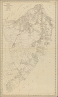
The south part of Virginia, now the north part of Carolina
0
Atlases, gazetteers, guidebooks and other books
377
Maps of the World
16
Maps of the Oceans
24
Maps of North and South America
23
Maps of North America.
551
Maps of New York City and State
1340
Lawrence H. Slaughter Collection of English maps, charts, globes, books and atlases
1020
John H. Levine Collection
60
More
Show filters
Hide filters
Show Only Public Domain
topic
Administrative and political divisions
280
Railroads
268
Real property
243
Landowners
175
City planning
107
More
Less
name
New York (N.Y.). Common Council
83
Mitchell, S. Augustus (Samuel Augustus), 1792-1868
48
Moll, Herman, -1732
40
Wells, Edward, 1667-1727
40
Dripps, M. (Matthew)
39
More
Less
collection
Maps of New York City and State
1389
Lawrence H. Slaughter Collection of English maps, charts, globes, books and atlases
216
Atlases, gazetteers, guidebooks and other books
74
John H. Levine Collection
10
Maps of the World
5
More
Less
place
New York (State)
936
New York (N.Y.)
458
New York
363
Manhattan (New York, N.Y.)
249
Brooklyn (New York, N.Y.)
201
More
Less
genre
Maps
1687
Cadastral maps
148
Manuscript maps
53
Topographic maps
24
Road maps
23
More
Less
publisher
publisher not identified
72
S. A. Mitchell, jr
42
Printed at the Theater,
37
G.W. & C.B. Colton & Co
33
... Sold ... by Tho. Bowles, print and map-seller in St. Paul's-Churchyard
28
More
Less
division
Map Division
1698
Manuscripts and Archives Division
2
type
cartographic
1682
text
18
still image
16
Date Range
to
1,700 results found for:
Niagara Canal (N.Y. : Proposed) -- Maps?tab=filter
Sort by:
Relevance
Title
Date created
Date digitized
Sequence
Results 1501 - 1550
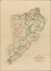
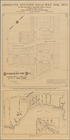
Map
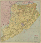
of a Richmond Borough Park System
m
New Standard
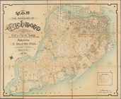
Map
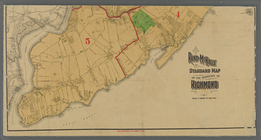
of the Borough of Richmond
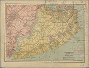
Map
of the Borough of Richmond, City of New York
Map
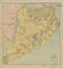
of Richmond Borough
Map
of the Borough of Richmond. Supplement
Map
of the Borough of Richmond
…
map
of Staten Island,
N
.
Y
., Borough
collection:
…
map
of Staten Island,
N.Y
., Borough
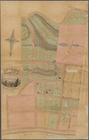
Map
of property at New Brighton, Staten
note:
Scale not given (W 74°05ʹ35ʺ/
N
40°38ʹ32ʺ)…
… Island,
N
.
Y
note:
…., West New Brighton,
N.Y
."…
Map
of borough of Richmond …
note:
… by Williams
Map
& Guide Co.,
N.Y
."…
Track
map
of the trolley lines of Staten
note:
…"
Map
compiled by Melvin Rosenberg, based
Map
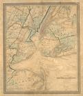
of New-York and its vicinity
note:
… to Early
Maps
of the Middle
m
Map
of New-York Bay and Harbor and the environs
note:
… to Early
Maps
of the Middle
m
Map
of New-York Bay and Harbor and the environs
note:
… to Early
Maps
of the Middle
Map
of New-York Bay and Harbor and the environs
note:
… to Early
Maps
of the Middle
Map
of New-York Bay and Harbor and the environs
note:
… to Early
Maps
of the Middle
Map
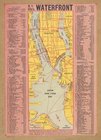
of the Harbor of New York
Outline
map
of New York Harbor & vicinity
note:
…." Red numbers on
map
N
.
Y
. City's waterfront.
collection:
N.Y
. City's waterfront.
Map
of the port & vicinity of New York
note:
… 74°14ʹ16ʺ--W 73°52ʹ26ʺ/
N
40°47ʹ08ʺ--
N
40°31ʹ29ʺ).
Asher & Adams'
map
image:
psnypl_
map
_292
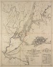
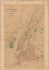
Map
of the cities of New York, Brooklyn
abstract:
… 73°53ʹ26ʺ/
N
40°53ʹ05ʺ--
N
m
Map
of the City of New York and its
abstract:
…ʹ--W 73°42ʹ/
N
40°56ʹ--
N
m
Map
of the five cities of New York
note:
NYPL
Map
Division
m
Higginson's
map
of New York and vicinity
abstract:
… 73°39ʹ18ʺ/
N
41°07ʹ08ʺ--
N
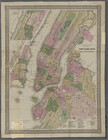
G. Woolworth Colton's new
map
of New York
note:
NYPL
Map
Div. copy has accession no
G. Woolworth Colton's new
map
of New York
note:
NYPL
Map
Div. copy has accession no
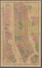
Map
of New York and vicinity
m
…
map
of the Great
m
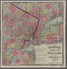
Map
of the country thirty-three miles around
Rand Mc Nally & Co.'s road
map
Pocket
map
of greater New York ;
Map
abstract:
…
map
shows radial
m
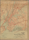
Road
Map
of the country around New York
Map
of greater New
New Indexed
Map
of the vicinity of New York City.
[
Map
of] Friends' in the vicinity of New York.
m
[3
maps
of New York and vicinity showing the system
Map
of the City
Map
of New York
[Three
maps
on one
…, Long Island,
N
.
Y
note:
Cadastral
map
showing property owners
Map
of a preliminary survey
note:
… and Queens,
N.Y
.
Map
of the country thirty three miles around
note:
…. Atwood,
N.Y
.
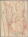
Map
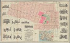
of Garden City, Queens Co., Long Island
note:
Map
shows blocks and lots numbers, lake
m
Map
of Long Island and the southern part
note:
…, railroads,
canal
, mills
m
New
map
of Kings and Queens counties, New York
note:
Mapping
the Nation (NEH grant, 2015-2018)…
m
…, Long Island
N
.
Y
.
note:
Mapping
the Nation (NEH grant, 2015-2018)…
m
Map
of upper New York City and adjacent
note:
Shows railroads, opened and
proposed
Topographical
map
of New York City, County
note:
Mapping
the Nation (NEH grant, 2015-2018)…
m
Watson's new
map
of New York, Brooklyn
note:
… 74°03ʹ13ʺ--W 73°57ʹ36ʺ/
N
40°48ʹ07ʺ--
N
40°38ʹ54ʺ)…
1
2
3
4
5
6
7
Previous
Next
1
2
3
4
5
6
7
Previous
Next