Click to visit the main New York Public Library Homepage
The New York Public Library
Digital Collections
About Digital Collections
Browse
Search only public domain materials
Items
Collections
Divisions
Home
Search
Browse
About
Search only public domain materials
Items
Collections
Divisions
Digital Collections
Using Images
Using Data
Collections
Charting America: Maps from the Lawrence H. Slaughter Collection and Others
Charting America: Maps from the Lawrence H. Slaughter Collection and Others
Navigation
Filters
Charting America: Maps from the Lawrence H. Slaughter Collection and Others
Previous
The south part of Virginia, now the north part of Carolina
0
Atlases, gazetteers, guidebooks and other books
377
Maps of the World
16
Maps of the Oceans
24
Maps of North and South America
23
Maps of North America.
551
Maps of New York City and State
1340
Lawrence H. Slaughter Collection of English maps, charts, globes, books and atlases
1020
John H. Levine Collection
60
More
Show filters
Hide filters
Show Only Public Domain
topic
Administrative and political divisions
282
Railroads
264
Real property
249
Landowners
182
City planning
105
More
Less
name
New York (N.Y.). Common Council
87
Mitchell, S. Augustus (Samuel Augustus), 1792-1868
49
Moll, Herman, -1732
41
Wells, Edward, 1667-1727
41
Dripps, M. (Matthew)
39
More
Less
collection
Maps of New York City and State
1385
Lawrence H. Slaughter Collection of English maps, charts, globes, books and atlases
262
Atlases, gazetteers, guidebooks and other books
85
John H. Levine Collection
13
Maps of the World
5
More
Less
place
New York (State)
930
New York (N.Y.)
464
New York
362
Manhattan (New York, N.Y.)
252
Brooklyn (New York, N.Y.)
206
More
Less
genre
Maps
1744
Cadastral maps
151
Manuscript maps
52
Topographic maps
24
Road maps
23
More
Less
publisher
publisher not identified
72
S. A. Mitchell, jr
42
Printed at the Theater,
38
G.W. & C.B. Colton & Co
33
s.n
30
More
Less
division
Map Division
1755
Manuscripts and Archives Division
2
type
cartographic
1736
text
26
still image
14
Date Range
to
1,758 results found for:
North Hempstead (N.Y. : Town) -- Maps?tab=filter
Sort by:
Relevance
Title
Date created
Date digitized
Sequence
Results 1001 - 1050
Rand McNally
Map
of Brooklyn
note:
Map
index is found
Map
of the borough of Brooklyn, City of New York
m
Map
of the borough of Brooklyn, New York …
Map
showing proposed extension
note:
Oriented with
north
toward lower left corner.
Map
of the borough of Brooklyn …
note:
Oriented with
north
at upper left corner.
Bush Terminal,
map
showing business section
note:
Oriented with
north
at upper left corner.
Map
of 272 lots in the 30th wards, borough
m
Map
of the borough of Brooklyn, City of New York …
note:
Oriented with
north
at upper left corner.
Map
of the borough of Brooklyn, City of New York, …
Map
of the borough of Brooklyn, New York …
note:
Oriented with
north
at upper left corner.
Guide
map
to the Brooklyn and Queens parks
note:
Oriented with
north
at upper right corner.
Hammond's handy reference
map
of Brooklyn
Brooklyn, from Rand McNally metropolitan
map
note:
…, and
N
.J.
Map
of property New York Dock Company
note:
Oriented with
north
at lower left corner.
Williams'
map
of Borough of Brooklyn …
note:
by Wilaims
Map
& Guide co.
m
The Blanchard Press correctly indexed
map
note:
On verso: Index, and ancillary
Map
of New York
Map
of Flatbush Meadows …
note:
Oriented with
north
at upper right corner.
m
Petersen's
map
of Brooklyn
note:
Oriented with
north
at upper left corner.
m
Map
of Brooklyn
Map
of lots belonging to the Bay Ridge
m
Map
of property belonging to Milton S
m
Map
of the borough of Brooklyn, New York …
note:
… 73°51ʹ17ʺ/
N
40°45ʹ04ʺ--
N
Map
of the borough of Brooklyn, 1902
note:
Oriented with
north
at upper right.
Hammond's handy reference
map
of Brooklyn
Map
of the borough of Brooklyn, City of New York …
note:
Oriented with
north
at upper left corner.
m
Hammond's complete
map
of Brooklyn …
The Albemarle Hotel
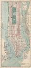
map
of Manhattan, New
image:
psnypl_
map
_295
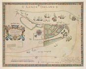
A description of the
Towne
of Mannados or New
note:
Originally published:
N.Y
. : Geo
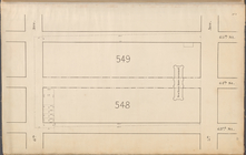
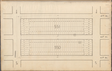
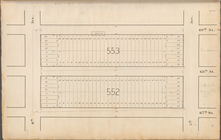
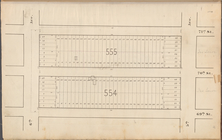
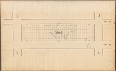
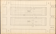
Central Park Planning
Map
No. 3: Bounded
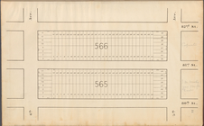
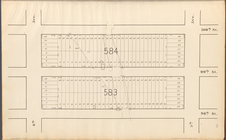
Central Park Planning
Map
No. 6: Bounded
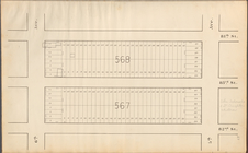
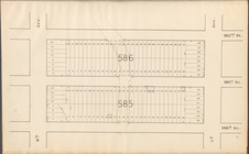
Central Park Planning
Map
No. 9: Bounded
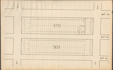
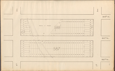
Central Park Planning
Map
No. 12
Central Park Planning
Map
No. 15
Central Park Planning
Map
No. 18
Central Park Planning
Map
No. 21
Central Park Planning
Map
No. 24
Central Park Planning
Map
No. 27
Central Park Planning
Map
No. 30
Central Park Planning
Map
: Bounded
collection:
Central Park Planning
Map
: Bounded by 80
Central Park Planning
Map
: Bounded
collection:
Central Park Planning
Map
: Bounded by 82
Central Park Planning
Map
: Bounded
collection:
Central Park Planning
Map
: Bounded by 84
Central Park Planning
Map
: Bounded
collection:
Central Park Planning
Map
: Bounded by 86
Central Park Planning
Map
: Bounded
collection:
Central Park Planning
Map
: Bounded by 98
Central Park Planning
Map
: Bounded
Central Park Planning
Map
: Bounded
Central Park Planning
Map
: Bounded
Central Park Planning
Map
: Bounded
Central Park Planning
Map
No. 5: Bounded
Central Park Planning
Map
No. 2: Bounded
Central Park Planning
Map
: Bounded
collection:
Central Park Planning
Map
: Bounded by 91
1
2
3
4
5
6
7
8
Previous
Next
1
2
3
4
5
6
7
8
Previous
Next