Click to visit the main New York Public Library Homepage
The New York Public Library
Digital Collections
About Digital Collections
Browse
Search only public domain materials
Items
Collections
Divisions
Home
Search
Browse
About
Search only public domain materials
Items
Collections
Divisions
Digital Collections
Using Images
Using Data
Collections
Charting America: Maps from the Lawrence H. Slaughter Collection and Others
Charting America: Maps from the Lawrence H. Slaughter Collection and Others
Navigation
Filters
Charting America: Maps from the Lawrence H. Slaughter Collection and Others
Previous
The south part of Virginia, now the north part of Carolina
0
Atlases, gazetteers, guidebooks and other books
377
Maps of the World
16
Maps of the Oceans
24
Maps of North and South America
23
Maps of North America.
551
Maps of New York City and State
1340
Lawrence H. Slaughter Collection of English maps, charts, globes, books and atlases
1020
John H. Levine Collection
60
More
Show filters
Hide filters
Show Only Public Domain
topic
Administrative and political divisions
282
Railroads
264
Real property
249
Landowners
182
City planning
105
More
Less
name
New York (N.Y.). Common Council
87
Mitchell, S. Augustus (Samuel Augustus), 1792-1868
49
Moll, Herman, -1732
41
Wells, Edward, 1667-1727
41
Dripps, M. (Matthew)
39
More
Less
collection
Maps of New York City and State
1385
Lawrence H. Slaughter Collection of English maps, charts, globes, books and atlases
262
Atlases, gazetteers, guidebooks and other books
85
John H. Levine Collection
13
Maps of the World
5
More
Less
place
New York (State)
930
New York (N.Y.)
464
New York
362
Manhattan (New York, N.Y.)
252
Brooklyn (New York, N.Y.)
206
More
Less
genre
Maps
1744
Cadastral maps
151
Manuscript maps
52
Topographic maps
24
Road maps
23
More
Less
publisher
publisher not identified
72
S. A. Mitchell, jr
42
Printed at the Theater,
38
G.W. & C.B. Colton & Co
33
s.n
30
More
Less
division
Map Division
1755
Manuscripts and Archives Division
2
type
cartographic
1736
text
26
still image
14
Date Range
to
1,758 results found for:
North Hempstead (N.Y. : Town) -- Maps?tab=filter
Sort by:
Relevance
Title
Date created
Date digitized
Sequence
Results 1001 - 1050
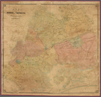
…, Long Island,
N
.
Y
note:
Cadastral
map
showing property owners
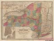
Map
of the state
note:
Mapping
the Nation (NEH grant, 2015-2018)…
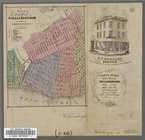
Map
of the City of Williamsburg with part
m
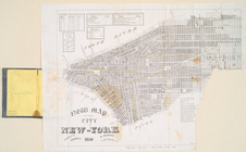
Map
of the City of New York
abstract:
…, New York (
N.Y
.) south
Map
of the city of New York, shewing
note:
[New York,
N.Y
.] : Lith. by Geo. Hayward
m
Map
of the village of Astoria, Queens Co. L.I.
note:
… catalog of the
Map
Map
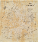
of Newtown, Long Island
note:
… catalog of the
Map
m
Map
of the state of New-York
note:
Mapping
the Nation (NEH grant, 2015-2018)…
m
Map
of the city of Williamsburgh and
town
abstract:
…. Oriented with
north
m
Map
of Oswego, Oswego Co.,
N
.
Y
., 1851
note:
Oriented with
north
toward the upper right.
Map
of French & English grants on Lake
note:
Mapping
the Nation (NEH grant, 2015-2018)…
Map
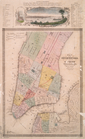
of the City of New York with part
Map
of the City of New York, 1851
note:
…ʹ54ʺ/
N
40°42ʹ01ʺ--
N
m
Map
of the vicinity of Albany and Troy
note:
Shows counties, principal cities and
towns
Map
of West Chester County, New York
note:
Mapping
the Nation (NEH grant, 2015-2018)…
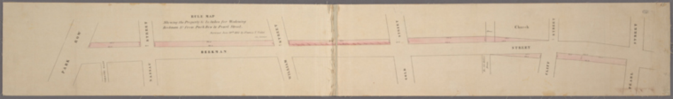
Rule
map
showing the property to be taken
m
Map
of that part
… of Ogdensburgh,
N
.
Y
.
note:
Cadastral
map
showing lot numbers
Map
of the Cities of Brooklyn and Williamsburg
note:
Contains also small
map
of vicinity of New
Map
of the State
note:
…. Hayward, 120 Water St.
N.Y
.
Map
of the City of New York
abstract:
…, New York (
N.Y
.) south
Map
of Saratoga Springs, Saratoga Co., New
note:
… 73°47ʹ04ʺ/
N
43°04ʹ59ʺ)…
Map
of the "Hunter Fly Farm" in the 9th
abstract:
… the western edge of the
map
Map
of valuable property situated
note:
… to Early
Maps
of the Middle
Map
of 465 valuable building lots
note:
… to Early
Maps
of the Middle
Map
of the City of New-York with part
note:
At the lower right corner of the
map
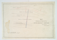
Map
showing land required for Croton
note:
… Croton Aqueduct and
N.Y
Map
of the village of Hermannville,
Town
of Islip
note:
Inset:
Map
of Long Island, 1850.
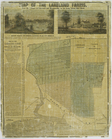
Map
of the Lakeland farms, near the villages
note:
… of Fulton St.,
N.Y
., where a
map
of the farms
New
map
of the city of New York.
note:
… to Early
Maps
of the Middle
Map
of the country thirty three miles around
note:
…. Atwood,
N.Y
.
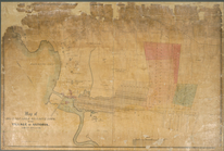
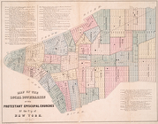
Map
of the local boundaries of the Protestant
note:
… to Early
Maps
of the Middle
Map
of the City of New-York with part
note:
… to Early
Maps
of the Middle
Map
of the city of New York.
note:
… to Early
Maps
of the Middle
Map
of the city of New York, 1850
note:
… to Early
Maps
of the Middle
Map
of wharves and piers on
North
River
note:
… to Early
Maps
of the Middle
Map
of the city of New York
note:
… Beekman St.,
N.Y
.
Map
of the state
note:
… to Early
Maps
of the Middle
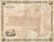
Map
of the state of New York : compiled
note:
… -- Vicinity of New York --
Map
Map
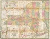
of the state of New York
note:
… to Early
Maps
of the Middle
m
Map
of Dutchess County, New-York from
note:
… to Early
Maps
of the Middle
Chart shewing the tracks across the
North
note:
… to Early
Maps
of the Middle
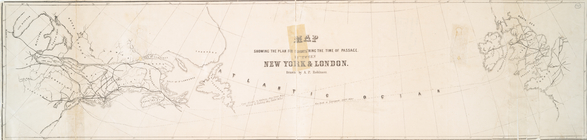
Map
showing the plan for shortening
note:
… to Early
Maps
of the Middle
Map
of the state of New York : compiled
note:
… -- Vicinity of New York --
Map
Map
of the city of New York : prepared
note:
… to Early
Maps
of the Middle
… at the Merchants' Excha[nge,
N
.]
Y
.,…
collection:
… at the Merchants' Excha[nge,
N.]Y
.,…
A
map
of the
towns
of Livingston, Germantown
note:
… regional
map
of 3
towns
(townships) in
N.Y
. State
Map
of the tertiary of Essex Co. …
note:
… catalog of the
Map
m
Map
of Geneva, Ontario Co.,
N
.
Y
.
note:
Mapping
the Nation (NEH grant, 2015-2018)…
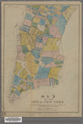
Map
of Seneca County, New York
note:
General-content county
map
showing
towns
1
2
3
4
5
6
7
8
Previous
Next
1
2
3
4
5
6
7
8
Previous
Next