Click to visit the main New York Public Library Homepage
The New York Public Library
Digital Collections
About Digital Collections
Browse
Search only public domain materials
Items
Collections
Divisions
Home
Search
Browse
About
Search only public domain materials
Items
Collections
Divisions
Digital Collections
Using Images
Using Data
Collections
Charting America: Maps from the Lawrence H. Slaughter Collection and Others
Charting America: Maps from the Lawrence H. Slaughter Collection and Others
Navigation
Filters
Charting America: Maps from the Lawrence H. Slaughter Collection and Others
Previous
The south part of Virginia, now the north part of Carolina
0
Atlases, gazetteers, guidebooks and other books
377
Maps of the World
16
Maps of the Oceans
24
Maps of North and South America
23
Maps of North America.
551
Maps of New York City and State
1340
Lawrence H. Slaughter Collection of English maps, charts, globes, books and atlases
1020
John H. Levine Collection
60
More
Show filters
Hide filters
Show Only Public Domain
topic
Administrative and political divisions
282
Railroads
264
Real property
249
Landowners
182
City planning
105
More
Less
name
New York (N.Y.). Common Council
87
Mitchell, S. Augustus (Samuel Augustus), 1792-1868
49
Moll, Herman, -1732
41
Wells, Edward, 1667-1727
41
Dripps, M. (Matthew)
39
More
Less
collection
Maps of New York City and State
1385
Lawrence H. Slaughter Collection of English maps, charts, globes, books and atlases
262
Atlases, gazetteers, guidebooks and other books
85
John H. Levine Collection
13
Maps of the World
5
More
Less
place
New York (State)
930
New York (N.Y.)
464
New York
362
Manhattan (New York, N.Y.)
252
Brooklyn (New York, N.Y.)
206
More
Less
genre
Maps
1744
Cadastral maps
151
Manuscript maps
52
Topographic maps
24
Road maps
23
More
Less
publisher
publisher not identified
72
S. A. Mitchell, jr
42
Printed at the Theater,
38
G.W. & C.B. Colton & Co
33
s.n
30
More
Less
division
Map Division
1755
Manuscripts and Archives Division
2
type
cartographic
1736
text
26
still image
14
Date Range
to
1,758 results found for:
North Hempstead (N.Y. : Town) -- Maps?tab=filter
Sort by:
Relevance
Title
Date created
Date digitized
Sequence
Results 751 - 800
m
Map
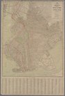
of the borough of Brooklyn, City of New York …
note:
Oriented with
north
at upper left corner.
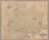
Map
of 272 lots in the 30th wards, borough
Bush Terminal,
map
showing business section
note:
Oriented with
north
at upper left corner.
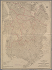
Map
of the borough of Brooklyn …
note:
Oriented with
north
at upper left corner.
Map
showing proposed extension
note:
Oriented with
north
toward lower left corner.
m
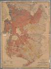
Map
of the borough of Brooklyn, New York …
Map
of the borough of Brooklyn, City of New York
Rand McNally
Map
of Brooklyn
note:
Map
index is found
Map
of the borough of Brooklyn, New York
Map
of Brooklyn
m
New quick reference street indexed
map
note:
the Ohman
Map
Co.
Rand, McNally & Co.'s new handy
map
m
Hammond's complete
map
of Brooklyn
note:
Scale approximately 1:36,500 (W 73°57ʹ08ʺ/
N
m
Eagle Almanac
map
of the borough of Brooklyn
note:
Oriented with
north
of upper left.
Rand McNally standard
map
of the borough
m
Map
of the borough of Brooklyn, City of New York
Rand McNally & Co.'s new handy
map
m
Map
of the borough of Brooklyn,
N
.
Y
note:
Map
is oriented with
north
at lower left
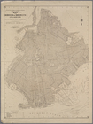
Map
of the enlarged city of Brooklyn …
note:
Oriented with
north
at lower left corner.
m
New
map
of Kings and Queens counties, New York …
note:
LC Land ownership
maps
, 512
New
map
of Brooklyn and vicinity …
note:
… catalog of the
Map
m
Map
of the city of Brooklyn
note:
… catalog of the
Map
Map
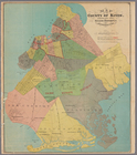
of the county of Kings, showing
note:
Also shows wards and
towns
.
Watson's new
map
of the city of Brooklyn
note:
Oriented with
north
to bottom left corner.
Map
of the city of Brooklyn
note:
Oriented with
north
to the lower left.
m
Map
of the consolidated City of Brooklyn
note:
Oriented with
north
to lower left of sheet.
m
Map
of the City of Brooklyn as consolidated
note:
… (
N.Y
.) south to 60th
m
Topographical
map
m
Map
of the city of Brooklyn, as laid out
note:
Oriented with
north
to the lower left.
m
… situate in the
town
note:
Oriented with
north
to the left.
Plan of the
town
of Brooklyn and part of Long
note:
… catalog of the
Map
m
Hagstrom's
map
of Brooklyn (New York City) …
note:
… 74°03ʹ21ʺ--W 73°50ʹ00ʺ/
N
40°44ʹ21ʺ--
N
40°32ʹ59ʺ).
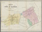
Map
of the
town
of Flatbush, Kings Co. L.I. …
note:
Mapping
the Nation (NEH grant, 2015-2018)…
Map
of the "Hunter Fly Farm" in the 9th
abstract:
… the western edge of the
map
m
Map
of the city of Williamsburgh and
town
abstract:
…. Oriented with
north
m
Manuscript
map
of Bushwick : from Samuel J
m
Watson's new
map
of the city of Brooklyn
m
Map
of the route of the New York and Sea Beach
note:
… catalog of the
Map
m
New
map
of the city of Brooklyn
note:
….
N.Y
."…
New
map
of the city of Brooklyn
note:
… catalog of the
Map
Map
of the county of Kings, showing
abstract:
….,
north
to Greenpoint
m
Map
of Brooklyn, House Number and Subway
m
Map
of the Borough of Brooklyn, City of New York
Map
of the Borough of Brooklyn, City of New York
Map
of the city of Brooklyn.
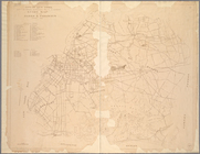
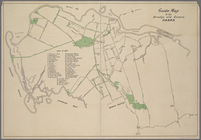
Guide
map
to the Parks and Parkways
Guide
Map
to the Brooklyn and Queens Parks
City of New York, Borough of Brooklyn ;
map
Map
of Brooklyn, Queens, and part
m
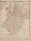
Transportation
map
of Brooklyn, Improvements
1
2
3
4
5
6
7
8
Previous
Next
1
2
3
4
5
6
7
8
Previous
Next