Click to visit the main New York Public Library Homepage
The New York Public Library
Digital Collections
About Digital Collections
Browse
Search only public domain materials
Items
Collections
Divisions
Home
Search
Browse
About
Search only public domain materials
Items
Collections
Divisions
Digital Collections
Using Images
Using Data
Collections
Charting America: Maps from the Lawrence H. Slaughter Collection and Others
Charting America: Maps from the Lawrence H. Slaughter Collection and Others
Navigation
Filters
Charting America: Maps from the Lawrence H. Slaughter Collection and Others
Previous
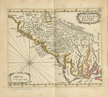
The south part of Virginia, now the north part of Carolina
0
Atlases, gazetteers, guidebooks and other books
377
Maps of the World
16
Maps of the Oceans
24
Maps of North and South America
23
Maps of North America.
551
Maps of New York City and State
1340
Lawrence H. Slaughter Collection of English maps, charts, globes, books and atlases
1020
John H. Levine Collection
60
More
Show filters
Hide filters
Show Only Public Domain
topic
Geography
224
Atlases, British
100
World maps
39
Cosmography
35
Atlases
18
More
Less
name
Thornton, Samuel
182
Ortelius, Abraham, 1527-1598
127
Coignet, Michel, 1549-1623
126
Shawe, James
126
Mitchell, S. Augustus (Samuel Augustus), 1792-1868
79
More
Less
collection
Atlases, gazetteers, guidebooks and other books
403
Lawrence H. Slaughter Collection of English maps, charts, globes, books and atlases
253
Maps of New York City and State
21
Maps of the World
17
John H. Levine Collection
6
More
Less
place
Maps
40
Great Britain
19
Atlantic Ocean
16
English Channel
14
New York (State)
14
More
Less
genre
Maps
616
Nautical charts
173
Registers (Lists)
26
preliminaries
24
pages (components)
13
More
Less
publisher
Printed for Ieames Shawe, and are to be solde at his shoppe nigh Ludgate,
126
S. A. Mitchell, jr
79
Printed for Robert Sayer, No. 53, Fleet-Street
76
M. Carey
46
... Sold ... by Tho. Bowles, print and map-seller in St. Paul's-Churchyard
32
More
Less
division
Map Division
702
type
cartographic
610
text
86
still image
21
Date Range
to
703 results found for:
World maps?tab=filter
Sort by:
Relevance
Title
Date created
Date digitized
Sequence
Results 501 - 550
A mapp of the
world
image:
ps_
map
_173
Title page
note:
… to Early
Maps
of the Middle
Frontispiece
note:
… to Early
Maps
of the Middle
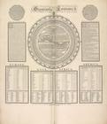
Geography epitomiz'd.
note:
… to Early
Maps
of the Middle
m
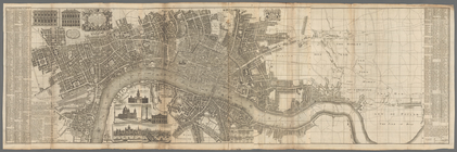
London surveyed or a new
map
of the cities
note:
… to Early
Maps
of the Middle
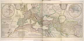
An historical
map
of Roman Empire
note:
… to Early
Maps
of the Middle
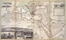
The Turkish Empire in Europe,…
note:
… to Early
Maps
of the Middle
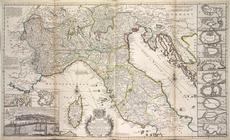
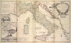
A new
map
of the upper part of Italy
note:
… to Early
Maps
of the Middle
A new
map
of Italy, distinguishing all
note:
… to Early
Maps
of the Middle
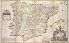
A new & exact
map
of Spain and Portugal
note:
… to Early
Maps
of the Middle
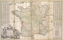
A new and exact
map
of France divided into all
note:
… to Early
Maps
of the Middle
…, ou a most exact
map
note:
… to Early
Maps
of the Middle
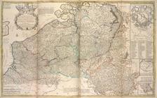
A new and exact
map
of the United Provinces
note:
… to Early
Maps
of the Middle
The seat of war on the Rhine being a new
map
note:
… to Early
Maps
of the Middle
A new & exact
map
of the electorat of Brunswick
note:
… to Early
Maps
of the Middle
A new
map
of Germany, Hungary
note:
… to Early
Maps
of the Middle
A new
map
of Ireland, divided into its
note:
… to Early
Maps
of the Middle
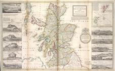
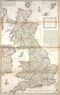
The north part of Great Brita…
note:
… to Early
Maps
of the Middle
The south part of Great Brita…
note:
… to Early
Maps
of the Middle
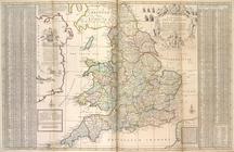
A new
map
of Great Britain.
note:
… to Early
Maps
of the Middle
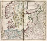
A new
map
of the Baltick &c. ...
note:
… to Early
Maps
of the Middle
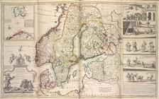
A new
map
of Denmark and Sweden. ...
note:
… to Early
Maps
of the Middle
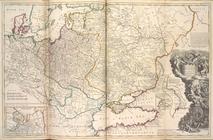
Map
of Moscovy, Poland, Little Tartary
note:
… to Early
Maps
of the Middle
A new & exact
map
of the coast, countries
note:
… to Early
Maps
of the Middle
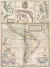
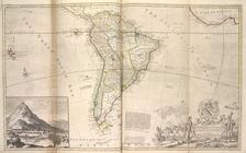
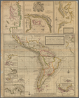
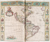
Map
of South America ...
note:
… to Early
Maps
of the Middle
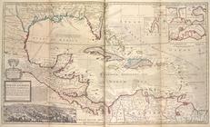
A
map
of the West-Indies or the Islands
note:
… to Early
Maps
of the Middle
m
A new
map
of the north parts of America
note:
… to Early
Maps
of the Middle
m
A new and exact
map
of the dominions of the King
note:
… to Early
Maps
of the Middle
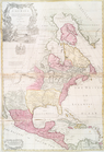
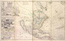
This
map
of North America, according to ye
note:
… to Early
Maps
of the Middle
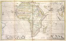
Map
of Africa ...
note:
… to Early
Maps
of the Middle
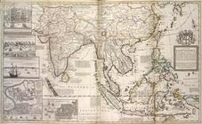
A
map
of the East-Indies and the adjacent
note:
… to Early
Maps
of the Middle
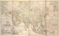
Map
of Asia ...
note:
… to Early
Maps
of the Middle
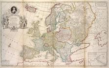
Map
of Europe according to the newest
note:
… to Early
Maps
of the Middle
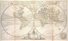
A new and correct
map
of the whole
world
note:
… to Early
Maps
of the Middle
A new and correct
map
of the
world
, laid
note:
… to Early
Maps
of the Middle
m
North America divided into it…
note:
… to Early
Maps
of the Middle
A new & exact
map
of the coast, countries
note:
… in Moll's The
world
m
North America : : corrected f…
note:
… to Early
Maps
of the Middle
A chart of the West Indies fr…
note:
… consisting of
maps
by Wit
A chart of the sea coasts of …
note:
… consisting of
maps
by Wit
Nova totivs Americæ descripti…
note:
… consisting of
maps
by Wit
A general chart of the West I…
collection:
… of the
world
: collected from
… known
World
, the whole
topic:
Maps
in education
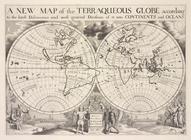
A new
map
of the terraqueous globe according
topic:
Maps
in education
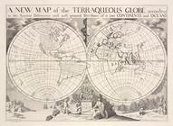
A new
map
of the terraqueous globe according
topic:
Maps
in education
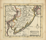
New Iarsey
note:
… to Early
Maps
of the Middle
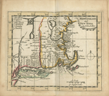
New England and New York
note:
… to Early
Maps
of the Middle
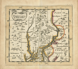
Pensilvania
note:
… to Early
Maps
of the Middle
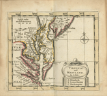
Virginia and Maryland
note:
… to Early
Maps
of the Middle
Carolina newly discribed
note:
… to Early
Maps
of the Middle
1
2
3
Previous
Next
1
2
3
Previous
Next