Click to visit the main New York Public Library Homepage
The New York Public Library
Digital Collections
About Digital Collections
Browse
Search only public domain materials
Items
Collections
Divisions
Home
Search
Browse
About
Search only public domain materials
Items
Collections
Divisions
Digital Collections
Using Images
Using Data
Collections
Charting America: Maps from the Lawrence H. Slaughter Collection and Others
Charting America: Maps from the Lawrence H. Slaughter Collection and Others
Navigation
Filters
Charting America: Maps from the Lawrence H. Slaughter Collection and Others
Previous
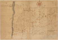
The south part of Virginia, now the north part of Carolina
0
Atlases, gazetteers, guidebooks and other books
377
Maps of the World
16
Maps of the Oceans
24
Maps of North and South America
23
Maps of North America.
551
Maps of New York City and State
1340
Lawrence H. Slaughter Collection of English maps, charts, globes, books and atlases
1020
John H. Levine Collection
60
More
Show filters
Hide filters
Show Only Public Domain
topic
Geography
516
Administrative and political divisions
340
Railroads
317
Real property
302
Landowners
216
More
Less
name
Thornton, Samuel
182
Ortelius, Abraham, 1527-1598
130
Coignet, Michel, 1549-1623
126
Shawe, James
126
Montanus, Arnoldus, 1625?-1683
118
More
Less
collection
Maps of New York City and State
2004
Lawrence H. Slaughter Collection of English maps, charts, globes, books and atlases
1252
Atlases, gazetteers, guidebooks and other books
543
John H. Levine Collection
60
Maps of North and South America
40
More
Less
place
New York (State)
1295
New York (N.Y.)
652
New York
524
Manhattan (New York, N.Y.)
347
Brooklyn (New York, N.Y.)
266
More
Less
genre
Maps
3810
Nautical charts
187
Cadastral maps
183
Manuscript maps
71
Aerial views
30
More
Less
publisher
Printed for Ieames Shawe, and are to be solde at his shoppe nigh Ludgate,
126
publisher not identified
119
Printed by the author, and are to be had at his house
116
Chapman and Hall
115
S. A. Mitchell, jr
79
More
Less
division
Map Division
3930
Manuscripts and Archives Division
2
type
cartographic
3687
text
191
still image
161
Date Range
to
3,936 results found
Sort by:
Title
Date created
Date digitized
Sequence
Results 1751 - 1800
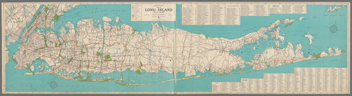
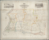
Long Island Sound (western sh…
Middle part of Long Island So…
m
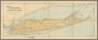
Hagstom's map of Long Island …
m
Hagstrom's map of Long Island…
Map of Long Island showing th…
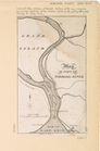
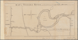
Map of part of Niagara River
Sketch of the Niagara River.
Map of Niagara River or the s…
Map of historic Niagara: show…
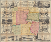
Map of Niagara Falls, and gui…
Map of the River Niagara and …
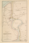
Survey for a ship canal aroun…
General plan for the improvem…
m
Niagara 1819
The second section of the sur…
City of Niagara Falls: the po…
Map of New York State reserva…
Map of Niagara Falls, suspens…
Niagara Falls: from surveys e…
Map of the town of Niagara
Map of the vicinity of Niagar…
The course of the River St. L…
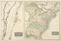
A map of the British Empire i…
m
Map of Dutchess County, New-Y…
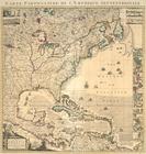
Nieuwe Werelt kaert
Map of the county of Sullivan
Map of the county of Westches…
m
Map of Kings and part of Quee…
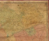
Allegany Co., N. Y. to accomp…
m
New map of St. Lawrence Count…
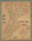
Map of West Chester County, N…
Untitled manuscript map of Gr…
Preliminary geologic map of A…
Geologic map of parts of Beek…
Geological map of a part of C…
Geological map of Onondaga Co…
m
Map of the town of Westcheste…
Geologic map of Orange County…
m
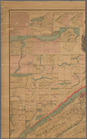
Map of Albany County, New Yor…
m
Map of Cayuga and Seneca Coun…
m
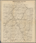
Map of Allegany Co., N.Y.: fr…
m
Map of Ontario County, New Yo…
m
Map of Dutchess Co., New York…
Map of Broome County, New York
Map of Chenango County, New Y…
m
Map of Clinton Co., New York:…
Map of Erie County, New York:…
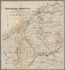
Map of Chautauqua County, N.Y…
Map of Duchess County, New Yo…
A map of the towns of Livings…
1
2
…
5
6
7
8
9
10
11
12
…
15
16
Previous
Next
1
2
…
5
6
7
8
9
10
11
12
…
15
16
Previous
Next