Click to visit the main New York Public Library Homepage
The New York Public Library
Digital Collections
About Digital Collections
Browse
Search only public domain materials
Items
Collections
Divisions
Home
Search
Browse
About
Search only public domain materials
Items
Collections
Divisions
Digital Collections
Using Images
Using Data
Collections
Charting America: Maps from the Lawrence H. Slaughter Collection and Others
Charting America: Maps from the Lawrence H. Slaughter Collection and Others
Navigation
Filters
Charting America: Maps from the Lawrence H. Slaughter Collection and Others
Previous
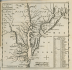
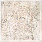
The south part of Virginia, now the north part of Carolina
0
Atlases, gazetteers, guidebooks and other books
377
Maps of the World
16
Maps of the Oceans
24
Maps of North and South America
23
Maps of North America.
551
Maps of New York City and State
1340
Lawrence H. Slaughter Collection of English maps, charts, globes, books and atlases
1020
John H. Levine Collection
60
More
Show filters
Hide filters
Show Only Public Domain
topic
Geography
262
Nautical charts
82
Administrative and political divisions
58
Mathematics
57
Astronomy, 1681
55
More
Less
name
Ortelius, Abraham, 1527-1598
130
Coignet, Michel, 1549-1623
126
Shawe, James
126
Moll, Herman, -1732
95
Flamsteed, John, 1646-1719
55
More
Less
collection
Lawrence H. Slaughter Collection of English maps, charts, globes, books and atlases
749
Maps of New York City and State
263
John H. Levine Collection
47
Maps of the Oceans
17
Maps of North and South America
15
More
Less
place
New York (N.Y.)
161
New York (State)
144
United States
139
Maps
105
North America
96
More
Less
genre
Maps
1097
Early maps
11
Facsimiles
11
Title pages
7
Early works to 1800
6
More
Less
publisher
Printed for Ieames Shawe, and are to be solde at his shoppe nigh Ludgate,
126
Printed by A. Godbid and J. Playford, for R. Scott, bookseller
55
Printed for Timothy Childe at the White Hart at the West-end of St. Paul's Church-yard
47
s.n
36
... Sold ... by Tho. Bowles, print and map-seller in St. Paul's-Churchyard
32
More
Less
division
Map Division
1109
type
cartographic
1079
text
31
still image
18
Date Range
to
1,111 results found for:
Early maps?tab=filter
Sort by:
Relevance
Title
Date created
Date digitized
Sequence
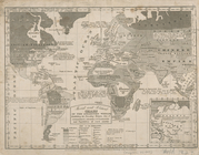
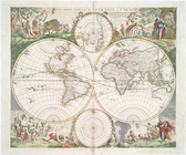
A chart of the world : exhibi…
note:
… to
Early
Maps
of the Middle
The generall historie of Virg…
note:
… to
Early
Maps
of the Middle
A
map
of the world from the best
note:
… to
Early
Maps
of the Middle
Novae insvlae XXVI nova tabvla
note:
… to
Early
Maps
of the Middle
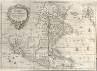
Province de New-York : en 4 f…
abstract:
…'s A
map
of the Province
A new and accurat
map
of the world
note:
… to
Early
Maps
of the Middle
Carte generale de la terre : …
note:
… to
Early
Maps
of the Middle
State of New-York for Spaffor…
note:
… to
Early
Maps
of the Middle
Chart of the world on Mercato…
note:
… to
Early
Maps
of the Middle
A
map
of the British dominions in North
note:
… to
Early
Maps
of the Middle
Die Neüwen Inseln so hinder H…
note:
… to
Early
Maps
of the Middle
Isothermal chart, or, View of…
note:
… to
Early
Maps
of the Middle
Nouvelle carte de la Pensylva…
note:
… to
Early
Maps
of the Middle
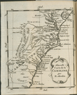
Nouvelle carte de la Caroline
note:
… to
Early
Maps
of the Middle
A
map
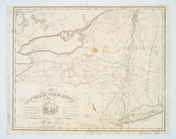
of the state of New York : compiled
note:
… to
Early
Maps
of the Middle
Americae sive Indiae occident…
note:
… to
Early
Maps
of the Middle
Moral and political chart of …
note:
… to
Early
Maps
of the Middle
A
map
of the country between Albemarle
note:
… to
Early
Maps
of the Middle
A
map
of the state of New York : exhibiting
note:
… to
Early
Maps
of the Middle
No. 1: [This
map
shows the position
note:
… to
Early
Maps
of the Middle
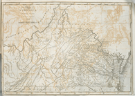
The state of Virginia : from …
note:
… to
Early
Maps
of the Middle
Nova orbis tabvla
note:
… to
Early
Maps
of the Middle
A new mapp of America Septent…
note:
… to
Early
Maps
of the Middle
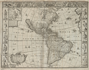
America with those known part…
note:
… to
Early
Maps
of the Middle
A
map
prepared for the report of the New York
note:
… to
Early
Maps
of the Middle
Scientia terrarum et coelorum…
note:
… to
Early
Maps
of the Middle
A new
map
of Virginia from the best
note:
… to
Early
Maps
of the Middle
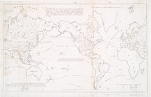
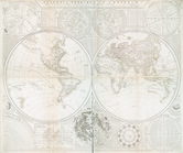
The world, on Mercator's proj…
note:
… to
Early
Maps
of the Middle
An Accurate
map
of New York in North
note:
… to
Early
Maps
of the Middle
Americæ nova descriptio
note:
… to
Early
Maps
of the Middle
The state of Virginia : from …
note:
… to
Early
Maps
of the Middle
Distance
map
of the state of New York
note:
… to
Early
Maps
of the Middle
The world in hemispheres : wi…
note:
… to
Early
Maps
of the Middle
m
Map
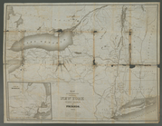
of New York exhibiting the post offices
note:
… to
Early
Maps
of the Middle
Map
of New-York : on the improved plan of Sidney E
note:
… to
Early
Maps
of the Middle
A general
map
of the world, or terraqueous
note:
… to
Early
Maps
of the Middle
A new projection of the Weste…
note:
… to
Early
Maps
of the Middle
A
Map
of the country round Philadelphia
note:
… to
Early
Maps
of the Middle
Map
of the State of New York
note:
… to
Early
Maps
of the Middle
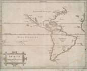
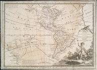
America
note:
… to
Early
Maps
of the Middle
Map
of the State of New York
note:
… to
Early
Maps
of the Middle
Map
of the State of New York
note:
… to
Early
Maps
of the Middle
Americae descrip.
note:
… to
Early
Maps
of the Middle
Map
of the meetings constituting New York Yearly
note:
… to
Early
Maps
of the Middle
L'America secondo leultime os…
note:
… to
Early
Maps
of the Middle
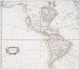
America
note:
… to
Early
Maps
of the Middle
A new generall chart for the …
note:
… to
Early
Maps
of the Middle
m
Map
of the route of the proposed New York & Erie
note:
… to
Early
Maps
of the Middle
Amérique ou Indes Occidentale…
note:
… to
Early
Maps
of the Middle
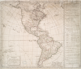
North America : : corrected f…
note:
… to
Early
Maps
of the Middle
1
2
3
4
5
Previous
Next
1
2
3
4
5
Previous
Next