Click to visit the main New York Public Library Homepage
The New York Public Library
Digital Collections
About Digital Collections
Browse
Search only public domain materials
Items
Collections
Divisions
Home
Search
Browse
About
Search only public domain materials
Items
Collections
Divisions
Digital Collections
Using Images
Using Data
Collections
Charting America: Maps from the Lawrence H. Slaughter Collection and Others
Charting America: Maps from the Lawrence H. Slaughter Collection and Others
Navigation
Filters
Charting America: Maps from the Lawrence H. Slaughter Collection and Others
Previous
The south part of Virginia, now the north part of Carolina
0
Atlases, gazetteers, guidebooks and other books
377
Maps of the World
16
Maps of the Oceans
24
Maps of North and South America
23
Maps of North America.
551
Maps of New York City and State
1340
Lawrence H. Slaughter Collection of English maps, charts, globes, books and atlases
1020
John H. Levine Collection
60
More
Show filters
Hide filters
Show Only Public Domain
topic
Atlases, British
4
Geography
4
History
4
Coasts
3
Discovery and exploration
3
More
Less
name
Moll, Herman, -1732
5
Childe, Timothy
4
Montanus, Arnoldus, 1625?-1683
4
Ogilby, John, 1600-1676
4
Blaeu, Joan, 1596-1673
3
More
Less
collection
Lawrence H. Slaughter Collection of English maps, charts, globes, books and atlases
23
Maps of North and South America
4
Atlases, gazetteers, guidebooks and other books
3
John H. Levine Collection
2
Maps of New York City and State
2
place
America
11
North America
8
Caribbean Area
7
Mexico
7
West Indies, British
4
More
Less
genre
Maps
34
Cadastral maps
1
publisher
Printed by the author, and are to be had at his house
4
Joan Blaeu
3
Printed for Timothy Childe at the White Hart at the West-end of St. Paul's Church-yard
3
J. Seller
2
J. Senex
2
More
Less
division
Map Division
34
type
cartographic
30
still image
4
text
4
Date Range
to
34 results found for:
Mexico?tab=filter
Sort by:
Relevance
Title
Date created
Date digitized
Sequence
Carte nouvelle de la mer du S…
note:
… ville de
Mexico
-- Istme
North America : : corrected f…
abstract:
… of
Mexico
and Caribbean
m
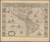
Americae nova tabula
note:
…, Cartegena,
Mexico
City
m
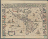
Americae nova tabula
note:
…, Cartegena,
Mexico
City
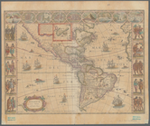
m
Americae nova tabula
note:
…, Cartegena,
Mexico
City
m
North America : : corrected f…
abstract:
… of
Mexico
and Caribbean
m
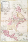
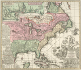
North America divided into it…
note:
…,
Mexico
or N. Spain, N.
Mexico
, the islands
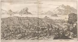
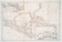
A map of the West-Indies or t…
note:
Insets: The city of
Mexico
in New Spain
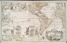
America.
note:
In upper right corner:
Tab
. 46.
m
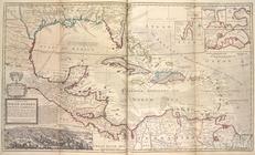
A chart of the West Indias fr…
m
A chart of the West Indias fr…
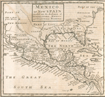
Mexico
, or, New
m
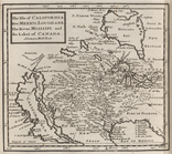
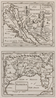
The isle of California, New
Mexico
Mexico
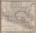
, or, New
note:
…, or the Kingdom of
Mexico
.
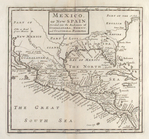
Mexico
, or, New
Mexico
, or, New Spain.
note:
Covers
Mexico
, Central America
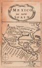
Mexico
, or, New Spain
note:
Covers
Mexico
, Caribbean area, and Southern
New
Mexico
; Florida.
Vetus
Mexico
Nova
Mexico
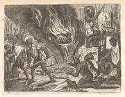
Funerary activities, Tabasco,
Mexico
.
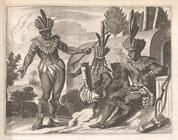
The Inhabitants of
Mexico
went antiently
note:
…"The Inhabitants of
Mexico
went antiently
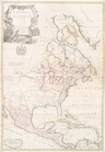
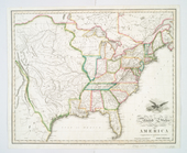
United States of America.
note:
… to Early Canada and
Mexico
.
A new mapp of the Empire of
Mexico
Carte du Mexique et de la Flo…
United States of America
note:
… of Canada and
Mexico
.
A new & correct map of the tr…
note:
… --
Mexico
-- Vera Cruz
A map of the British Empire i…
note:
Insets:
Mexico
-- Fall of Niagara
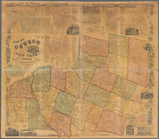
Map of Oswego County, New Yor…
note:
… --
Mexico
-- Oswego
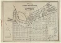
Village of Port Ontario, in t…
note:
Includes inset of: [
Mexico
Bay area]
Accurata delineatio celeberri…
note:
… to the Gulf of
Mexico
, and to New
Mexico
in the west.
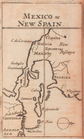
Mexico
of New Spain
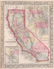
County map California; Map of…
note:
[Utah Territory, New
Mexico
Territory
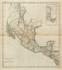
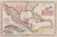
Map of
Mexico
, Central America
End of results
|
Top