Click to visit the main New York Public Library Homepage
The New York Public Library
Digital Collections
About Digital Collections
Browse
Search only public domain materials
Items
Collections
Divisions
Home
Search
Browse
About
Search only public domain materials
Items
Collections
Divisions
Digital Collections
Using Images
Using Data
Collections
Charting America: Maps from the Lawrence H. Slaughter Collection and Others
Charting America: Maps from the Lawrence H. Slaughter Collection and Others
Navigation
Filters
Charting America: Maps from the Lawrence H. Slaughter Collection and Others
Previous
The south part of Virginia, now the north part of Carolina
0
Atlases, gazetteers, guidebooks and other books
377
Maps of the World
16
Maps of the Oceans
24
Maps of North and South America
23
Maps of North America.
551
Maps of New York City and State
1340
Lawrence H. Slaughter Collection of English maps, charts, globes, books and atlases
1020
John H. Levine Collection
60
More
Show filters
Hide filters
Show Only Public Domain
topic
Geography
79
Administrative and political divisions
58
Road maps
53
Nautical charts
31
Maps
30
More
Less
name
Moll, Herman, -1732
82
Tiebout, Cornelius, 1777-1832
54
Colles, Christopher, 1738-1816
53
Childe, Timothy
47
Falconer, Robert, active 1700
47
More
Less
collection
Lawrence H. Slaughter Collection of English maps, charts, globes, books and atlases
344
Maps of New York City and State
251
John H. Levine Collection
26
Maps of the World
4
Atlases, gazetteers, guidebooks and other books
3
More
Less
place
New York (N.Y.)
139
New York (State)
139
United States
137
Middle Atlantic States
98
Manhattan (New York, N.Y.) -- Maps
59
More
Less
genre
Maps
627
Title pages
4
Early works to 1800
2
Facsimiles
1
Posters
1
More
Less
publisher
Printed for Timothy Childe at the White Hart at the West-end of St. Paul's Church-yard
47
... Sold ... by Tho. Bowles, print and map-seller in St. Paul's-Churchyard
32
Printed for J. Stockdale
26
s.n
26
M. Carey
15
More
Less
division
Map Division
630
type
cartographic
617
text
19
still image
8
Date Range
to
632 results found for:
Middle Atlantic States?tab=filter
Sort by:
Relevance
Title
Date created
Date digitized
Sequence
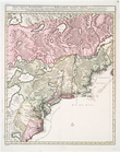
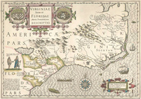
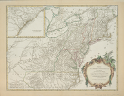
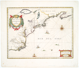
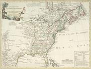
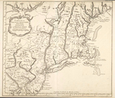
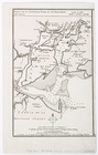
Virginiae partis australis, e…
note:
Covers the
Atlantic
coast from the mouth
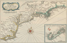
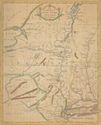
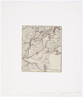
Virginiae partis australis, e…
note:
Covers
Atlantic
Coast from Virginia
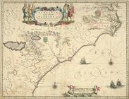
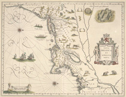
Virginiae item et Floridae Am…
note:
… to Early Maps of the
Middle
Atlantic
Seaboard.
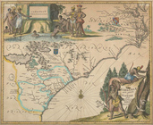
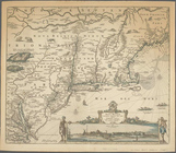
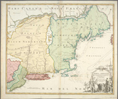
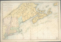
Virginia, Nieu Neder-landt, N…
note:
Covers
Atlantic
coast from New England
The United
States
of North America
note:
… to Early Maps of the
Middle
Atlantic
Seaboard.
Recens edita totius Novi Belg…
note:
… to Early Maps of the
Middle
Atlantic
Seaboard.
Partie de l'Amerique septentr…
note:
… the
Atlantic
coast
Novi Belgii Novaeque Angliae …
note:
… to Early Maps of the
Middle
Atlantic
Seaboard.
Nova tabula geographica compl…
note:
… to Early Maps of the
Middle
Atlantic
Seaboard.
m
Nova tabula geographica compl…
note:
… to Early Maps of the
Middle
Atlantic
Seaboard.
Nova Belgica et Anglia Nova.
note:
… to Early Maps of the
Middle
Atlantic
Seaboard.
Nova Anglia, Novum Belgium, e…
Nova Anglia Septentrionali Am…
note:
Also covers eastern New York
State
… : with the adjacent
states
of New
note:
… to Early Maps of the
Middle
Atlantic
Seaboard.
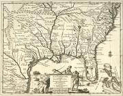
La Floride : suivant les nouv…
note:
Koeman, C.
Atlantes
Neerlandici, I, p. 14
Ètats-Unis de l'Amérique sept…
note:
…
states
plus Vermont
Carte réduite des côtes orien…
note:
… to Early Maps of the
Middle
Atlantic
Seaboard.
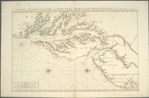
Carte particuliere de Virgini…
note:
… to Early Maps of the
Middle
Atlantic
Seaboard.
Carte de la Virginie et du Ma…
note:
Fifth
state
, according to: The Fry
Carte de la Nouvelle Angleter…
note:
… to the
middle
of Lake Ontario.
An Accurate map of New York i…
note:
Covers New York
State
as far west
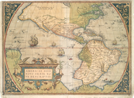
Americae sive novi orbis, nov…
note:
State
2 according to Burden. Azores
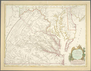
Baltimore, Annapolis, and adj…
note:
… to Early Maps of the
Middle
Atlantic
Seaboard.
Philadelphia and adjacent cou…
note:
… to Early Maps of the
Middle
Atlantic
Seaboard.
New York and adjacent country.
note:
… to Early Maps of the
Middle
Atlantic
Seaboard.
A plan of the city and enviro…
note:
Includes "Elevation of the
State
House."…
A new map of part of the United
States
of North
note:
… to Early Maps of the
Middle
Atlantic
Seaboard
m
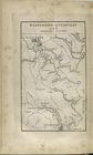
The engagement on the White P…
note:
… to Early Maps of the
Middle
Atlantic
Seaboard.
A plan of the country from Fr…
note:
… to Early Maps of the
Middle
Atlantic
Seaboard.
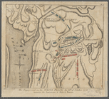
Sketch illustrating the progr…
note:
… to Early Maps of the
Middle
Atlantic
Seaboard.
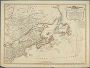
Map of New-York Bay and Harbo…
note:
… to Early Maps of the
Middle
Atlantic
Seaboard.
Map of New-York Bay and Harbo…
note:
… to Early Maps of the
Middle
Atlantic
Seaboard.
m
Map of New-York Bay and Harbo…
note:
… to Early Maps of the
Middle
Atlantic
Seaboard.
New York Harbor and entrance …
note:
… to Early Maps of the
Middle
Atlantic
Seaboard.
m
Map of New-York Bay and Harbo…
note:
… to Early Maps of the
Middle
Atlantic
Seaboard.
Map of New-York and its vicin…
note:
… to Early Maps of the
Middle
Atlantic
Seaboard.
A chart of the bar of Sandy H…
note:
… to Early Maps of the
Middle
Atlantic
Seaboard.
A chart of New York Harbour :…
note:
Appears in Des Barres's
Atlantic
Neptune.
Ports de la Nouvelle York et …
note:
… to Early Maps of the
Middle
Atlantic
Seaboard.
New York and Perthamboy Harbo…
note:
… to Early Maps of the
Middle
Atlantic
Seaboard.
Map of the Marine Hospital gr…
note:
… to Early Maps of the
Middle
Atlantic
Seaboard.
Map of 465 valuable building …
note:
… to Early Maps of the
Middle
Atlantic
Seaboard.
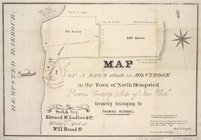
Map of valuable property situ…
note:
… to Early Maps of the
Middle
Atlantic
Seaboard.
Map of Garret Nostrand's farm…
note:
… to Early Maps of the
Middle
Atlantic
Seaboard.
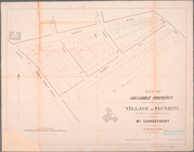
Map of the village of Flushin…
note:
… to Early Maps of the
Middle
Atlantic
Seaboard.
…, Queens County,
state
note:
… to Early Maps of the
Middle
Atlantic
Seaboard.
Ville de Manathe ou Nouvelle-…
note:
… to Early Maps of the
Middle
Atlantic
Seaboard.
A view of Collect Pond and it…
note:
… to Early Maps of the
Middle
Atlantic
Seaboard.
A view of Collect Pond and it…
note:
… to Early Maps of the
Middle
Atlantic
Seaboard.
Topographical map of the city…
note:
… to be an intermediate
state
between
1
2
3
Previous
Next
1
2
3
Previous
Next