Click to visit the main New York Public Library Homepage
The New York Public Library
Digital Collections
About Digital Collections
Browse
Search only public domain materials
Items
Collections
Divisions
Home
Search
Browse
About
Search only public domain materials
Items
Collections
Divisions
Digital Collections
Using Images
Using Data
Collections
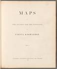
Charting America: Maps from the Lawrence H. Slaughter Collection and Others
Charting America: Maps from the Lawrence H. Slaughter Collection and Others
Navigation
Filters
Charting America: Maps from the Lawrence H. Slaughter Collection and Others
Previous
The south part of Virginia, now the north part of Carolina
0
Atlases, gazetteers, guidebooks and other books
377
Maps of the World
16
Maps of the Oceans
24
Maps of North and South America
23
Maps of North America.
551
Maps of New York City and State
1340
Lawrence H. Slaughter Collection of English maps, charts, globes, books and atlases
1020
John H. Levine Collection
60
More
Show filters
Hide filters
Show Only Public Domain
topic
Administrative and political divisions
282
Railroads
264
Real property
249
Landowners
182
City planning
105
More
Less
name
New York (N.Y.). Common Council
87
Mitchell, S. Augustus (Samuel Augustus), 1792-1868
49
Moll, Herman, -1732
41
Wells, Edward, 1667-1727
41
Dripps, M. (Matthew)
39
More
Less
collection
Maps of New York City and State
1385
Lawrence H. Slaughter Collection of English maps, charts, globes, books and atlases
262
Atlases, gazetteers, guidebooks and other books
85
John H. Levine Collection
13
Maps of the World
5
More
Less
place
New York (State)
930
New York (N.Y.)
464
New York
362
Manhattan (New York, N.Y.)
252
Brooklyn (New York, N.Y.)
206
More
Less
genre
Maps
1744
Cadastral maps
151
Manuscript maps
52
Topographic maps
24
Road maps
23
More
Less
publisher
publisher not identified
72
S. A. Mitchell, jr
42
Printed at the Theater,
38
G.W. & C.B. Colton & Co
33
s.n
30
More
Less
division
Map Division
1755
Manuscripts and Archives Division
2
type
cartographic
1736
text
26
still image
14
Date Range
to
1,758 results found for:
North Hempstead (N.Y. : Town) -- Maps?tab=filter
Sort by:
Relevance
Title
Date created
Date digitized
Sequence
Map
of the borough of Brooklyn, City of New York
m
Maps
of the Society for the Diffusion of Useful
Maps
of the Society for the Diffusion of Useful
Maps
of the Society for the Diffusion of Useful
Geological
map
of England and Wales
m
Maps
of the Society for the Diffusion of Useful
m
Maps
of the Society for the Diffusion of Useful
m
Maps
of the Society for the Diffusion of Useful
m
Johnson's Physical
Map
…
Ethnographic
map
of the world showing
m
Hammond's complete
map
of Brooklyn …
Map
of the borough of Brooklyn, City of New York …
note:
Oriented with
north
at upper left corner.
Hammond's handy reference
map
of Brooklyn
Map
of the borough of Brooklyn, 1902
note:
Oriented with
north
at upper right.
m
Map
of the borough of Brooklyn, New York …
note:
… 73°51ʹ17ʺ/
N
40°45ʹ04ʺ--
N
m
Freight
map
of the metropolitan district …
note:
published by Empire
Map
Co..
Hammond's complete
map
of New York City
m
Map
of property belonging to Milton S
Map
of lots belonging to the Bay Ridge
Map
of Brooklyn Manor
Map
of New York City and vicinity …
note:
… 73°42ʹ00ʺ/
N
40°54ʹ58ʺ--
N
m
Map
of Brooklyn
The Cord Meyer Development Co.
map
showing
note:
… 73°47ʹ17ʺ/
N
40°50ʹ48ʺ--
N
m
Petersen's
map
of Brooklyn
note:
Oriented with
north
at upper left corner.
Map
of Flatbush Meadows …
note:
Oriented with
north
at upper right corner.
m
The Blanchard Press correctly indexed
map
note:
On verso: Index, and ancillary
Map
of New York
Map
of the comprehensive plan as filed
note:
…ʹ/
N
41°07ʹ--
N
40°20ʹ).
… road
map
of the country
note:
… 73°37ʹ57ʺ/
N
41°00ʹ01ʺ--
N
Williams'
map
of Borough of Brooklyn …
note:
by Wilaims
Map
& Guide co.
Map
and profile showing sources of
note:
Oriented with
north
to right side.
The Evening Mail's complete
map
and guide
m
The John Wanamaker automobile & route
map
note:
Includes index to cities and
towns
.
m
Official
map
covering territory within
note:
Includes 14 inset
maps
.
Map
of Jamaica in the 4th ward, borough
note:
…ʹ21ʺ--W 73°45ʹ51ʺ/
N
40°42ʹ47ʺ--
N
40°41ʹ36ʺ).
m
Flushing Bay, Long Island,
N
.
Y
. …
note:
Includes insets: Flushing Bay
N.Y
m
Rand, McNally & Co.'s complete
map
note:
Includes inset:
Map
of lower part of Manhattan
Map
of the suburban territory served by the New
note:
… 73°29ʹ36ʺ/
N
41°30ʹ59ʺ--
N
Road
map
of the New York district …
note:
…ʹ/
N
41°19ʹ--
N
40°16ʹ).
Map
of property New York Dock Company
note:
Oriented with
north
at lower left corner.
Brooklyn, from Rand McNally metropolitan
map
note:
…, and
N
.J.
m
Map
showing 100 miles around New York
note:
…,
N.Y
."…
Hagstrom's
map
of lower New York City …
…
map
New York City
note:
…ʹ/
N
42°48ʹ--
N
39°09ʹ).
Hammond's handy reference
map
of Brooklyn
Map
of Kissena Park, third ward borough
note:
Oriented with
north
at upper left corner.
m
Map
of Manhattan showing the district
Map
showing suggested connections
note:
… 73°39ʹ54ʺ/
N
41°04ʹ14ʺ--
N
Rand McNally standard
map
of New York
note:
…
map
of New York
Guide
map
to the Brooklyn and Queens parks
note:
Oriented with
north
at upper right corner.
Map
of the borough of Brooklyn, New York …
note:
Oriented with
north
at upper left corner.
1
2
3
4
5
6
7
8
Previous
Next
1
2
3
4
5
6
7
8
Previous
Next